And it came to pass. All night long the heavens did their best to turn this area of Ireland into a lake.
A decent breakfast of eggs benedict warmed the cockles of our hearts. We donned the wet weather gear. We had a rain window of around 3 hours. During this time, we needed to reach our next accommodation in Donegal.
I had to cut the itinerary down to a quick dash of 140 Kms. I hoped to arrive before the frontal system.
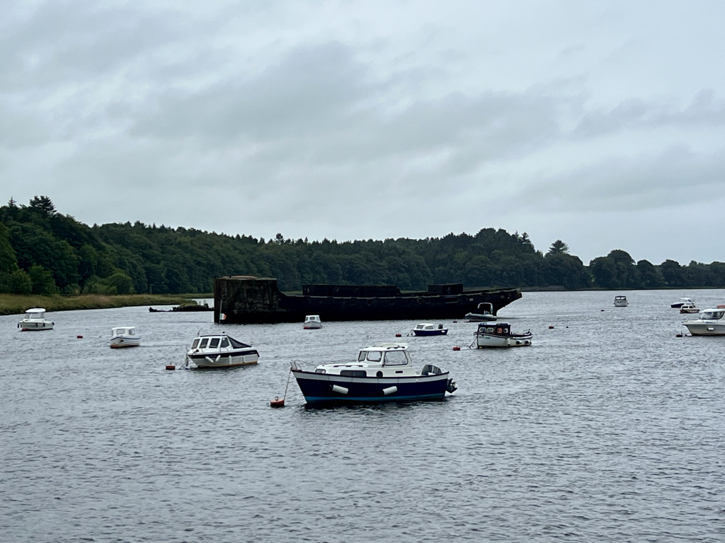
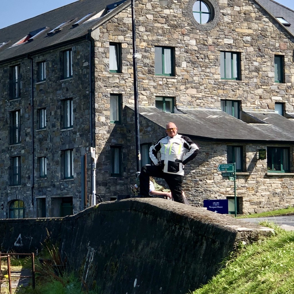
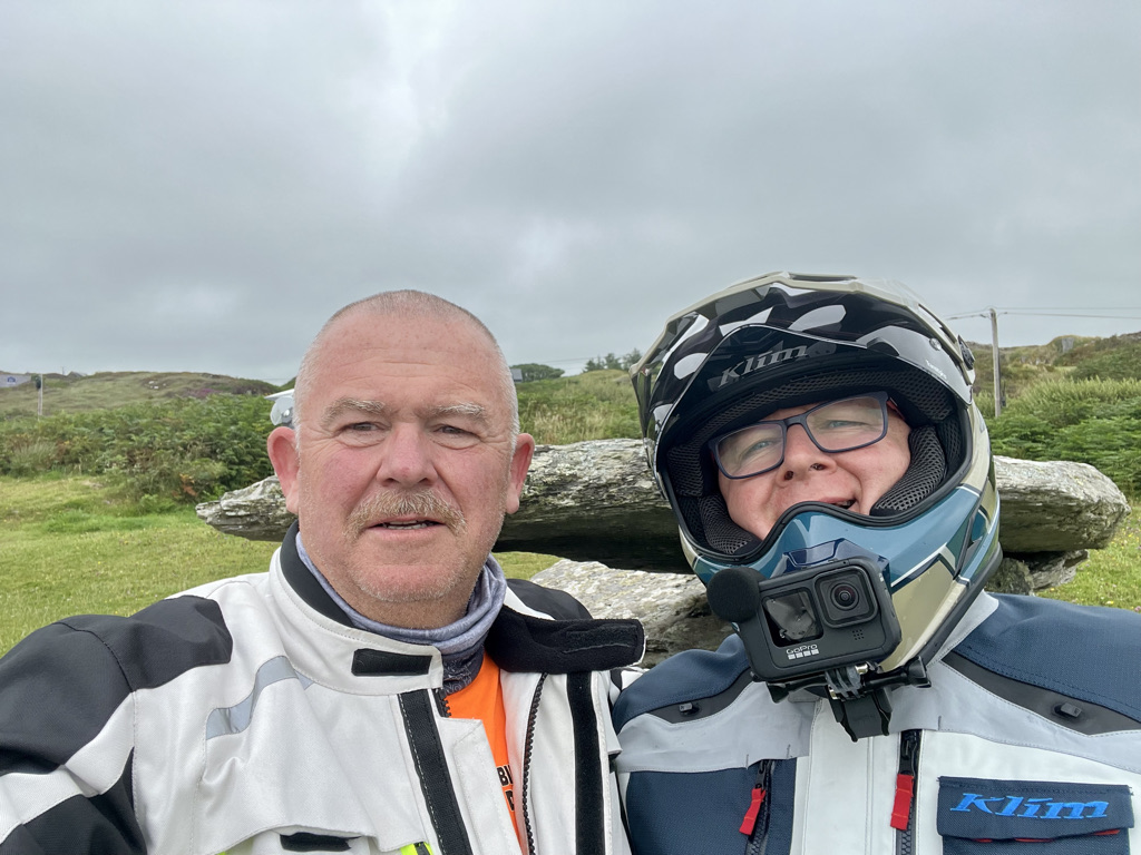
There was one thing I wanted to show Andy. I know he is a bit of a war historian. I had seen an old concrete hulk anchored in the river here on an earlier visit.
It was time now for the dash to Donegal. No time to stop for photos. With dark clouds all around us and spots of rain already on our visors it was fingers crossed now. There was a strong and buffeting wind from the south. We had to ease off on the speed for safety. No time to stop at the Yeats grave of take in the mountains to our right.
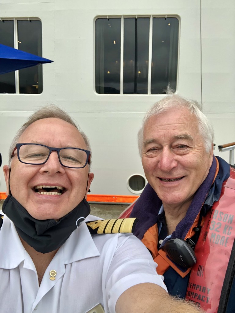
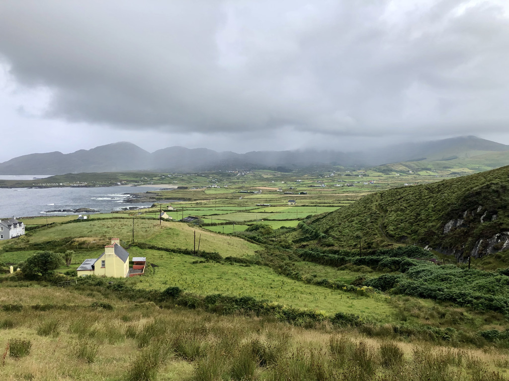
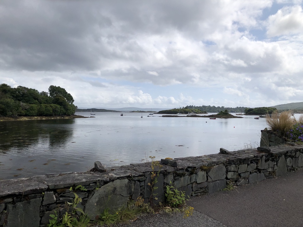
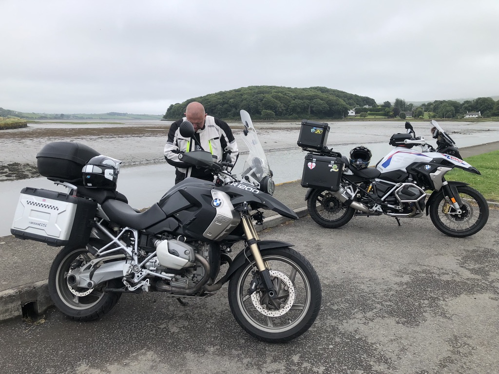
We arrived at the cottage of Patsy. He is the port of Killybegs pilot. I met him two years ago when I brought my ship into the harbour. He we were back then.
His cottage is charming. I mentioned back then my will to do the Wild Atlantic Way. He offered his place to us and what a boon it is.
Not 30 minutes after we arrived the rain really started to thump down. It has not stopped since. We made it just in time.
We shall have to wait and see what tomorrow brings. Hopefully this system will have moved through and normal service can resume tomorrow.
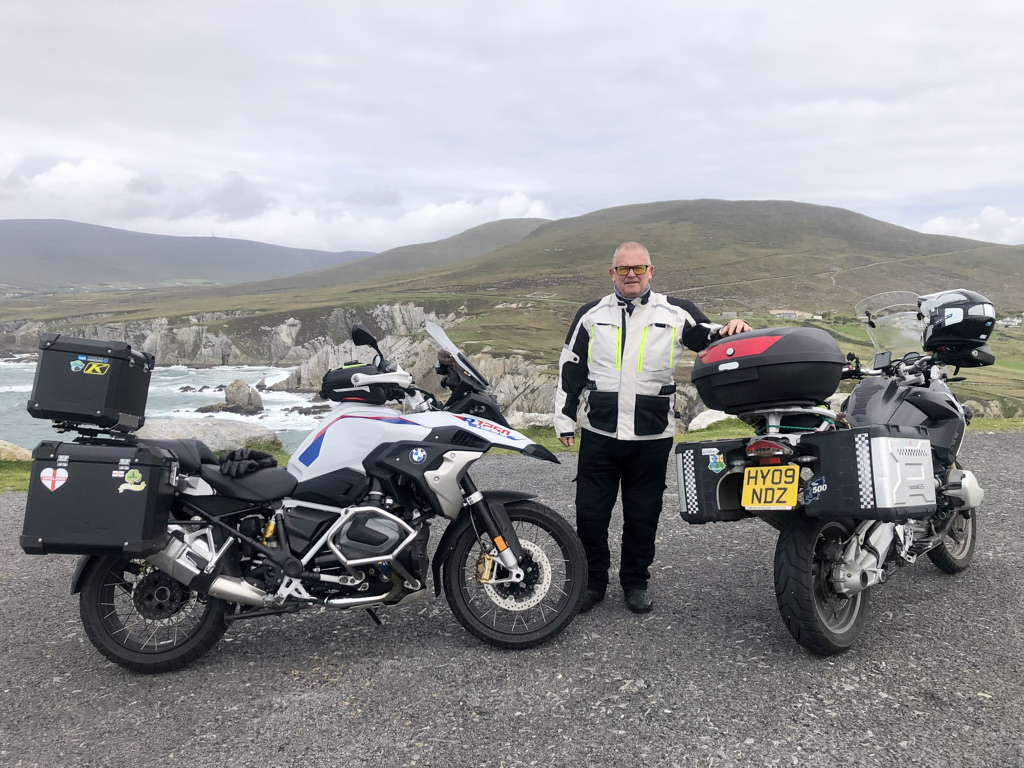
After a decent breakfast of scrambled eggs on toast rustled up by Andy, we bid farewell to Denise and Nicholas at the Whitethorn House B+B. We then set off to refuel in Newport.
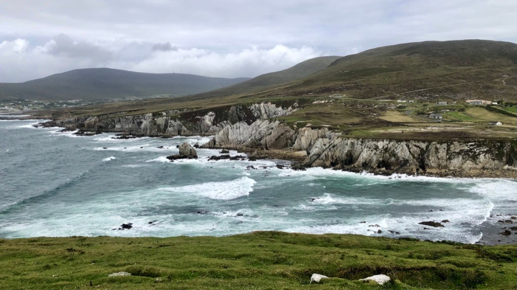
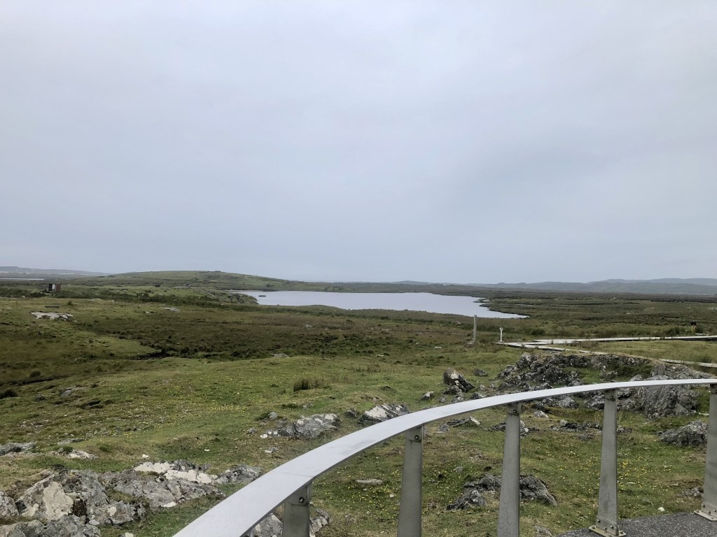
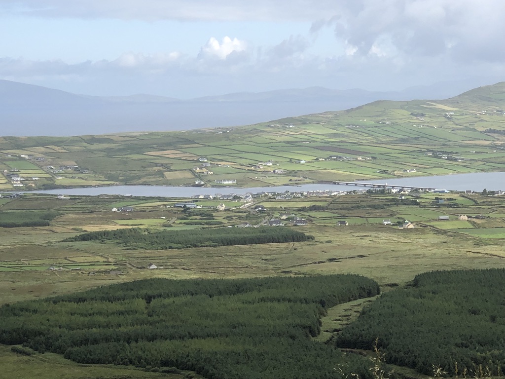
Taking the N59, the road follows the coast to the small town of Mulranny where it splits. We turn left to Dooghbeg. The views along this coast are staggering. Looking out across the inlets to distant hills where rain is sweeping in, we snap a photo. Then, we continue on to the Spanish Armada viewpoint.
Who knew 5 ships of the Armada lie wrecked somewhere below.
We continue to Achill and take the small bridge across to Achill Island. At various points on the island are the locations for the film The Banshees of Inisherin. It is clear these draw quite a few people to find them.
The road snakes around the island in loops. Sheep roam the hillsides. Great care must be taken to keep yourself and the animals safe as they wander over the road.
The panoramic views are breathtaking. North Atlantic rollers crash ashore and the stiff wind blowing up the cliffs buffets us as we progress.
The seaside town of Keel is very busy. Not what we came for. We turn around and via different roads return to Mulranny and turn north on the N59.
Dark clouds are gathering ahead heralding some serious rain showers. They are menacing looking.
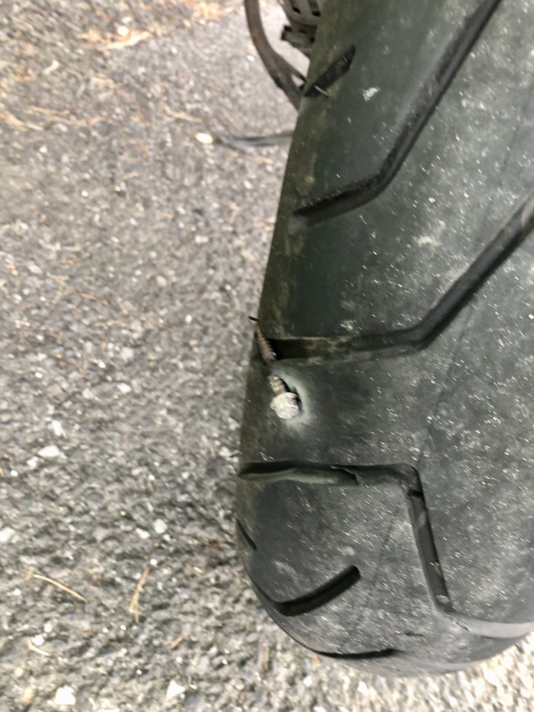
At Bangor Erris we chicken out and put the waterproofs back on. Just in time for the heavens opened and we got a soaking. Just as we were about to leave I noticed something stuck in Andys rear tyre. He had managed to pick up a large steel screw. Luck would have it that it had only pierecd a small rubber web and not the tyre itself. We removed it and moved on.
We ducked under the shelter of a garage forecourt. We filled up the bikes and grabbed a coffee to let the rain pass through. Turning off the N59 onto roads less travelled by tourists we wind our way via the L1205 through undulating moors. The wind is relentless. Coming from our left hand side it gives you a sore neck trying to keep your head straight. Passing through Bunnahowen we turn to put the wind behind us and take the R314 east. We get instant relief as the wind is now on our backs.
The next 50 kms are spent on this road running down into Ballina. We have checked into the Ballina Manor Hotel for the night. The weather forecast for tomorrow is horrid. We need to tweak the itinerary to keep dry ish.
I have no idea where Carrowbeg is either. Somewhere north of Westport.
The day dawned. I wish it hadn’t. All night the wind rattled the bedroom window. The alarm went off and simply insisted we got up and start the day. The rain was already tinkling on the glass.
We went to breakfast in the conservatory of the Sea Mist guesthouse. It is a 200 year old coaching house. We watched the rain and wind lash the garden.
You don’t come to Ireland on a motorcycle without wet weather gear. We donned ours. Fully encapsulated in PVC outer clothing we ventured forth into the morning.
First order of the day was to tip toe around the Sky Road. It climbed steadily away from Clifden to the lofty heights to the west. As we climbed, the wind increased in intensity. It was slow going as the wind buffeted us. We stopped at the lookout point. We looked at the rain lashing the hills. The wind did its level best to rip our outer garments to shreds. It failed.
After the obligatory photo, we continued around the Sky Road circuit back to Clifden. Then, we struck east to Maams Cross and north to Clonbur. By now the concentration to keep a motorcycle on the road when Mother Nature is doing her best to get you off it was taking its toll. Coffee and cake was needed. Joyces Country Bakery in Clonbur duly obliged with an Almond Croissant for myself and a Belgian Brownie for Andy plus coffee. The staff thought we were “Eejits” for riding in this weather.
This is fun. No really it is.
We can’t fault their argument. Replenished we continued in the driving rain. The R300 winding road rises and falls along the shores of Lough Mask. It crosses the County line from Galway to Mayo. Then, it passes through the hamlet of Finney. The brooks are roaring. Swollen with rain water draining from the lofty heights all around. The colour of black tea, the water boils as it descends through the gullies. We pause for a moment at the top of the climb to take in the view. Such as it is. Curtains of rain sweep across the moors. Andy’s gloves are now saturated. Whilst I have waterproof overgloves, a good trick is to use bread bags. His worked a treat even if they do look odd.
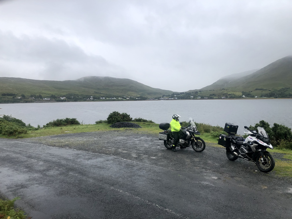
Descending into Leenaun, we take the N59 east. It runs along the southern shore of what many people consider to be Ireland’s only true fjord.
At the village of Clog, we turn off onto the R335. We cross the Aasleagh Falls bridge. Then, we strike north through Delphi and along the shores of Doo Lough. A coffee truck provides another welcome break and a chance to shelter. As we sit there a change in the weather comes through. The wind increases appreciably. With it the rain passes and blue skies emerge. We continue on now in sunshine to Killadoon, Carrownisky and Louisburgh. All are busy with holiday traffic. We press on.
The struggles of keeping safe in the weather takes its toll on both of us. We decide to stop for lunch in Westport. Having rested and resupplied at a local supermarket we take the rustic backroads to our nights rest in an Air BnB owned by Nicholas and Denise in the small hamlet of Carrowbank.
What an awesome house. Our room is super comfy. We have the run of the house. It comes complete with a snooker and pool room, no less.
Todays ride was only 179Kms, 112 miles. But it was tough going in the horrible weather. Total concentration needed to avoid the gravel washed onto the road by the rain, greasy tarmac and spray from other vehicles. We will sleep well tonight.
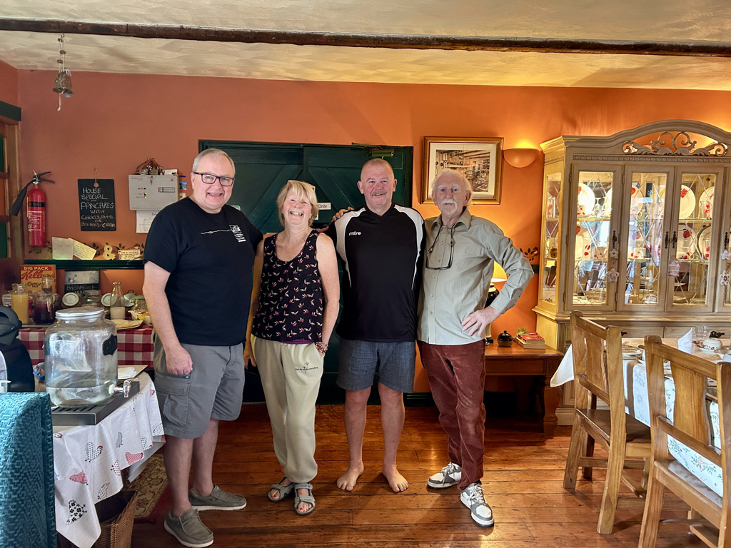
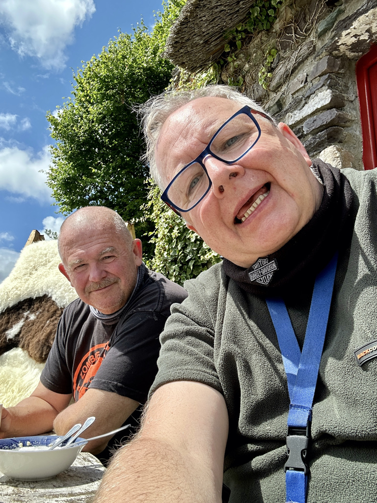
The Corrib View lodge was an amazing place to stay. It was well run. The host was very friendly and easy to talk to. The place was spotlessly clean. A pot of tea and home baking on arrival added a lovely touch. The other guests were all staying to fly fish in Lough Corrib for trout. July 31st dawned bright and clear and a little chilly to start with. Our host sent us on our way with two home made plum muffins.
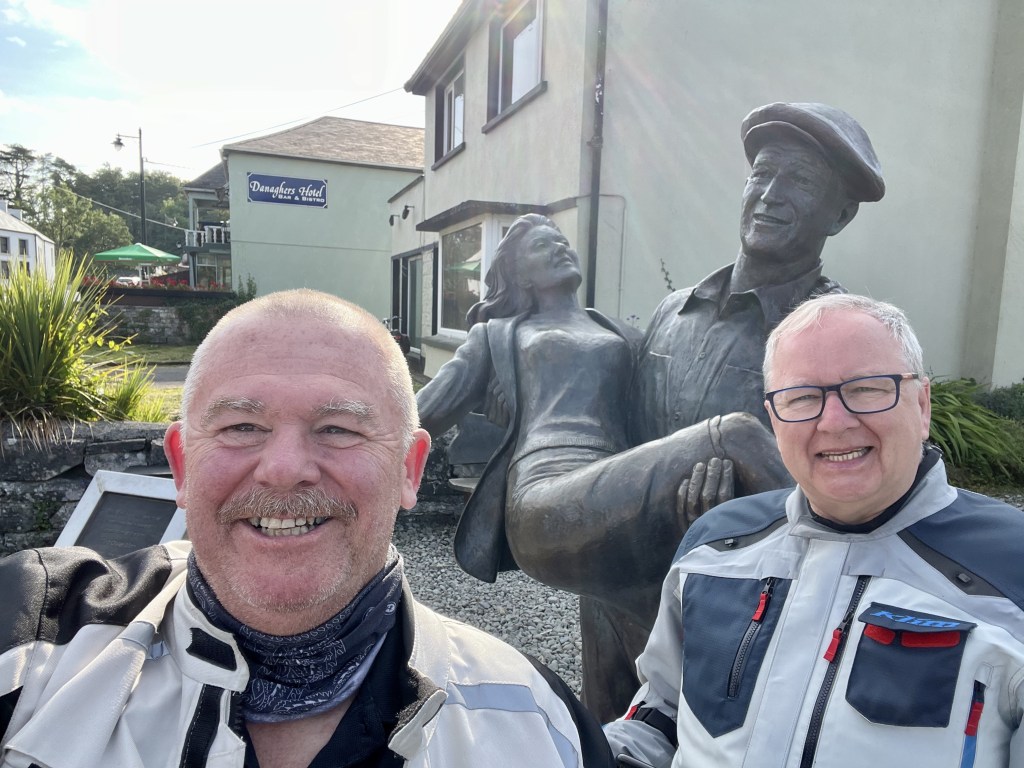
Two film stars. And John wayne and Maureen O’Hara.
By the time we reached the little village of Cong, only a few kilometers away, the temperature was on the rise. We stopped at the John Wayne and Maureen O’Hara bronze for the obligatory tourist photo and a little rest. This part of Connemara was immortalised in the film “The Quiet Man.” This ensures a steady trail of tourists to keep the local emporia in business forevermore.
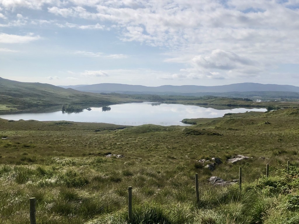
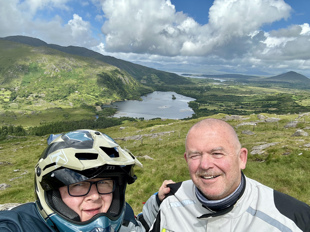
Taking the R345 road, we follow the northern fringes of Lough Corrib. It is dotted with hundreds of little islands. The water sparkles in the morning sun. The road twists this way and that, a motorcycling heaven. The smell of wild flowers wafts up as we pass. The heady perfume is sweet. The road veers left onto the R336. It crosses the Bealan Na Brock river by a honey coloured stone bridge. We climb steadily into the moorland-covered hills. Sheep rest on the road. We pick our way around them. Maunwee Lough lies at the crest. Its waters are dark and still and show the surrounding hills in them like a mirror. This section of road has been lifted straight out of the McKenzie country in New Zealand. It brought back many great memories for me of riding that country.
Maunwee Lough
Taking it all in.
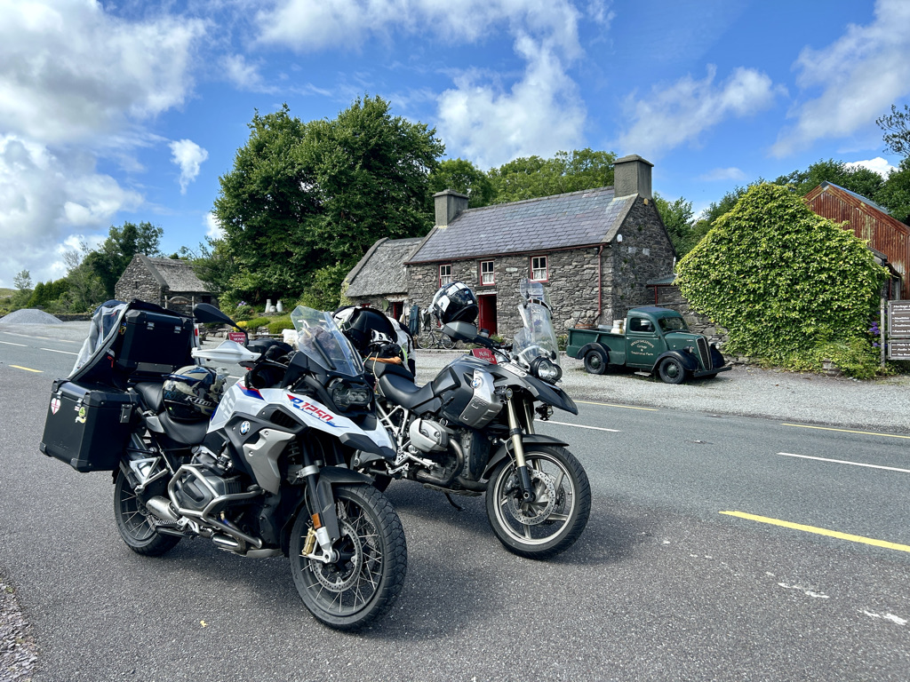
The road drops down into Maam Cross. Here lies an abandoned rail yard with some old wagons and coaches being slowly reclaimed by nature. But plans are afoot to restore this section of the Connemara railway. The signal box has already been attended to. In days past a broad gauge railway ran from Galway to Clifden. Only the old station, engine shed, and water tower in Clifden still exist. The remains in Maam Cross are also present.
Turning left onto the N59 the road follows the west side of Lough Corrib. It continues to the pretty little town of Oughterard. Two riders stop for coffee and a bun in the sun. On leaving this lovely little place we turn off the main road onto a road named Annaghkeelaun. It is mainly single track and runs through beautiful wooded countryside dotted with rather large beautiful houses. Rather an exclusive area I think. Deciduous trees line the road. The smell of freshly mown lawns is carried on the breeze. One big advantage of riding a motorcycle is you get to experience all the smells. Some beautiful. Some rustic.
We cross the N59 Galway road onto the L1320. This road cuts cross country in peace and quiet. Then, it joins the R336 on the coast. This part of the country is vast open bogs. Lakes litter the landscape in all directions. Peat is being cut and loaded onto trailers. The smell of burning peat drifts on the wind as we pass remote homesteads. It is earthy and not at all unpleasant. The road is quite busy. We turn off onto the single track R374. This track runs NW away into remote Connemara. Andy slows down and puts his hazard lights on. A car between he and I slows down. I pull around the car to take a peek at what has caused the slow down. Cows loose on the road! A bit of cowboying on motorcycles is called for.
Rounding up cattle the modern way
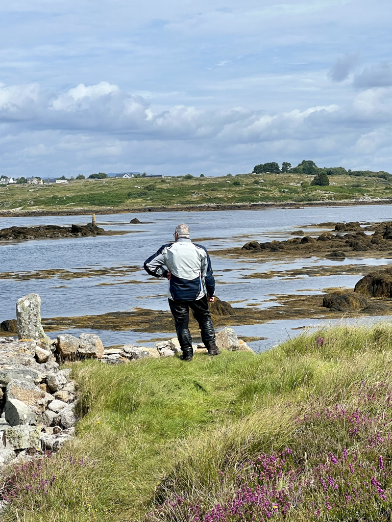
Crossing a rebuilt bridge we stop at what appears to be an old harbour. The area is overgrown with grass and weeds. It is clear that once upon a time this was a fishing boat harbour. It was accessible at high tide. Drawn as ever to anything nautical I have to stop to investigate.
The not so ancient mariner.
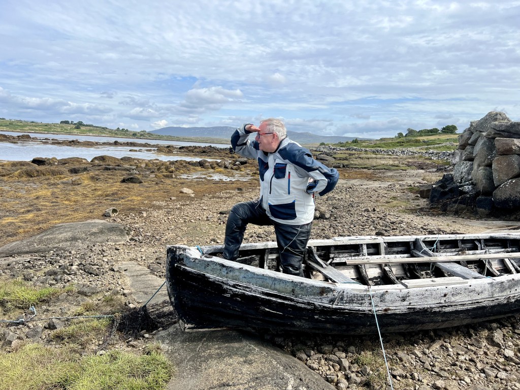
An abandoned rowing boat provides a photo op.
Hemmingway perhaps?
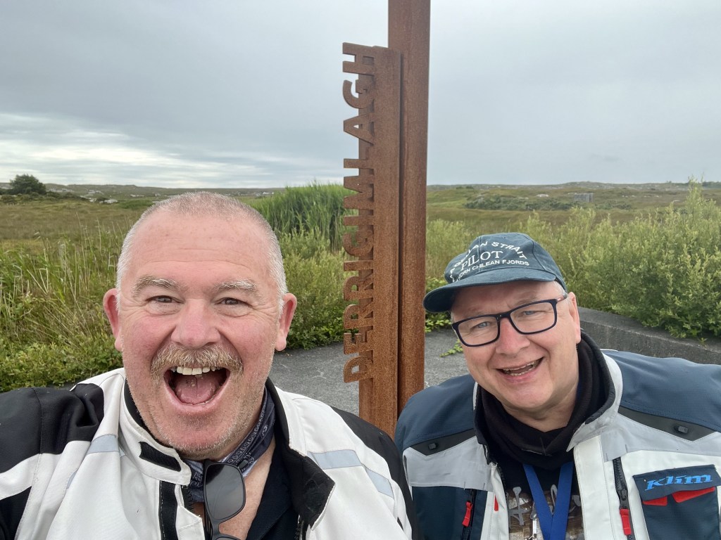
We move on and rejoin the R336 and the tourist traffic. We run onto the R340 and 342. We continue along the sinuous route. We head towards the turn off for the Alcock and Brown and Marconi transmitter site. This was a must see for me on this tour. I was not disappointed. You can read more here.
Walking among the ruins of Marconis transatlantic transmitter station is quite moving. When I first went to sea, morse code was still in daily use.
The large cairn marking Alcock and Brown’s landing site stands dominantly upon Derrigimlagh Bog. It is unfortunate that some people deem it necessary to deface it with inane scribbles.
The landing strip.
From the air, it looked like a grass field. On landing, the Vickers Vimy plane ended up on its nose after the wheels sank into the boggy ground.
We are now holed up in the Sea Mist guesthouse in Clifden. We will have another rest day tomorrow to get our laundry done. The coming days do not look promising from a weather perspective. I fear we will need full wet weather gear. We shall see.
Alcock and Brown stand proudly in Clifden.
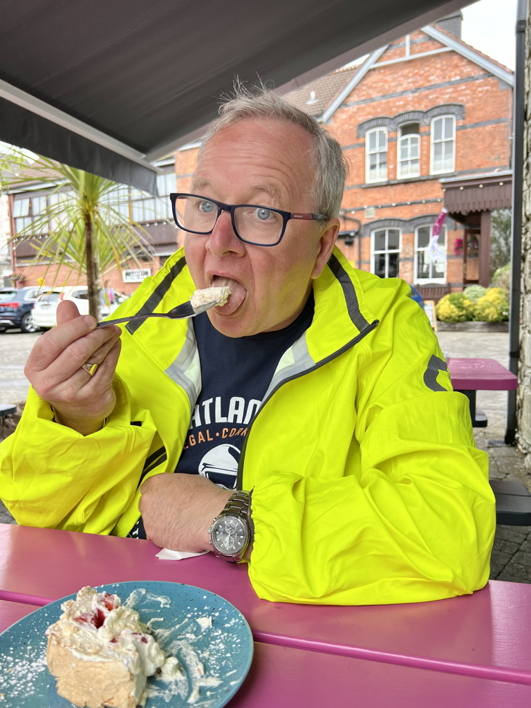
Having dropped our laundry off at the local emporium pour lavage, we took a look around the local museum housed in the old railway engine shed. We grabbed a coffee to wash down a very nice strawberry roulade. I had it on very good authority from the curator of the musem that the coffee and strawberry roulade at Steam cafe was not to be missed. I must concur.
Oh go on then!
I hope to report tomorrow that my hunt for a decent Irish stew has been successful. It is on the menu in a local restaurant. Dinner shall be the test.
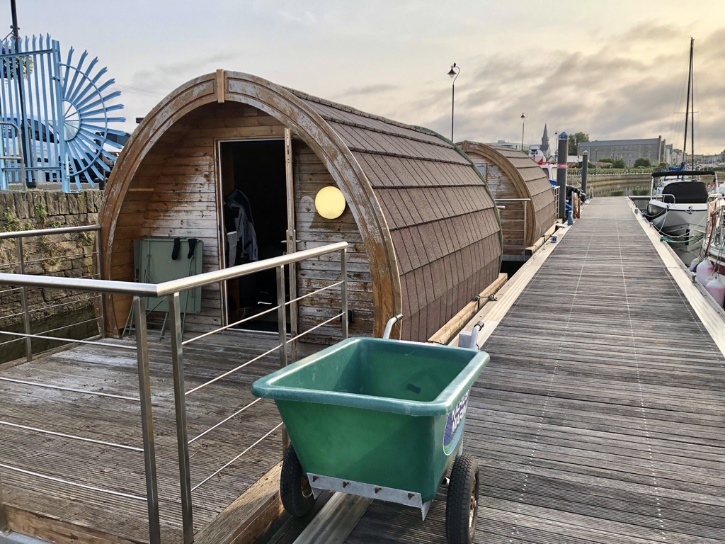
There was no sinking feeling today! A night in a floating pod needs to be experienced. Each time one of us got on or off it rocked a little. At first quite disconcerting but after a while you got used to it. I really enjoyed our nights stay here. A little different, a little quirky. Clean and comfortable and a view a little out of the ordinary.
The wind died away completely overnight. We woke to a blue sky day and not a breath of wind. The water was like a mirror.
We packed up and moved on.
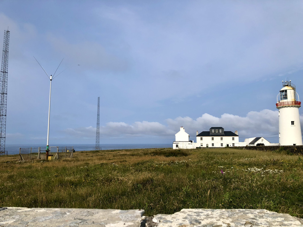
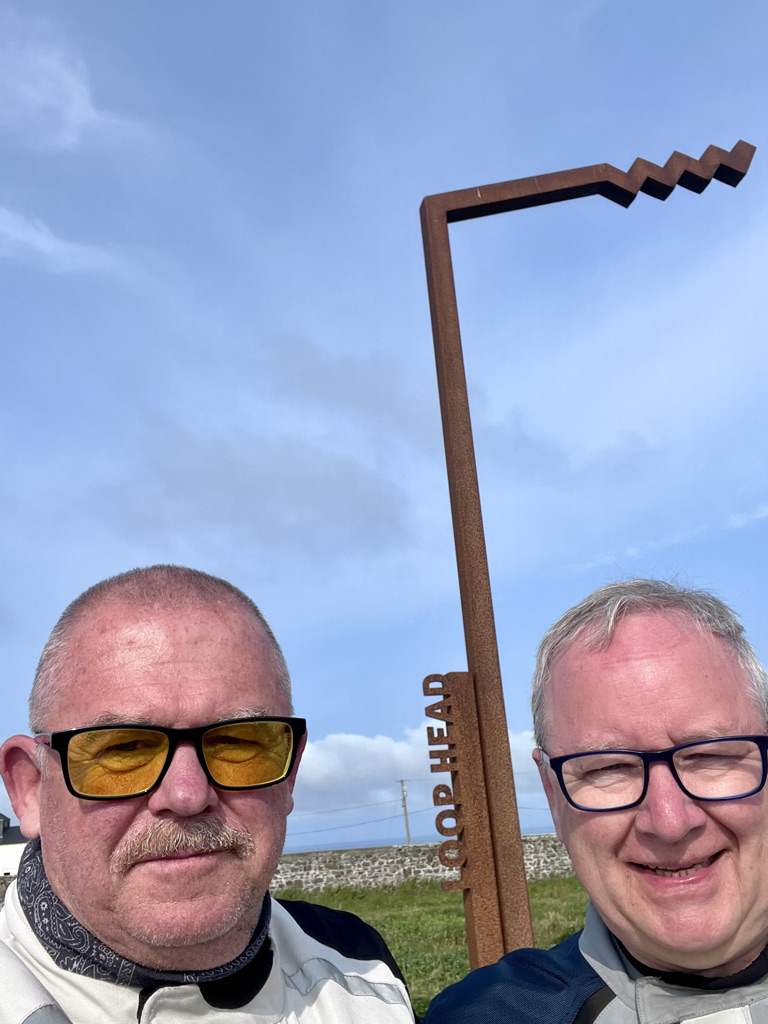
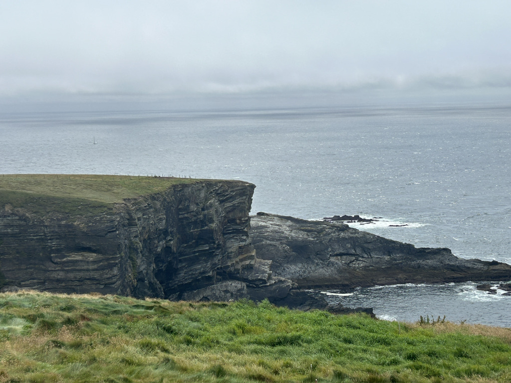
First stop was a run down to the Loop Head Lighthouse, a signature point on the Wild Atlantic Way. The road is narrow and winding. It passes through small hamlets that appeared deserted. Wide open vistas of fields stretch to the horizon on all sides. Then suddenly on top a rise ahead the lighthouse appears. Its light flashed 4 times every 20 seconds and marks the northern entrance to the River Shannon. Ripe tides and currents can be seen at the base of the cliffs. According to an information board a light of some description has existed on the point since the 1600s. It was a fire in a bazier on the roof of a cottage built on the point in those days.
Oh the sun burn!
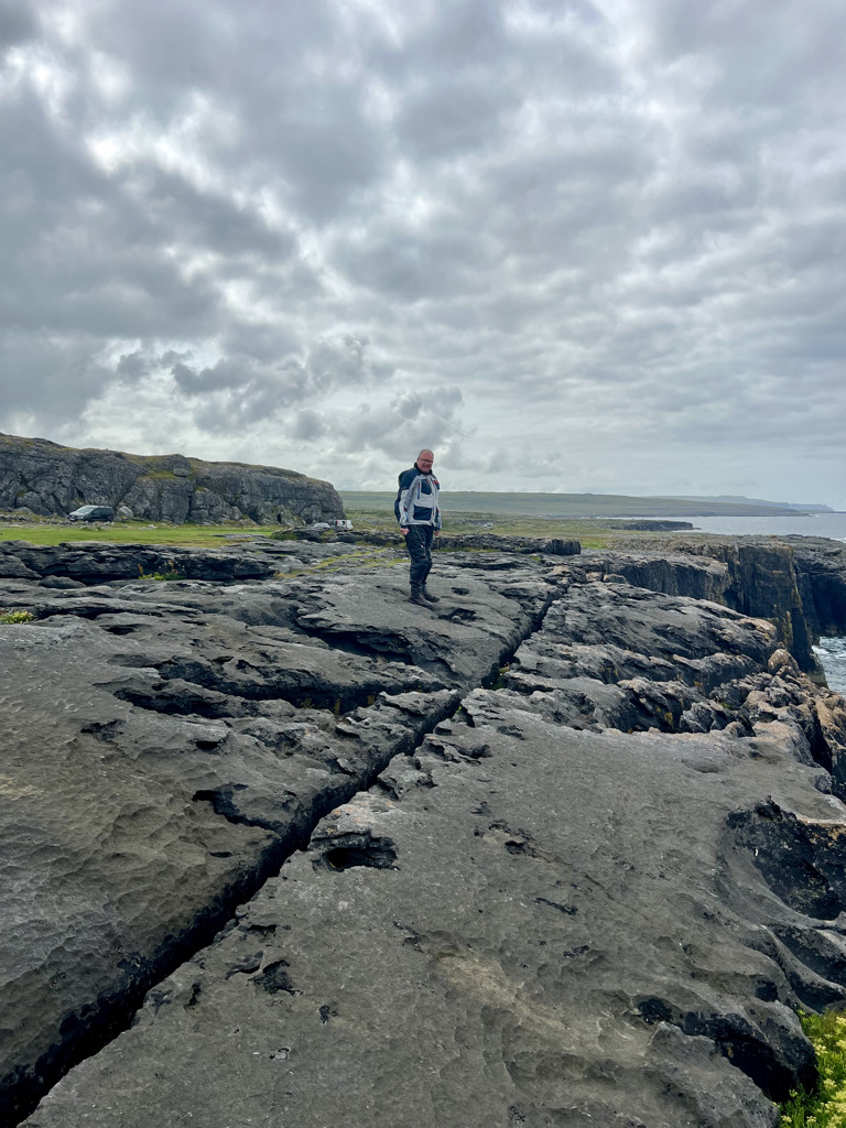
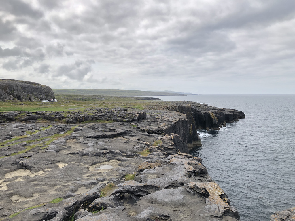
We retrace our steps. After a brief stop in the seaside town of Kilkeel, we press on to the geological park called The Burren. Click this link for more information. It seems barren at first, but hidden in the nooks and crannies are colourful plants.
The road clings to the coast rounding Black Head and heads east towards the city of Galway.
We stop for lunch. The roads are not so testing but the added traffic means concentration is paramount.
Galway is a city like any other. Not much to write about but there was no other way to get to our accommodation for the night. So we stopped for another coffee then pressed on to journeys end.
We had 5 near misses today. Drivers came around bends on our side of the road. Others pulled out in front of us at junctions. Until now the standard of driving has been good. Today was not. The silly thing is most of them were on Irish plate cars and they did not care. Maybe hire cars. Who knows. No apologies. Nothing. So take care if ever you come this way. Take your time and be aware of the road conditions at all times and you will be fine. Maybe it was just one of those days.
We are now set for the night. Tomorrow we head for Cong where the film the Quiet Man was filmed with John Wayne and Maureen O’Hara.
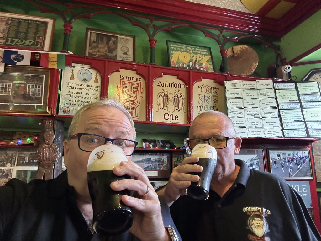
Our day of rest in Dingle was wonderful. The sun shone brightly all day and we got burnt to a crisp. No excuses just stupid. Not enough sun cream and too long outdoors. The day ended in a pub with a nice cold Guinness. Of course it did.
Well rested of body and mind are we after our days rest in Dingle. This is what a body needing rest looks like. He is going to kill me when he sees this. Bear in mind this is 9:15 in the morning.
We had a decent breakfast. Then, we bid our hosts, Pat and his daughter Anne-Marie, farewell. We wrote something apt in their visitors book and departed. Duinin House is a 10/10 place. Well presented, clean and warm and friendly hosts, I can’t fault the place at all.
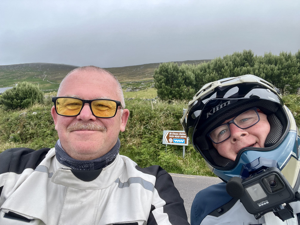
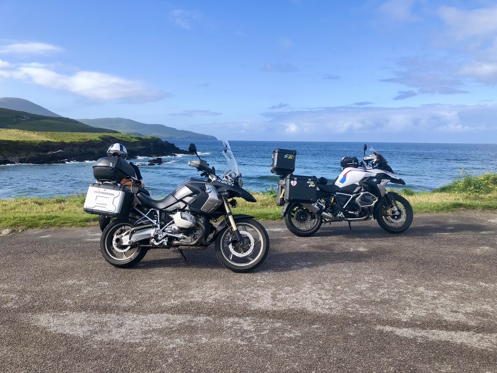
The day dawned heavily overcast but as we left the cloud looked like it was breaking in places. It was dry. We retraced our steps to Dingle and struck west to join the Slea Head tourist route. The road snakes its way around the coast climbing and dipping as the contours allow. This is bleak country. Stone walls enclose sheep in small fields. Beehive structures dating back hundreds of years dot the coastline. They used to house animals, crops and even families.
The road continues back to Dingle where we refuelled before heading up into the Connor Pass. The view from the top is usually spectacular. Today we were in cloud with zero visibility, a strong wind and a chilly and damp air clung around us. We took a photo. Descending down the other side of the pass, the road is down to one lane clinging to the rock face. We drop below cloud level and the view goes on for miles and miles.
A tad breezy up in the lofty heights of the Connor Pass. Apologies for the sound.
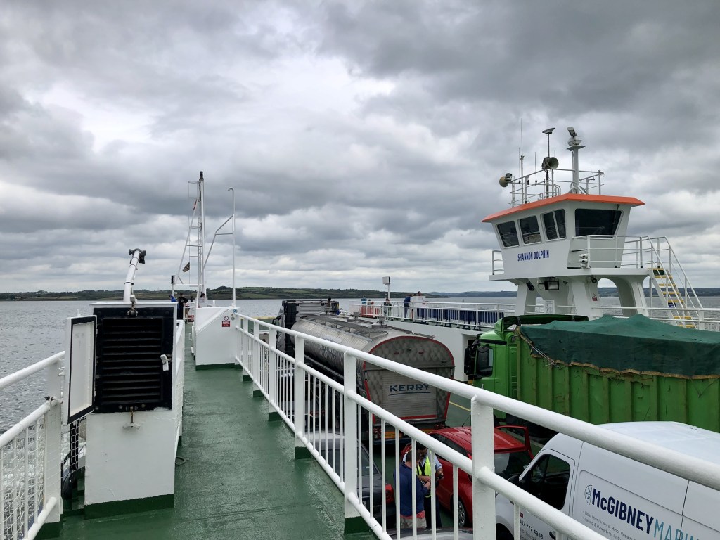
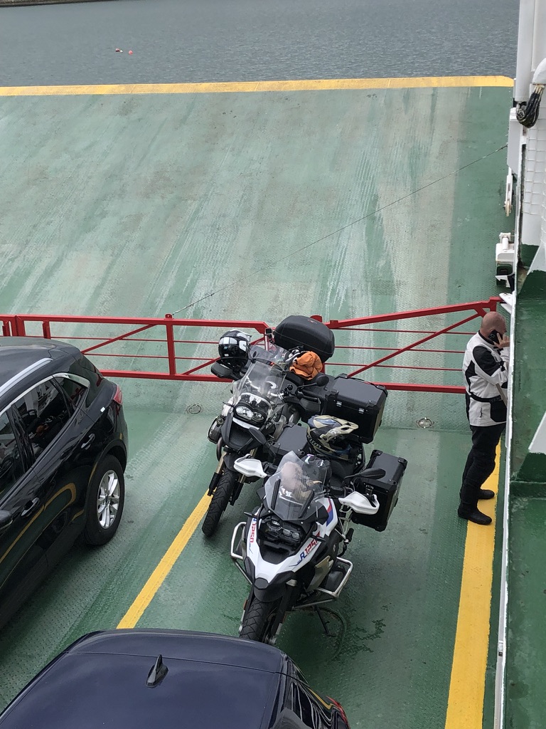
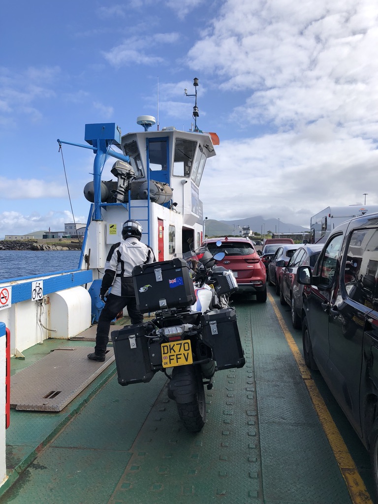
The road then follows a rather dull route into the large city of Tralee. It seems to be a bit of a sprawl. Run down in parts. New shopping zones in others. True of many towns. We pass through. The road leaves the major route and heads north west towards the beach and the seaside town of Ballyheigue. It is a bustling little town. It is busy with holiday makers. Continuing on through Drommartin, Ballyduff and Ballybunion we arrive in Tarbert. Here is the southern end of the River Shannon Ferry crossing. The ferry is already boarding when we arrive and we are beckoned onboard the MV Shannon Dolphin by a crew member and park our bikes for the 15 minute crossing over to Killimer on the north shore.
The run to our stay for the night is a short 4 miles for we are staying in a floating pod in Kilrush marina. Rather unusually it sits on a raft tethered to a pontoon. It rocks about on the water. Just like being back at sea again. We took a walk up into town to find somewhere for dinner. Nothing! A supermarket shop for a roast chicken and a bottle of wine sorted the evening menu.
Todays ride was around 200 kms, around 125 miles.
We are now in County Clare having left County Kerry. Tomorrow we continue our journey north into County Galway.
Hark! What light through yonder window breaks? ’Tis the sun! Shhh. Dont scare it away.
Our hosts Lillian and Dominic at the Old School House B+B in Cloon sure know how to put on a good breakfast. What an awesome couple they are. Witty, charming, warm and interesting and wanting to get to know their guests. With stories of the history of the old school, Dominics career in the music industry, Lillians talk of walking the Camino to Santiago de Compostella and meeting fellow travellers, the day got off to a flying start. Elegantly quirky, the Old School House is not for the traveller that wants all the mod cons, squeaky clean perfection or business like fitments. This is more for the traveller that wants a traditional Irish welcome into a 1800s family home with plumbing to match. We loved it!
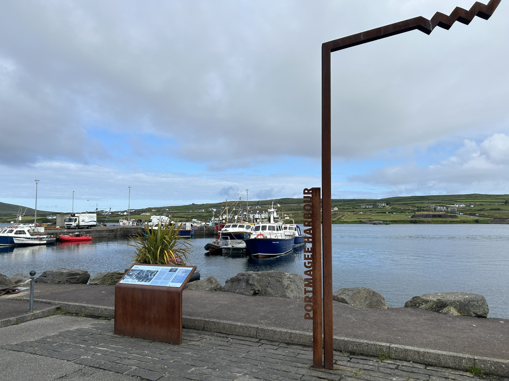
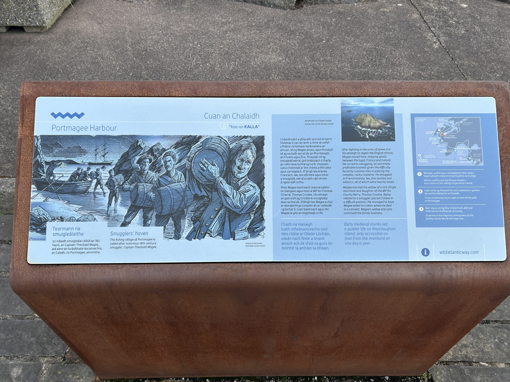
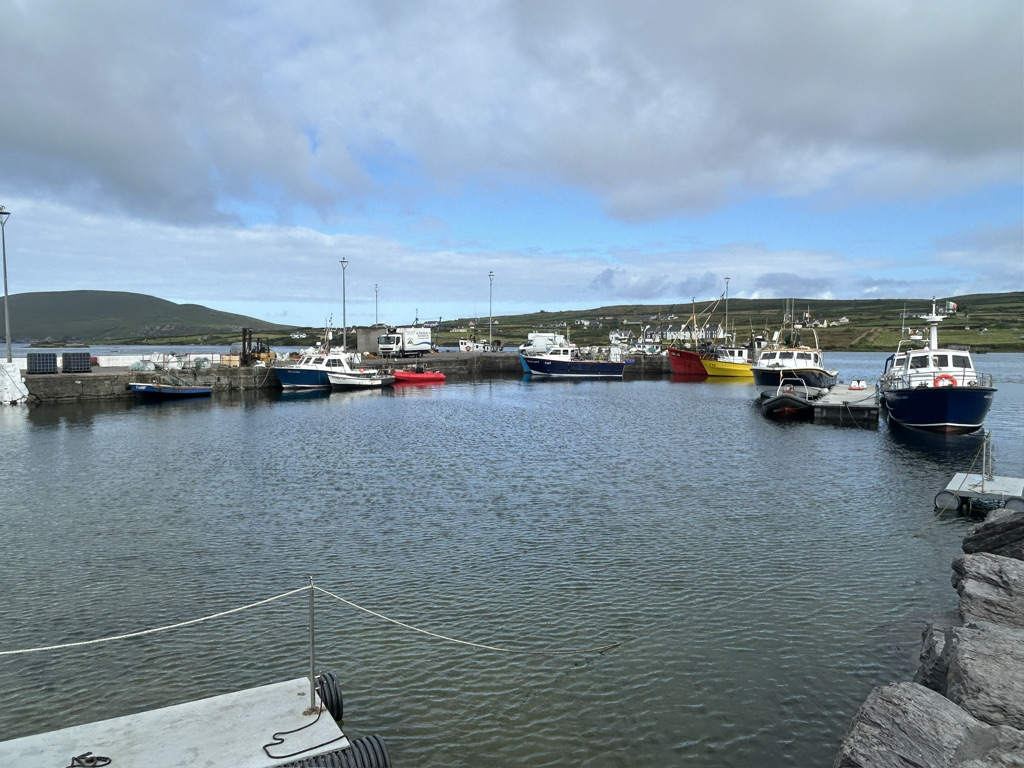
We packed up the bikes and set off on a cool and bright morning. Patchy clouds passed over. The rain stayed away. The hedges of fuscia spangled the green fields with red, wild flowers of orange, purple, red, mauve and white cast an artists palette of colour over the hillsides. The road snaked its way following the contours of the hills along the coast and dropped from height through hairpin bends down into Port Magee. It is a small port town lying in the waterway between Valentia Island and the mainland. It offers the traveller all they need from supplies to cafes to points of interest.
Valentia Island joins the mainland by a causeway. Port Magee sits on the south side.
We stopped for a break in the town and to take in the views. It is a busy little place. Boats take day trippers over to the island of Skellig Michael if they can brave the sea conditions whilst others take fishermen out to try their luck with a rod and reel.
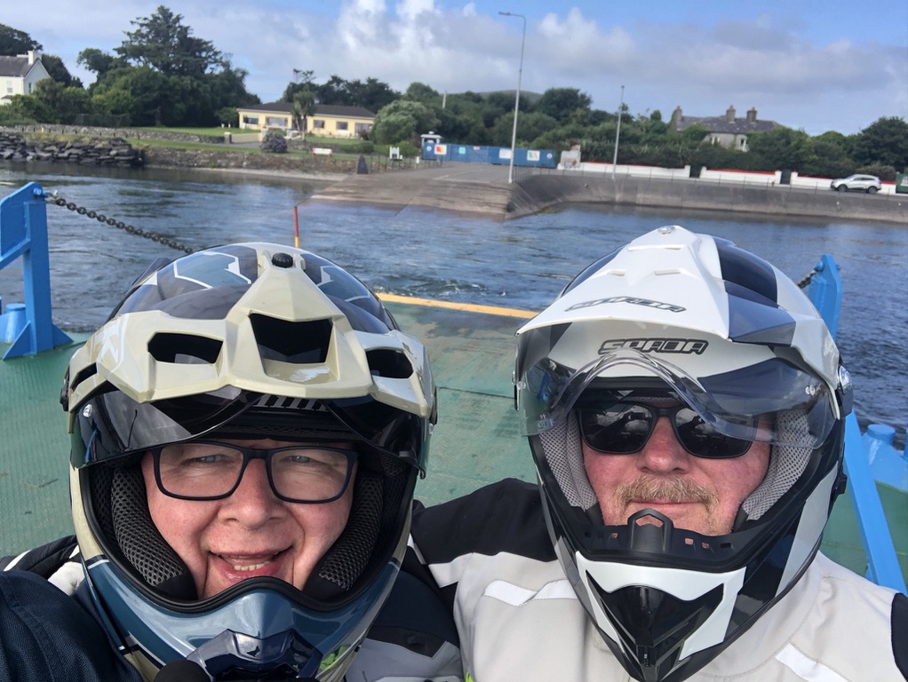
We crossed over to Valencia Island by the causeway and turned right to run along the southern coast to Knightstown. A small settlement on the eastern tip of the island, it is one end of the 6 minute ferry run that connects the island back to the mainland.
By the time we got on the ferry and took a few photos it was time to get going again.
Just after the town of Cahersiveen we turned off the usual tourist route to take the road less travelled and climbed once again up into the hills that form the spine of the Kerry Peninsular to the small town of Glencar. It nestles among the green valleys. Blink and you miss it. The colours of the wild flowers are no less vibrant up here. Probably more so against the lush greens of the grass and brackens. The road skirts the northern fringes of Lough Leane before turning sharply left to rejoin the tourist road in the rather ordinary looking town of Milltown.
At Castlemaine we turn left to join the Dingle Peninsular road west. The weekend traffic is much heavier now. This is clearly a popular road. We pass a heavily populated beach at Inch. A magnet for beach lovers, the car park is stuffed full and tents have been erected willy nilly. We pushed on into Dingle. It too was heaving with people. Too many. It was not pleasant. Coach loads of people had been bussed in. It was impossible to find somewhere to sit.
Last year I brought my ship to Dingle and was inspired to travel the Wild Atlantic Way by one of the travel reps who visited us. I tried to find her in the tourist office to say well here I am doing it but she was not on duty. I left her a wee note to say thank you.
Tomorrow will be a rest day in Dingle. Time to give the bikes a once over, ourselves a bit of rest and a catch up with the wider world. We decided to go back into town hoping the day visitors had all left. Hurrah. They had. The day was rounded off in a local watering hole recommended by our hosts at the Duinin House B+B.
Yup. I have no idea where Cloon is either but here we are. Lets start at the days dawning.
The sun eased its way above the horizon to be veiled by clouds. The clouds parted. Briefly. The sun continued its valiant effort to bring warmth to this part of Ireland. The jury is out on its success.
Its gallant attempts did not go unnoticed by my good self. “OOO Andy, Blue skies”. Zero response from my colleague in duvet land in his bed. Nothing. Oh well. It was only 5:40 in the morning. The weather looked good to start with.
We got up, showered and ate a hearty breakfast. We started packing the bikes up and the only black cloud on the entire west coast of Ireland moved over and dropped its contents on us. Clearly we have been praying to the wrong God.
Slightly moist now we set off on the days ride.
The road continues in a SW direction. Sometimes rough and ready and sometimes even worse than that but always fabulous on a motorcycle.
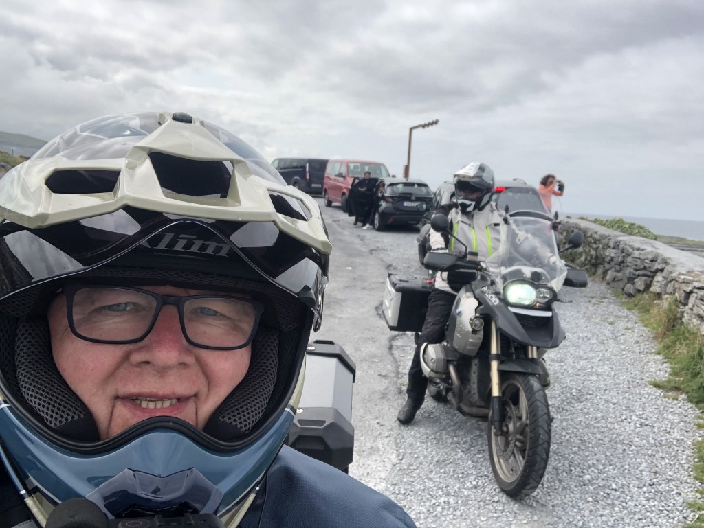
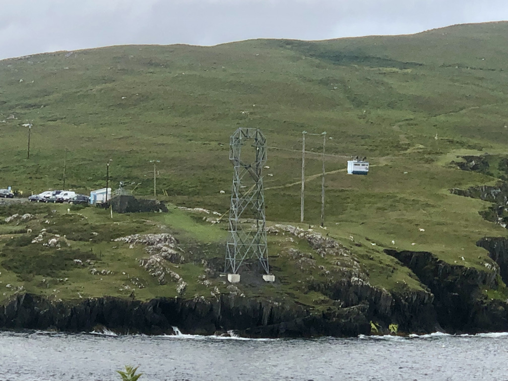
We stopped briefly at the carpark where the cable car to Dursey Island leaves should you choose to be transported in what looks like a caravan suspended above the sea on wires. Not for us. We chose to take a selfie in the rain instead.
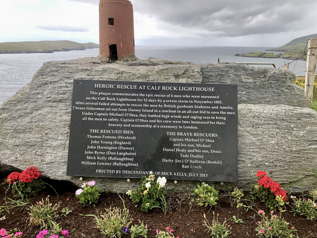
Retracing our steps and in what can only be described as a chance encounter in a lay-by we came across a cairn attesting to a feat of amazing seamanship. Blink and you would have missed it. A photo was taken.
On On!! We followed the tourist route of the Beara Ring. For tourist route read farm track. In many places it was a single track road with eye height bracken obscuring everything. Grass grew down the middle of the road. The bracken obscured Camper vans driven by loons who thought that 60 km/hr was a safe speed coming the other way. It beggars belief why people drive faster than the distance they can stop in. Anyway. We continued on to a small cafe in Eyeries where a coffee and a slab of carrot and walnut cake in warmth and shelter alleviated the rising damp that had by now found its way past ankle height, above the knees, above even the trouser area into the midriff where the bottom of my shirt got wet. We needed to dry out. We went from wet to damp to slightly moist in around 45 minutes.
We continued on. Stopping now and then to take in the vistas and have a break the kilometres passed.
We turned off to take the Healy Pass road. If there is one road that simply must be ridden on a motorcycle then this is it. Twists, hairpin bends, a climb into a mountain pass and a descent to boot had us both grinning.
We stopped at the top to take some photos. Whilst I was snapping away Andy took a tumble behind me. He slipped on a rock. I turned and he was lying on the ground. I ran over and did what all good friends would do in such a dire situation. I roared with laughter. Called him various unpleasant names. He took a photo of me laughing from his prone position. He has a little bruise to show for it. I helped him up. I had to. Who else was going to pour my gin and tonic later in the day?
We moved on.
Back to Glengariff and turn north into the Caha Pass. A brief stop for a coffee break at Molly Gallivans Emporium.
We dropped down into Kenmare township for lunch. A superb bowl of Seafood chowder. Rich, tasty and a boon to the weary and now getting dry biker.
The final leg of our journey took us onto the southern part of the Ring of Kerry. It is busy. Tourist coaches rattle along at a fair pace. Traffic is busy. But then again it is promoted as a premier tourist route. For me, the Beara Ring is much more rustic, more beautiful and less trodden.
We arrived at our stop for the night. The Old School House in Cloon. Quirky, well lived in, an owner who keeps bees, a little dog that greets you. Time to rid ourselves of the last vestiges of the days showers, relax, recharge self and various gizmos batteries and write home. 140 miles of smiling, cussing, oh wowing and sheer unadulterated motorcycling pleasure.
Our host for our overnight stay in Clonakilty was Joan. She was like your mother. She just wanted to feed us all the time. She sent us on our way after an amazing breakfast. We left the B+B and the road meanders south. It passes the Dunmore House hotel and follows a coastal route. The route is dotted with rocky inlets. We pass small hamlets with lovely names like Rosscarbery, Glandore, and Rineen. Then, we dropped into the larger town of Skibbereen for a coffee.
So far the rain had held off. It did not last. Whilst enjoying the coffee, the rain came. Not much. But persistent for about an hour.
We tried to find a waterproof over jacket for Andy. Unfortunately, none of the shops had one. So, we pressed on.
The local rural roads have an R designation and some were basic to say the least. Although tarmac covered they were bumpy and very narrow at times. The major roads are designated as N and are so much better but a little boring. So a mix of both produces an interesting ride and makes progress at the same time.
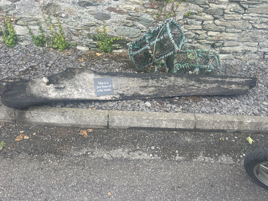
The road twists and bends around the coast. Surprises are to be found at every turn. Small coastal settlements with tiny harbours offer safe moorings for yachts and fishing boats alike. Children line up in lifejackets to take kayak lessons. A man loads a van with trays of langoustines in crushed ice. They have newly arrived on a fishing boat. A whale bone lies at the roadside. Yes, a whales jaw bone.
The road continues west towards Mizzen Head. It passes Ballydehob (got to love that name), Schull, and the Altar Wedge tomb. There, my touring companion decided to put it to good use and stretch his back. The ancestors would be mortified.
Now we started to feel the full force of a strong west wind blowing off the Atlantic. It was 25 to 30 knots, buffeting and needed a slower pace to be safe. The road continues its sinuous passage culminating at the most SW part of Ireland, Mizzen Head. It is a windswept and barren part of the world punctuated by cliffs and wild waters. A lighthouse warns mariners away. Among the barren rocks purple heather and yellow gorse bring vivid colour highlights.
We returned to our bikes. We retraced our path to Goleen and struck north towards the town of Durrus. In Durrus, Andy got a waterproof jacket in a charity shop for €10. Of course he did. I won’t hear the last of it. Mind you, it is a disgusting shade of puce.
We navigated around the Sheeps Head route on fairly good roads. We then dropped down into Bantry for a late lunch. We refueled both ourselves and the bikes. Bantry is a delightful little town nestled at the east end of Bantry Bay. It has an array of useful shops. A boon for the motorcycle tourist. I picked up a new Micro SD card for my camera. I also bought a cable for my external hard drive because I had forgotten to bring it with me.
Refreshed we pressed on to our final stop. Tonight we stay at the Island View guesthouse in Castletownbere. The wind is showing signs of abating. A hot mug of tea and some time to relax in shelter start to recharge the batteries. They relieve the aching muscles. Today has been a good day. Wonderful and challenging roads with weather to test us, scenery to inspire any poet and good craic with the locals.
Total mileage today was 145 miles although it did feel like more.
It rained on the way from home to the ferry in Fishguard. But, once the ferry had sailed for Ireland, the weather cleared and we enjoyed a wonderful crossing.
Until we got to Rosslare when the rain came once again. I had left the UK with a stinker cold caught on the airplane home from Tokyo. Just my luck. So having left the ferry we popped into the local supermarket to stock up on anti cold medicines. I felt dreadful. The next day dawned.
It was still raining. The major decision was whether to put on the wet weather over trousers and coat. You would think that it was an easy decision. However, if you do wear it you boil from within getting equally moist from perspiration. If you don’t wear it you get wet from the rain. Either way you are doomed. We put it on. We boiled.
The first part of the journey was an easy run. We bypassed Waterford and Cork on fairly fast roads. These roads lead to Kinsale, which is the official start of the Wild Atlantic Way. Lots of big trucks on the road kicked up spray reducing visibility quite a lot at times. Progress slowed.
We briefly stopped in the small seaside township of Dungarvan. We needed to get some more meds to try and keep me alive. Popping into the local pharmacy the first thing you notice is a barista coffee station. Never seen one of those in a pharmacy before. The people in the shop were fantastic. The pharmacist sorted me out with some cough linctus and offered us a coffee! Turns out he fitted the machine for his staff as they all love coffee. How cool is that. We both had a coffee. He would not take any money. So, I put some Euros in a lifeboat donation box on the counter. What is very clear is that if you make the effort to chat you are rewarded with warmth and kindness.
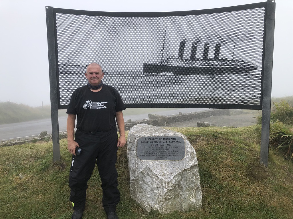
Kinsale was very busy. I guess being the holiday season it was to be expected. But the number of tourist coaches was probably more than the small town can handle. We dropped into the tourist information office to get a map. We did not hang around long and headed for the Lusitania signal tower on the Old Head of Kinsale.
We got there and could not see a thing for thick fog.
We ended a thoroughly wet day with a brief stop in Timoleague. It is a delightful spot. Then we headed for our night’s stay at Joans Bed and Breakfast just south of Clonakilty.
We were met with a big pot of tea and a very warm Irish Welcome. Now we have to dry out our gear ready for tomorrow. The forecast is better so hopefully we can continue in better weather. Just need to get rid of this awful cold.
Despite feeling dreadful and the unfriendly weather I am still delighted to be doing this. There is so much more to come. 179 miles under the belt. A mugshot to finish.