Day 24, Stirling to Lindisfarne.

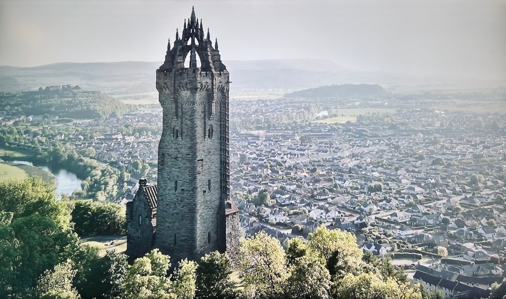
The day started foggy and ended foggy with a bit of mist in between. We saw sod all when we left and in fact saw sod all when we arrived and in between it was sort of ok. The sun did its best to burn off the mist but failed miserably.

Who knew?

We set off and took the road east to Alloa and then picked up the signs for the Forth Road bridge. Having been across it on a motorcycle recently, I was telling Debbie to get her camera ready for the spectacular views of the old road bridge and the rail bridge.

This is what ensued.

The temperature dropped 4C as we crossed the bridge and then recovered the same amount as we left the other side. Clearly the effect of the water below was cooling the air above and the water vapour condensed into blanketing cloud and we saw very little. Oh well. On we went.

The road skirts around the south of Edinburgh. It is Saturday and I had to resist the temptation of going through the city centre. The traffic in Edinburgh is awful at the best of times. I turned off the motorway to take a break, give the dog a chance for a walk and get a coffee. To get back on track we motored cross country and as I have said before and will say again, get off the motorway to see the best of the country. We passed through the delightful little town of Haddington.

Its majestic architecture harks back to prosperous days. Honey and rose coloured buildings, parks and open spaces attest to the fact that once upon a time it was the fourth biggest town in Scotland after Aberdeen, Roxburgh and Edinburgh. Clearly this was a wealthy place. I think it still is. I loved the place.

We continued on to Eyemouth passing though the golf country of Dunbar. Golf courses everywhere.

Eyemouth had been mentioned to us by a friend as a place where something rather special lay. Eyemouth itself is a small fishing town with a lovely harbour, a great fish and chip shop (ask me how I know 🙂 ) and the site of the Widows and Bairns sculpture. I was moved by this poignant piece of art. Bairns incidentally is children.

The fact that each bronze figure represents a real person I found really moving. The artist has captured the dreadful event in the faces and poses of the wives and children of the lost fishermen. The figures are only around 10- 20 cms tall and I wanted to spend a lot longer looking at them. But the fog rolled in and the temperature dropped and I was standing in shorts and a T shirt.

We crossed the border into England and passed through the delightful town of Berwick Upon Tweed. From there it was a short hop to our campsite for the next two nights at Beal Farm just a few miles away from the causeway that links Lindisfarne, Holy Island to the mainland.

It has been another wonderful day of exploration. Our van trip is drawing to a close now but still we have Lindisfarne to explore and one more place before we head home. I will leave you with a doggie picture. Leia the border collie was waiting for mum to return to the van with fish and chips from Eyemouth chippie.

Todays Distance : 115 miles

Total Distance : 2404 miles.

Day 23, Wallace Monument and Bannockburn battlefield.

Today was a day of exploring two notable local landmarks. The National Wallace Monument dominates the skyline of Stirling. On one side of the River Forth sits the monument. On the other sits Stirling Castle. Both occupy high hills on an otherwise flat river plain.

The monument sits on Abbey Craig. Craig is the name for a large outcrop of rock. It is said that William Wallace and his right hand man Andrew de Moray stood on this very spot to observe the army of King Edward 1 as it approached from Stirling Castle. You can read more here.

It was another beautiful day so having parked the car at the bottom of the craig we started the climb to the base of the tower. That got the heart and lungs working. Once we were in the tower there were another 246 steps to climb to the top 220 feet above in a winding spiral staircase for an outstanding view of the battle field and beyond. The tower is on 3 levels and each level has a room filled with history where weary legs can rest before continuing up.

The Battle of Stirling Bridge in 1297 was a decisive victory for Wallace. The battle field is now a rugby pitch. So I suppose battle still goes on albeit more gentlemanly.

In the above picture Stirling castle lies on the hill centre right. Zooming in a little…..

The rugby pitch is the site of the battle. Stirling castle is centre right and the site of the bridge over which Edwards doomed army marched still exists today where a stone bridge stands. You may just be able to make it out behind the rugby pitch.

William Wallace.

Having taken our fill of Wallace, De Moray and Co we set off for Bannockburn battlefield.

Rather like the moor at Culloden, the field at Bannockburn is hard to imagine. It is a well kept meadow now with little to remind you of the battle. Storyboards about the place point out features on the horizon showing where the advancing armies came. The large flag pole is where Robert The Bruce planted his flag having defeated the army of Edward II only 17 years after Wallace defeated Edward I. But I am pleased that we were able to fill in gaps in our knowledge of Scots history. My mother would often talk of Culloden and Bannockburn. She was a proud Scots girl and never forgot her heritage. I wished I had talked more to her on these subjects but alas it was not to be.

Tomorrow we head further south to cross the border into England. We will head to a place that Debbie and I have read much about. I last went as a small child. It is about time I returned.

Todays distance: 15 miles.

Total Distance: 2289 miles.

Day 22, Buckie to Stirling.

The actual name of the small fishing port where we stayed for the last two nights is Findochty. It lies 3 miles east of Buckie. We stayed in a small campsite right on the sea front. I adored it. After I wrote the blog last night Debbie and I took the dog for a walk around the small harbour. I was reprimanded by Debbie for pointing out that one of the fishing boats we looked at moored to the harbour wall had a liferaft overdue for service. I know I know!

Sat on the harbour edge looking out to sea was this fellow.

I have no idea who the artist is or what it represents. But I love it. The facial expression is one of longing for the sea or perhaps waiting for someone to return from sea. Either way it really made an impression on me.

Sunset over Findochty harbour.

As we were walking back to the van I saw a lady collecting sticks off the pebble beach. She chose each piece of wood carefully. When she was finished I asked her what she was up to. Sandy who had moved here from Yorkshire makes knitted birds and perches them on the sticks she collects. She already had ideas for each stick. The dog thought the sticks were for her.

We awoke to full sun beaming into the van at 5am. I forgot to draw the blind over the sunroof window. We packed up and set off South to Stirling. Why Stirling you may ask. You will see tomorrow.

We took the scenic route as we had all day. Taking mainly B roads, (short for bloody terrible!), we made for Huntly in the middle of nowhere. This is serious farm country. Up and over hills on single track roads not often used by loons in camper vans. The road surface tested the vans springs and the ability of the fridge to keep its contents within. We had to stop as this little beastie was staring at us.

A railway viaduct in the middle of nowhere. What a beautiful piece of industrial architecture.
I could quite happily live there.

The road continued into the Cairngorm National park. We had travelled north up the west side of the park on our way to Buckie. Now we travelled south down the east side, passing Balmoral Castle. The car park was mobbed so we kept going until we reached Braemar. Again all the car parks were full so we found a spot in the car park at the Braemar highland games park. Photos on a big notice board nearby attest to the fact that the Royal Family are frequent visitors. I had been through this town before when I did a tour on my motorcycle. To me it is quintessentially Scottish. I particularly loved the look of the Fife Arms Hotel. A peek inside revealed what I would call a proper old hotel that has stood the test of time and stayed true to its traditional values.

The road south from Braemar rises up to pass the Glen Shee mountain resort, passes the most wonderfully named settlement of Spittal of Glenshee (where four Glens meet), drops down into Blairgowrie and Rattray before skirting Perth and dropping into Stirling. This stretch of road is like Arthurs Pass back in New Zealand. Beautiful, twisty and scenic with still remnants of snow on the higher peaks. You have to concentrate when driving this stretch of road.

We are here for two reasons which will become clear tomorrow. But here is a clue.

Not the caravan!

It has been another day of fabulous roads, amazing scenery and meeting lovely people. Well most of them. The roads for the most part have been reasonable. Like a lot of roads in the UK they need repairing in a lot of places. But they snake through some of the most lovely pastoral scenery around. I had no idea how remote some parts of Scotland really are.

Todays distance: 175 miles

Total distance: 2274 miles.

Day 21, Buckie and Culloden.

What a day it has been. Of emotions, sunburn and filling in gaps in our knowledge of events of old.

The day dawned warm and clear with amazing blue skies. Debbie started the day off at the Buckie fishing and heritage centre.

The lady at our campsite reception recommended this as the place to go. She was armed with the knowledge that George Forbes Stevenson , her Great Grandfather was a butcher whose young son Alexander would become her Grandfather. George had a shop and we had an address. The entire family emigrated to new Zealand on the White Star Line ship Athenic departing Southampton on the 29th January 1926.

I don’t know about you but when we find out information on our ancestors it gives me a sense of wonder.

Georges shop is the property with the brown facade. It is now apartments. The building is unchanged from the day the family left it and headed for their new life in New Zealand. We filled in some gaps but the one question we wanted answered we did not manage. Why did a successful businessman in his 50s sell up and move to New Zealand? He had no known connections that we know of with New Zealand before going.

The shop would have been busy. It was right next door to what is now Buckpool and was the original harbour in Buckie. It can be seen just behind the house. It is now redundant when a new harbour was built further east. The old harbour has been filled in but the old walls remain.

We know the town prospered. I snapped this from a notice board in the town.

There was no more to be done in Buckie. It took us just a little over an hour to drive west to Culloden battlefield. On the way we chatted about what Debbie had found and what she had seen.

Culloden on the other hand is like many old battle fields around the world. It is now just a field. It is hard to imagine the horrors that took place in the very short 40 minute battle between the British Government troops and the Scottish Jacobite men. It was utter carnage and as you look out over the moor we both struggled to imagine the scene. It was a peat bog of muddy and wet heather and shrubs. In April. The site does its best to portray the scene. Stones mark the mass graves engraved with the Clan names.

You can only sit and look out at the line of red flags that marks the line of the Government troops and the blue flags marking the line of the Jacobites. It is a moving place.

We returned home thinking of the days events. There are still more questions to be answered. There always are. Tomorrow we start our journey south. There are still a few outstanding items to do though.

Todays distance: 110 miles

Total Distance: 2099 miles.

Day 20, Stranraer to Buckie.

Day 20 was mainly a sit in the car and motor north East across Scotland. Our destination was 291 miles that took us around Glasgow to Stirling and up the west side of the Cairngorms. It was a day of two halves weather wise. We started out on cold and wet weather.

By the time we got to our lovely campsite at Findochty as few miles east of Buckie it was 22C and patchy blue skies.

We passed through parts of Scotland I had never visited. It was probably best not to have done it in a 3 metre high camper van but oh well. We passed through Callander which is lovely and I wished we had time to stop. It was a picture perfect little place. The A84 turns onto the A827 at Killin and runs along the west shore of the Majestic Loch Tay before we struck north on the B8019. I should have known by the B it was going to be narrow and twisty. Thus it was but oh the views.

And the logging trucks hurtling the other way. I still have both wing mirrors. I was too kind to a lot of cars coming the other way trying to get over as much as possible on my side of the road occasionally flinging mud up under my nearside wheels. The cars coming the other way seemed to make no attempt to slow down or move over so I adopted the hard nasty approach and held my line. I am simply too nice. The van is now covered in mud, dirt and dead flies. We continued. The village of Fortingall could be lifted straight from the Cotswolds.

The van is 3.2 metres high at the tv aerial. I winced passing under this bridge but no nasty scraping noises.

After 7 ½ hours we arrived at our camp for the next two nights. Right outside the campsite is the Red Admiral pub. It would have been desperately rude to travel the best part of 300 miles and not support a local business. So we did. And I was glad of it. The dust of the road was heavy in the throat. A cold pint of local brew was just what the doctor ordered.

Tomorrow will be a special day. Debbies Great Grandfather and his son, her Grandfather both came from Buckie and we are going to see what we can find. In addition we will visit Culloden battlefield.

Todays Distance: 291 miles

Total Distance: 1989 miles.

Day 19, Island Magee to Stranraer

Our adventure around Ireland came to a close today but what a blast it has been. We left the campsite early today and said goodbye to the farmer on whose land the site rests. He was busy feeding his chickens, ducks and guinea fowl in the farmyard. A scene from a Constable.

We headed south along the A2 for the short drive into the town of Carrickfergus. Dominated by its castle on the shore it was a sleepy monday morning here. It started to rain. It did not stop. But for us it was a chance to grab a decent breakfast at Springsteens American Diner. Give them their due, they did do an amazing, if not the healthiest grant you, breakfast with non stop coffee. Debbie popped into Sainsbury’s next door whilst I took the dog for a walk around the marina. Clearly Carrickfergus was a place of some importance in days of yore. With a Scotch[sic] quarter and an Irish quarter (the other two quarters were missing?) this place has history. Alas we could not stick around to find out what it was.

Carrickfergus Castle

The road down into Belfast passes through the suburbs found in any town around the globe. We checked into Stena Line for the Cairnryan sailing. It is a route I have never been on. We were first to arrive for the 15:30 sailing. Just as we started to board it really started to pour with rain. Debbie spied the gusty wind conditions and popped a seasick tablet in her mouth just in case.

The last view of Northern Ireland. Rain!

She need not have worried. The dog stayed in the van and took up residence in Debbie’s front seat. The crossing was quick. 2 hours 25 minutes berth to berth. When we returned to the van the dog was still in Debbie’s seat curled up until we opened the van door. You would think we had been away for hours by the greeting we got.

We are now set for the night in Ryan Bay campsite just to the north of Stranraer. It is lashing down with rain. It is time to do nothing but get our books out. It is a filthy night. We arrived into Ireland in dirty weather. We left Northern Ireland in dirty weather. The beginning of the Scotland Sojourn seems likely to continue in the same vein.

The route around Ireland and Northern Ireland. In at Rosslare. Out at Belfast.

Tomorrow we have a 280 mile drive north. Why? You will have to wait until tomorrow for that.

Todays Distance: 65 miles including the ferry crossing.

Total Distance: 1698 miles.

Up and down and through the mountain pass.

The final day dawned overcast, gloomy and threatening to rain. After all, our accommodation last night, Tigh-na-Cheo means house in the fog.

But knowing this was the final day we had a spring in our steps and packed for the last push mentally and physically.

The guide book says the 15 mile walk from Kinlochleven to Fort William is challenging and starts with a long sustained climb. From past experience I know that means argggh! It goes on to say the walk crosses a beautiful high mountain pass and then undulates between open moorland and forests before a long descent down into journeys end at Fort William. Considering that Kinlochleven is at sea level the clue as to how far the long sustained climb would be is that we had to reach the high mountain pass.

We left our accommodation to see two wild red deer munching the grass on the lawn outside. A good omen I thought.

This very day there was also a UK championship trail running competition about to start from Kinlochleven and so it was that just after we started the climb we had to move to one side of the path to let the super fit trail runners pass us. Around 30 of them. That smashed me mentally as I was already in 1st gear for the climb. I had to regather my thoughts.

It took around 2 hours of heart thumping, leg aching, hard breathing climbing up a rough and stony path to reach the first summit. I was goosed already and we had only gone 1 ½ miles! I stopped for a brief rest and looked behind me to see how far we had climbed. The view to the small town of Kinlochleven below was superb.

Then the rain started and the wind picked up. It gusted to around 30 knots. The wind chill was significant. Our saving grace was that the wind was on our backs. Even though I had my rainproof poncho on, plus my coat, thermal hoodie, shirt and vest I still got a bit chilled. The backs of my legs were wet in no time. It was quite uncomfortable. I felt a bit miserable at this stage.

We could have turned back but what was the point of that? We had come so far. The effect of the rain in the mountains was to recharge all of the waterfalls and within 30 minutes the green grey mountains now were streaked with white as foaming water ran down their flanks. It was staggeringly beautiful. There was a silver lining to the miserable weather.

It is difficult to imagine what life must have been like living up here. We passed the ruins of crofts. One even had the remnants of an old plough and farming implements scatterd about in rusted broken pieces. The stone walls of the animal pens were long disused.

Once somebodys home. Now long forgotten. A derelict farmouse at Tigh-na-Sleubhaich. ( translates to the house of the gully place.)

We now joined another of the old military roads that climbed up to the mountain pass called the Lairig Mor. It was exposed. It was barren but the scale of the highland scenery made me feel so very small. There was no shelter. We just had to keep going.

An information board in the middle of nowhere next to a stone cairn. It recalled the Battle of Inverlochy. We were standing at the very point where history was made 1645. The board tells the story of Dairmid Campbell. The board and cairn beside it mark the spot where Clan Donald abandoned the chase of the Campbells after the battle as they headed back the way we had just come through the Lairig Mor.

We skirted the flanks of the UKs highest mountain, Ben Nevis.

We then started the long and knee torturing descent into Glen Nevis and the walk to the end of the West Highland Way in the town of Fort William. Emotions were running high as we crossed the silver line on the pavement. We had the obligatory photos by the sign and bronze walker statue on the bench. In time we would reflect. My feet and ankles were complaining. I was wet and cold but I was warm inside.

That is it. Done and dusted. Toworrow I will give a brief note to sum up the experience. What did we learn, did we enjoy it, would we do it again?

The Devil in the Glen

After a days rest in the Kingshouse Hotel it was time to get back on the trail again.

This was the day of all days that filled me with some trepidation. The climb up the Aonach Eagach ridge between Glencoe and Loch Leven was renowned.

We set off on the Way following the main road through Glencoe. It initially climbed up and down gently along the hillside to one side of the road. The massive peaks of the Glen seemed to look at you as we passed by.

We arrived at the bottom of the climb to the Devils Staircase and looked up. There was no going back. One foot in front of the other. The initial kilometre or so was not so bad. The path was rough loose stone which was wet and at times slippery. The heather was blooming around us and now and then a skylark would take to the sky disturbed by our passage.

An excellent piece on the climb can be found here.

But then the real climb started and progress slowed right down. The path took a series of switchbacks up the hill side. Each was around 50 metres long before turning back and climbing. This was a hard slog. It was just a case of keep moving. One foot in front of the other. Every 50 metres I had to stop for a small rest. Then do the next 50 metres. And so on. The stops gave me the chance to look back at how far we had come. The sun peeped between the clouds. The view back down the valley was staggeringly beautiful in the early morning sun.

Slow progress. We made it to the top 550 metres up and sat down by the two cairns of stone that mark the highest point of the entire way between Glasgow and Fort William.  My Scottish mother would often tell me the story of the massacre of Glencoe and how the McDonalds of Glencoe were betrayed. “Never trust a Campbell” she would often say. Here we were sat at the top of the ridge on the very path over which the English soldiers marched down into Glencoe to carry out the bloodshed. For this was another of the old military paths constructed to move the army around quickly to control the Clans.

It was cold so I put my wind cheater shell coat on. The wind was chilly and blowing over the peaks. A snack bar and some water provided the fuel. The views across the mountain tops were breathtaking. What lay ahead was now a long descent. All the way down to Kinlochleven. I just knew my knees were not going to like this one bit.

The rough stone path meandered down the ridge. Sometimes climbing, sometimes dropping down.

We crossed numerous streams draining the upper slopes of rainwater down into the River Leven far below.

The rough stone track then became a stone and gravel service track for the hydro system for the old aluminium smelter far below. The gradient increased dramatically on this track and my knees really started complaining. I was reduced to small baby steps to maintain safe progress and keep the discomfort to a reasonable level. This went on for around 2 ½ hours until we finally reached the little town of Kinlochleven where we will stay for the night.

Our accommodation is the Tigh Na Cheo guesthouse in Kinlockleven.

Tomorrow will be the final 15 mile leg to Fort William.

The road leads North.

If the weather is the harbinger of what is to come it is looking pretty good so far. Today dawned bright and warm. The two grinning loons took the train from Worcester to Birmingham and on to Glasgow Central. I was going to drive and leave the car for two weeks in a Glasgow city car park. It would have cost me around £90 to do so. There would always be that niggling doubt whether I would return in two weeks time to find it in the same state I left it. So we will risk the fact that trains in the UK are prone to strikes at the moment and take the iron horse. When the trains are running there is no better mode of transport in my humble opinion. The weather was fabulous from South to North, the scenery of rural England through the Borders and into Scotland is simply stunning and we arrived in Glasgow moderately relaxed.

We chose to stay in the Premier Inn in the city centre. From here it is a 20 minute walk to Kelvingrove Park where we can pick up the Kelvin Walkway that runs north for the 10 miles, 16 kms to Milngavie. The park is a classic example of a Victorian city centre park designed by Sir Joseph Paxton and comes complete with a museum and old fashioned bandstand. Now Milngavie is technically where the West Highland Way begins. But the walk from Glasgow will be a good leg stretch on what is forecast to be a beautiful day.

We checked in and dumped the backpacks and whilst I put the kettle on Debbie settled into her role as navigator to check on the route for tomorrow. It is fairly straightforward.

Chief tea maker in full swing.

The hotel is OK I suppose as city centre hotels go. It was a 15 minute walk from Central station and I reckon the Premier Inn group of hotels is always reasonable for what you pay.

I am responsible for the accommodation choice along the Way and if ever you come this way yourself I hope to give you some idea of quality. We carried a tent and all the stuff that goes with camping the first couple of times that we attempted this. I am a lot older and a heck of a lot wiser. Can’t be faffing around with all that now so accommodation complete with hot showers, comfy beds and a kettle for tea it shall be.

Todays walk was Glasgow Central Station to the city centre Premier Inn.

Tomorrow we head for Milngavie.

West Highland Way Prelude

September 5th 2023 rapidly approaches. So what you may ask. Well do read on…..

The West Highland Way is a footpath running from Milngavie (pronounced Mullguy) near Glasgow to Fort William in the Western Highlands of Scotland. At 96 miles or 154Kms from end to end it leaves the suburbs of Glasgow, runs up the eastern side of Loch Lomond taking in the magnificent views of the loch and surrounding hills, crosses the heather covered and bleak Rannoch moor, skirts around the towering peak of Ben Nevis the highest mountain in the UK before ending in Fort William.

If you have made it this far you will have gathered that Debbie and I will walk the walk. This bit is the talk the talk. This will not be the first time Debbie and I will have attempted the walk. In fact not even the second or indeed third for me. There is history here. The type that gnaws and chews at your very soul.

We first attempted it right after we got married in July of 1987. It was our honeymoon. I know. Should have gone to Majorca. We still have the original guidebook. That attempt was thwarted when we had a wholly inadequate tent which let in the dreaded Scottish Midge. This is no ordinary beast. Oh no. This minute flying insect is prone to suck the juices out of any bare flesh it can land on especially that attached to tourists and has a bite that itches like hell. For days. And nights. They decided to feast on my face as I slept in the aforementioned tent with the bright sign saying “midges welcome to Marks diner” on it. The next morning, I could hardly see such was the swelling from the bites of the little Bas****s. We abandoned the attempt at Balmaha on the southern shore of Loch Lomond. My father and my uncle came and picked us up in the car. They tittered and sniggered at the look of me. My visage resembled a chewed toffee. My pride was severely dented. I needed a week of antihistamine cream smeared on my face to get back some functionality in the sensory organs contained on it. I never forgot that.

The second attempt saw Debbie and I make it to Crianlarich at the Northern tip of Loch Lomond. That was after about 5 days walking. Debbie had suffered a back injury some time before we made attempt 2 but it returned to cause her too much pain and after some tears it was decided that it was best we abandon the attempt to recover and fight another day.

Attempt 3 was just myself and a friend of mine. We got as far as Tyndrum which is about 6 days in. This time I had to call off whilst my friend continued on and completed the walk himself. My boots caused me so much pain that I had to stop and return home. Then our family started and the West Highland Way was put on the back burner. To simmer and taunt from North of the border.

In 2014 Debbie and I walked the Camino from France to Santiago de Compostela in NW Spain. That was 42 days walking and around 850 kms. We learned so much about our fitness, clothing, feet and mental fortitude.

The West Highland Way is next. The old walking kit has been dug out of the loft, boxes, garage and every other nook and cranny it was found in. Dust was blown off. Cobwebs were removed along with their long deceased spinners. We will not be camping as we did some 35 years ago. Age, grown up family and a bit of cash in the pocket means we can take our time and afford a modicum of comfort. Nonetheless the walk still taunts us. Can we defeat it? What will happen this time? The body is not as young as it was…..

If you fancy, then come along for the ride…..well walk. You will get the day by day low down warts and all. As always I love to read your comments. That way I know that somebody reads this stuff other than me. 😁