Day 15, Rathmullan to Redcastle. Experiencing the Raw Beauty: Malin Head and Beyond.

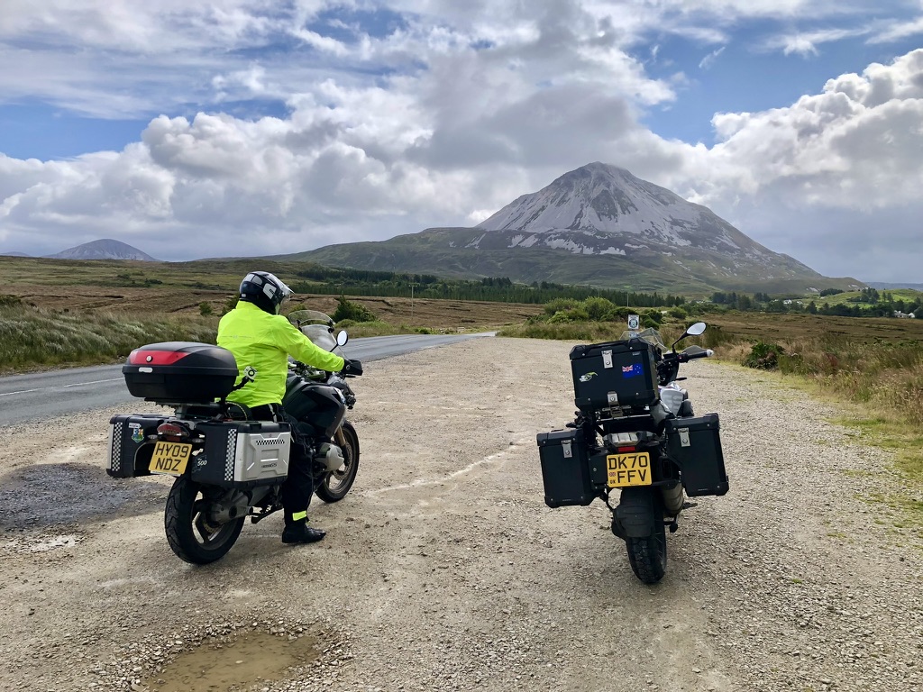
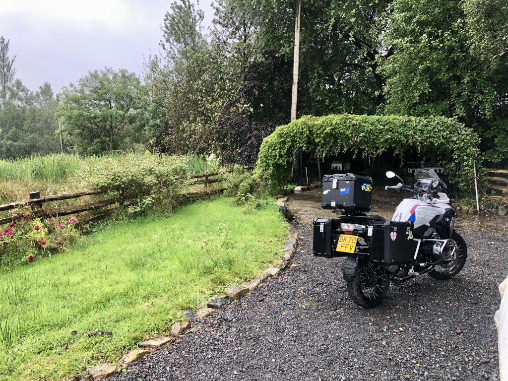
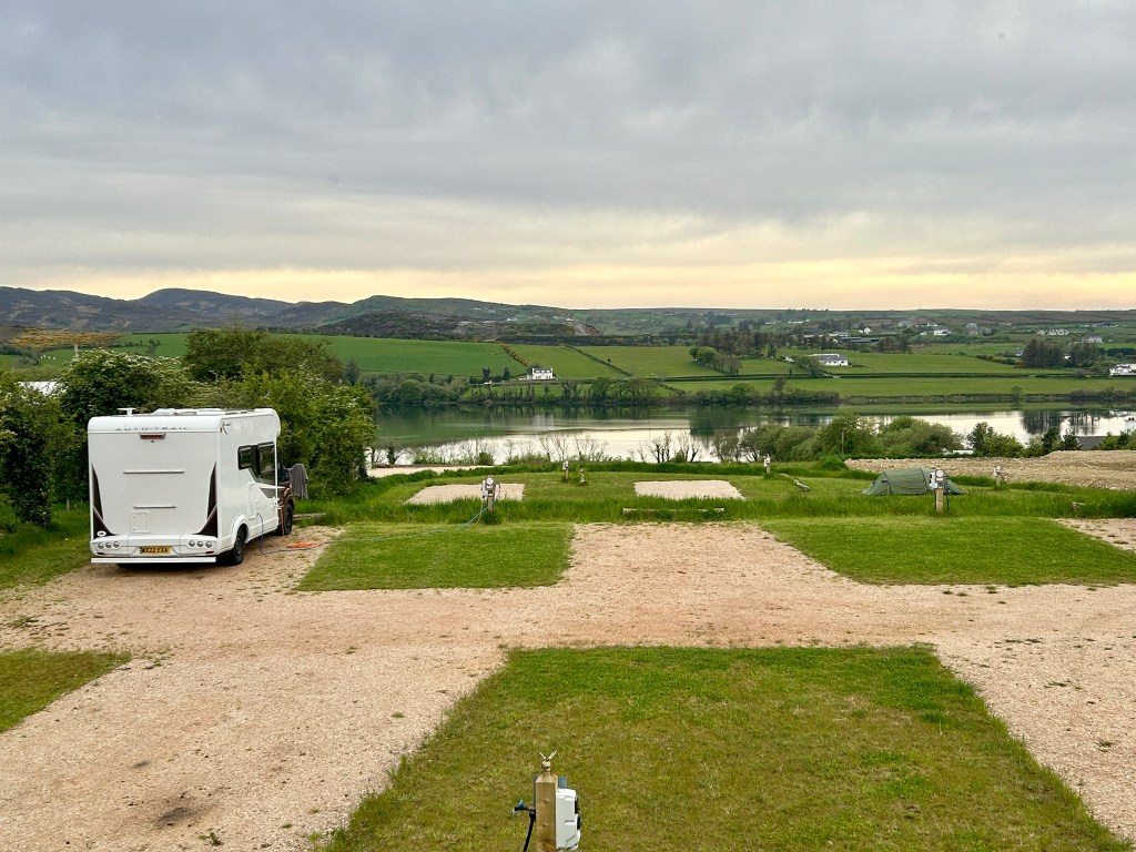
The Waters Edge hotel was a boon to the weary traveler. Except no breakfast was available until 10 am. Not good for those of us who want to get on the road.

So, we thought we were being clever by leaving early to hunt down a tasty breakfast somewhere down the road. Little did we know, it was a decision we’d come to rue. But I’ll save that story for later.

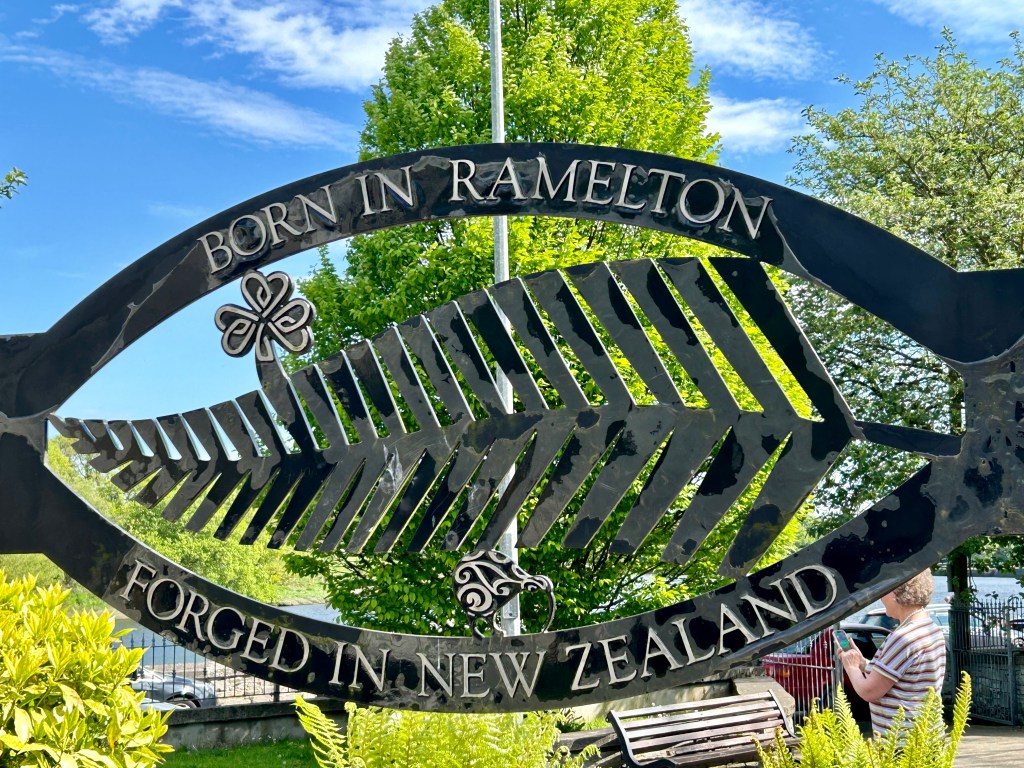
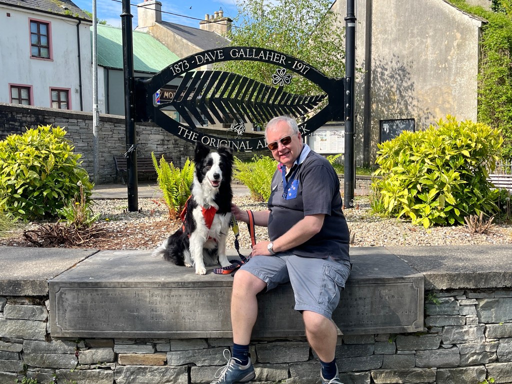
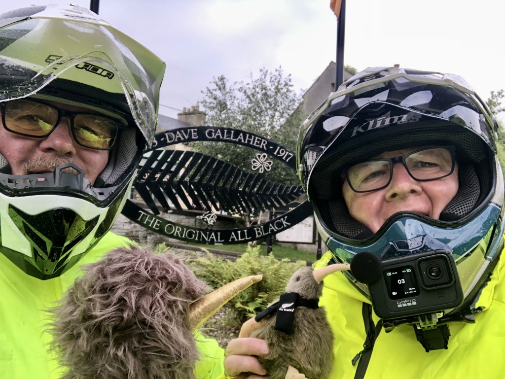
First stop of the day was the town of Ramelton. It is a pretty little place.

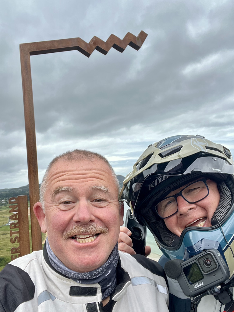
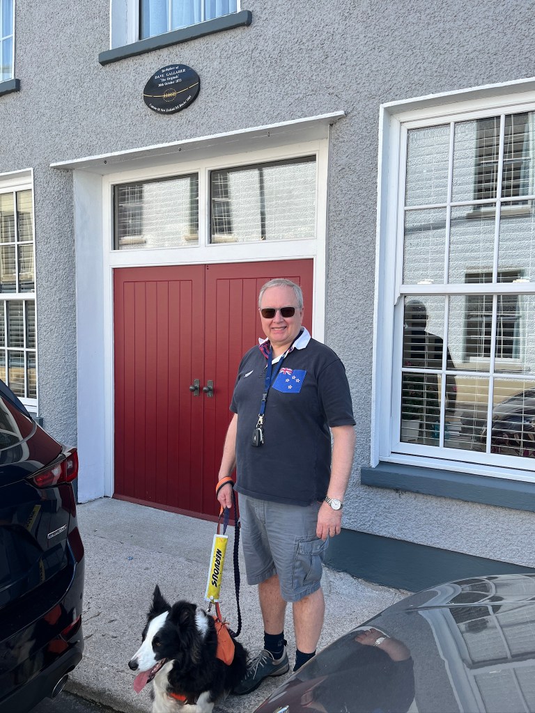
It is the birthplace of David Gallaher, the first All Blacks captain. The sculpture in his honour, “Forged in New Zealand,” stands as a testament to his legacy. I made sure to take Andy to visit the small park and capture a photo of my two kiwis.

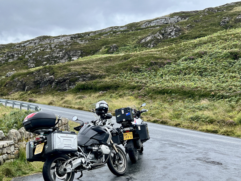
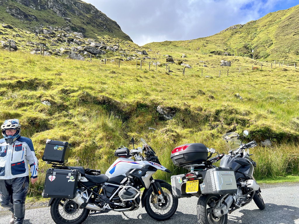
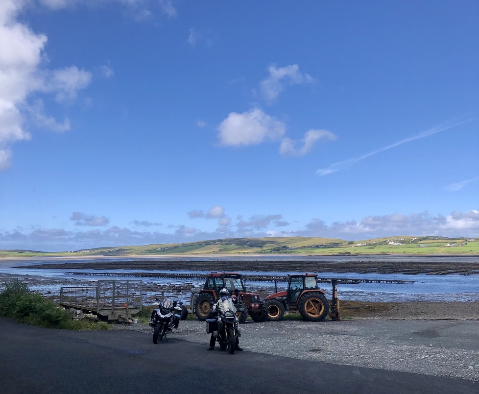
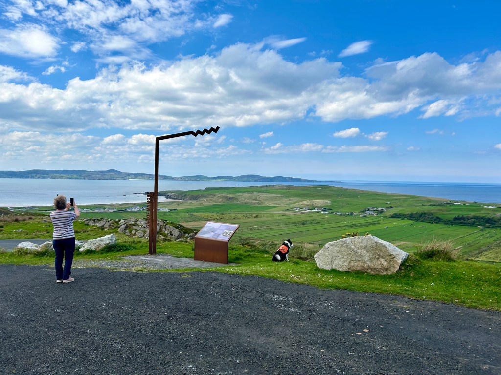
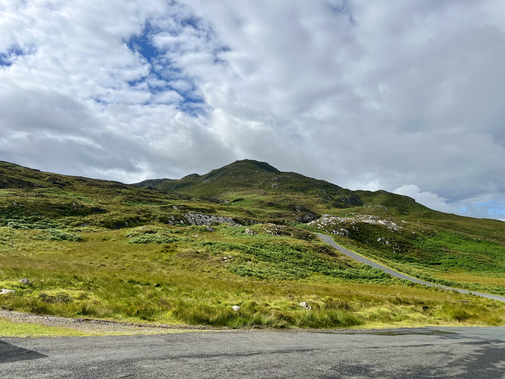
We continued on. You would think a town the size of Letterkenny would have an open cafe. Nope. On to Buncrana on the R238. Which was devoid of buns.  Leaving Buncrana we turn off onto the Westbrook road. This is a bit twisty but the best was to come. It disappears into the moors and turns and climbs into the Gap of Mamore.

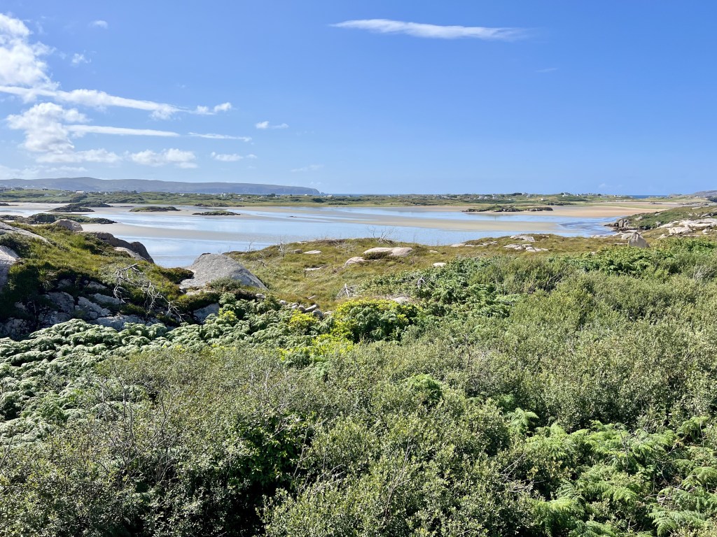
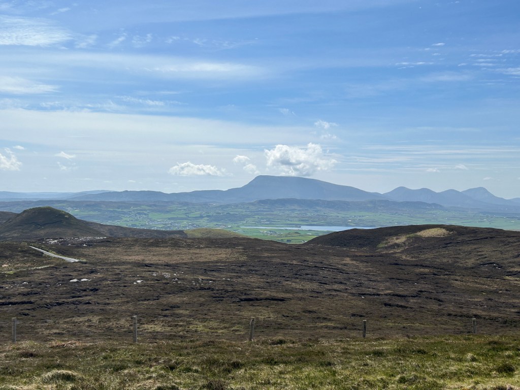
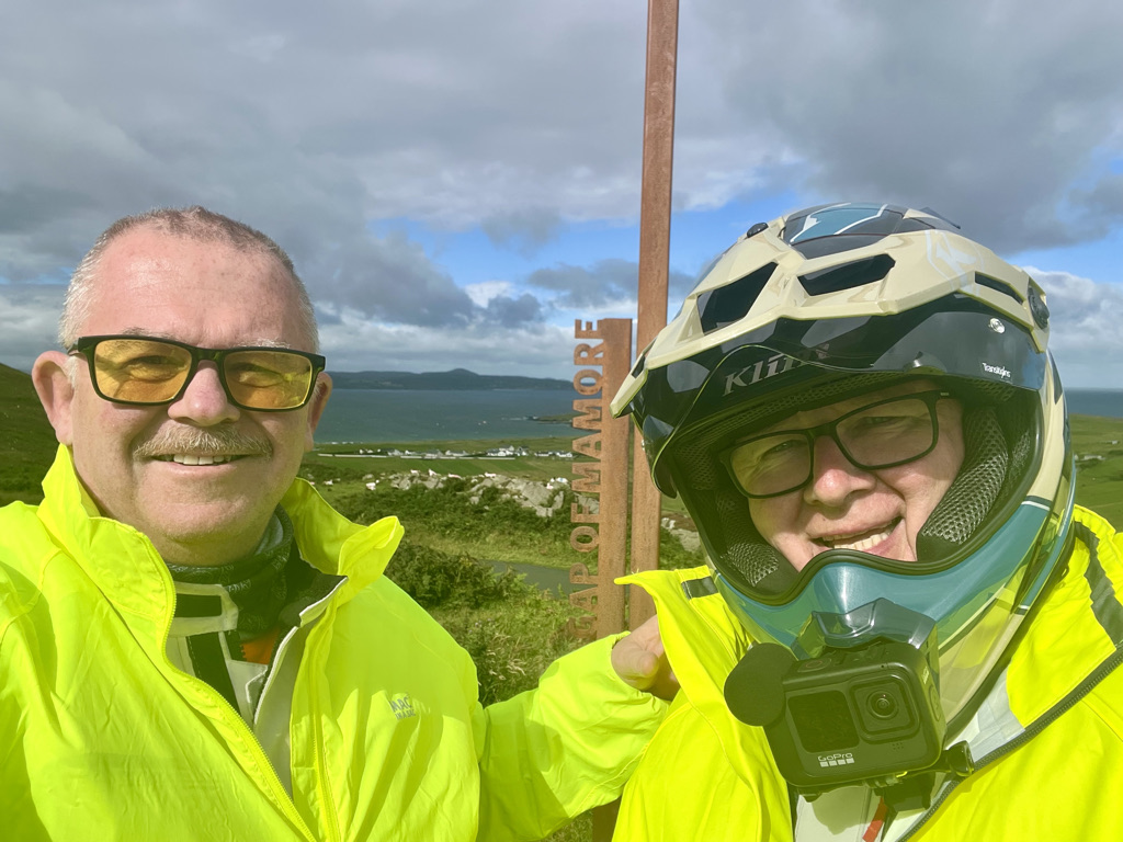
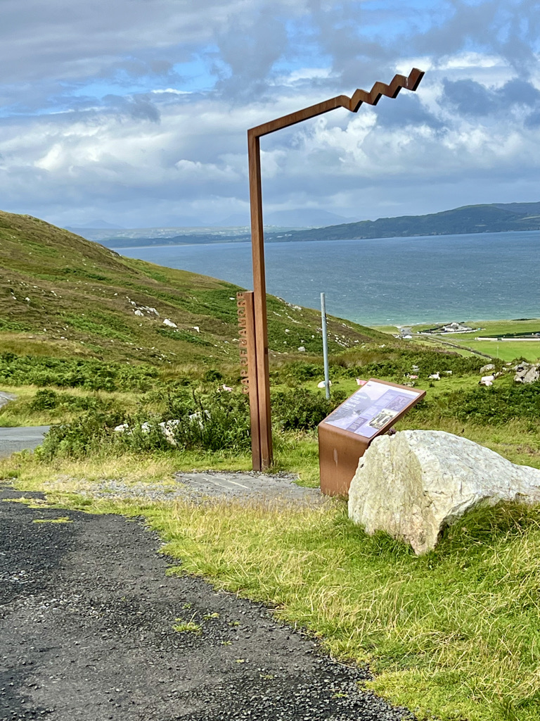
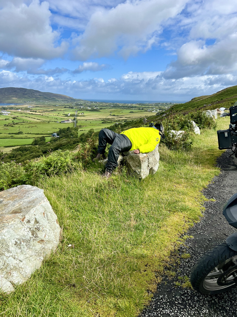
This is a fairly short but idyllic motorcycle road. Staggering views, hair pin bends, narrow and twisty. It has it all. We stopped for photos. How can you not when confronted with such beauty.

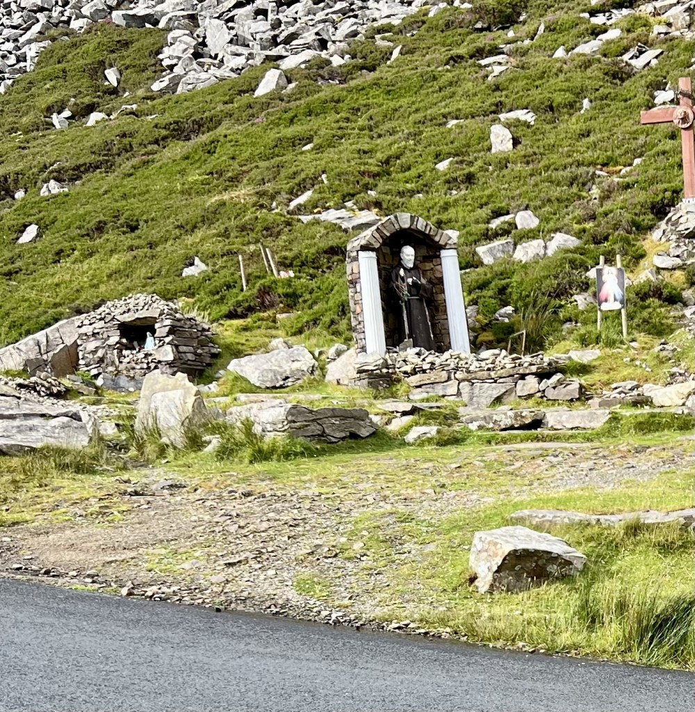
Photos never do it justice though. But the memories they provoke in the years ahead will. I had to take a little rest. Andy had his camera ready. Of course he did.

We continued the descent on the north side.

The road continues into the small village of Clonmany. At last! A Lavazza coffee sign. We stopped. We had breakfast. Well brunch really. A lonely local took pity on us and sat down at our table. Uninvited. We got a potted history of his life. You can guess it was not the stuff of legend. We gave the “oh really’s and wows” at the required time. He left us for his large scotch and lager at 11am. Just a lonely sole needing an ear. We ate. We moved on. 

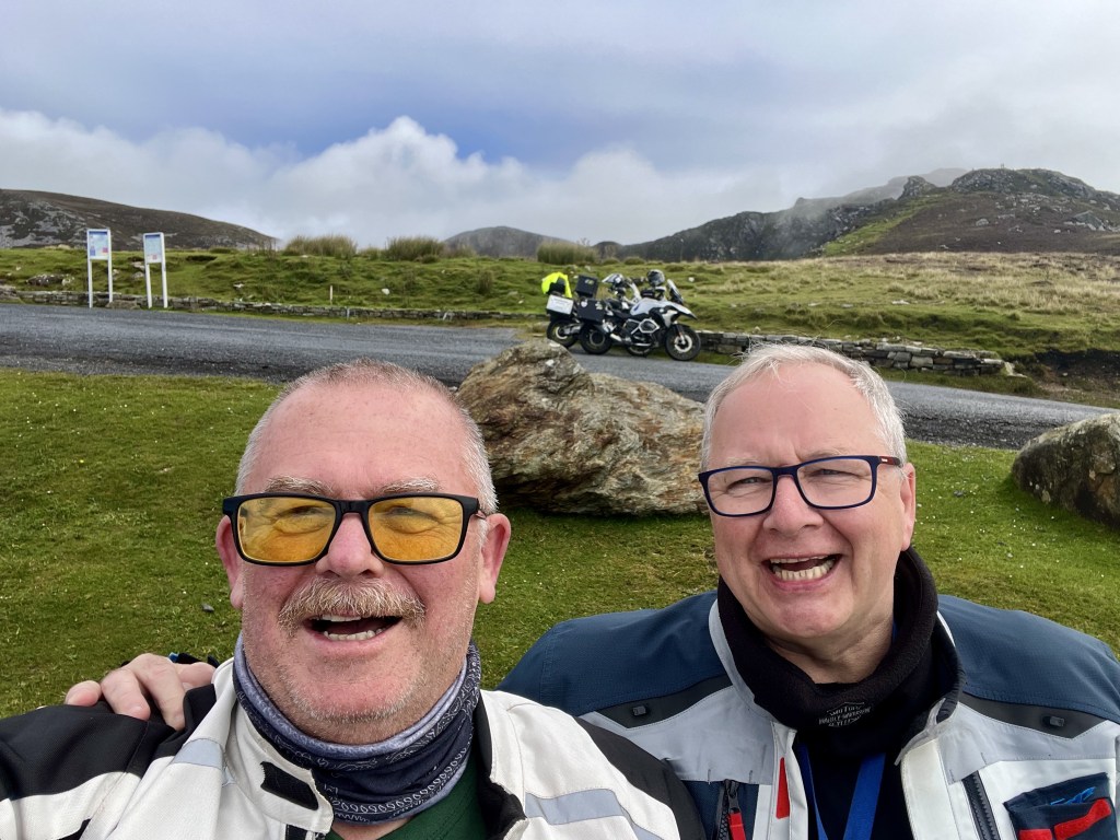
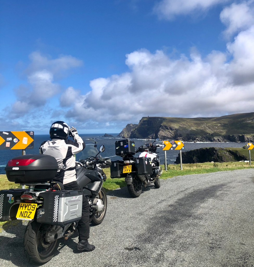
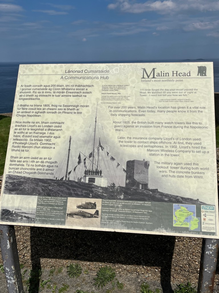
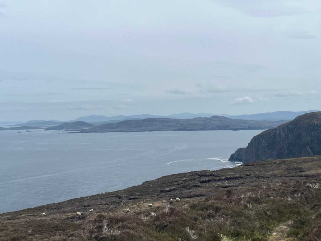
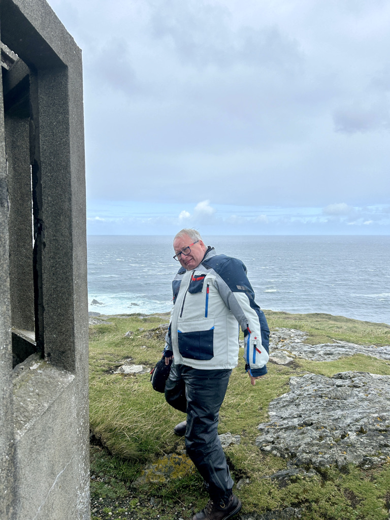
Rejoining the R238 through Ballyliffin we turned north on the road to Malin Head. Passing the aerials of the Malin Head Coastguard radio station, the road becomes slow going. The raw force of the wind tries its best to push us off the road. It twists and ducks over and around rocky outcrops before climbing to Malin Head.

A mere waft at Malin Head.

The wind screams. The sea is white and foaming. The very next minute, blue skies. We take shelter behind the lookout post as the next wave of rain and wind pass through. You cant go into the shelter. It smells like a Napoleonic toilet.

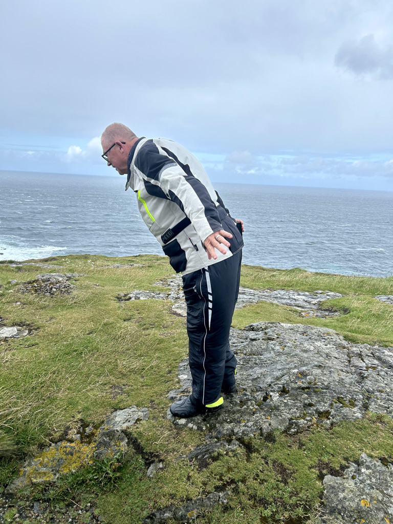
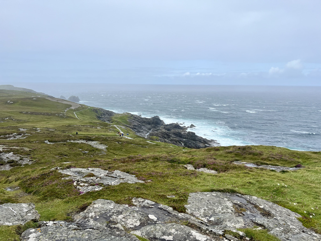
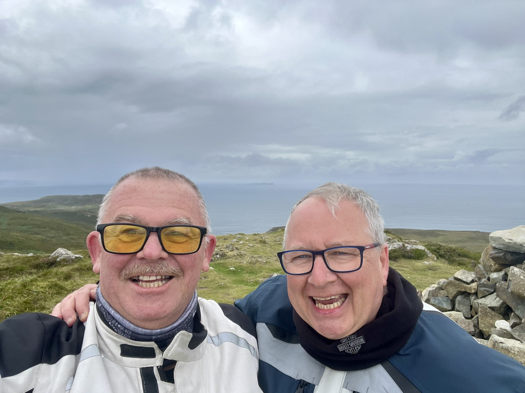
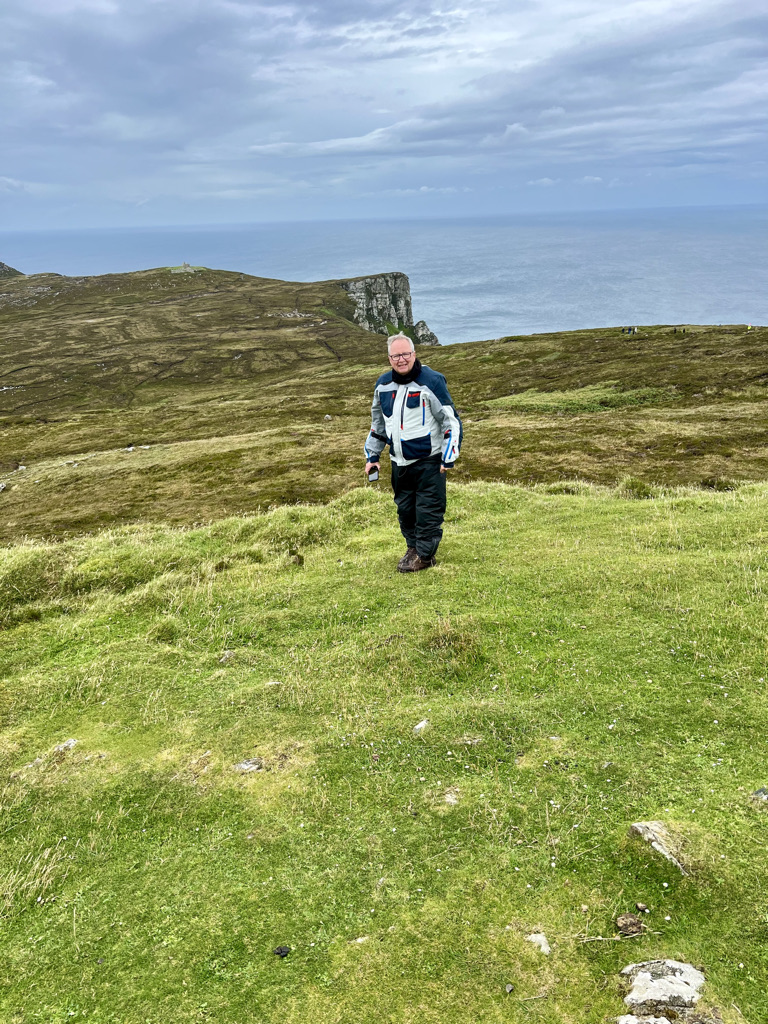
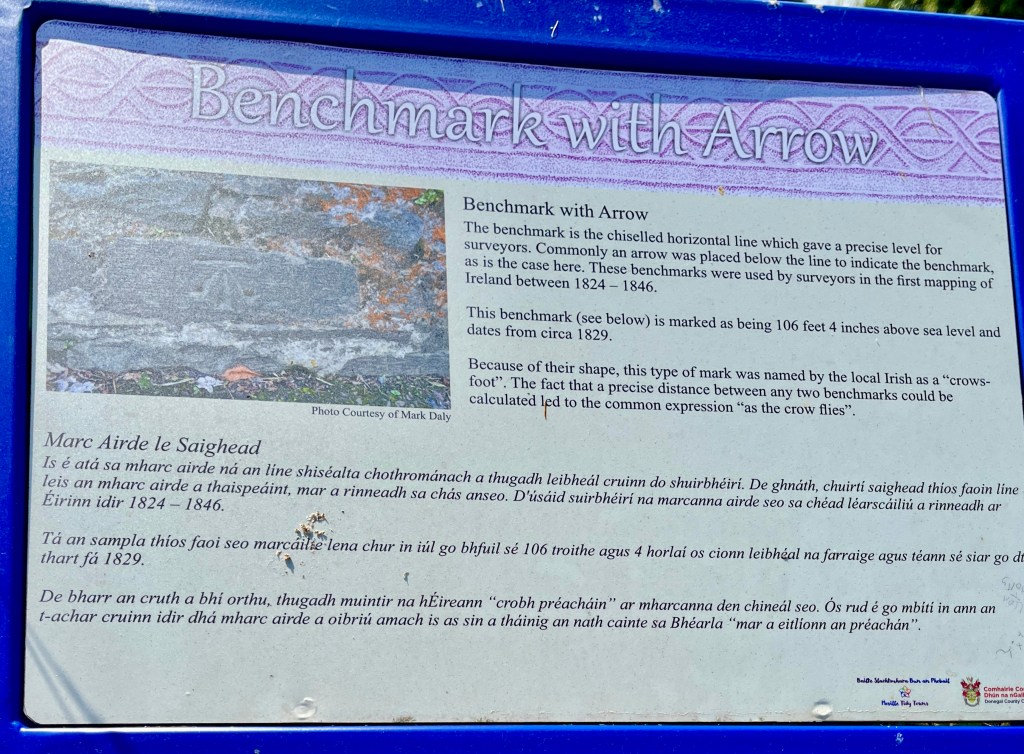
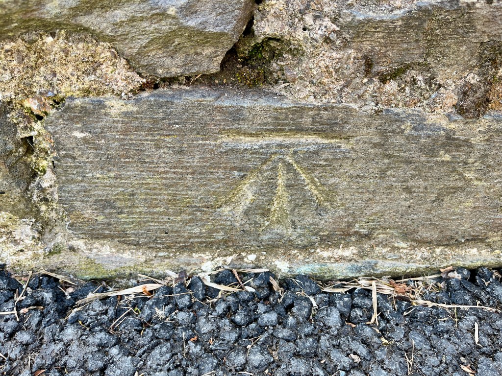
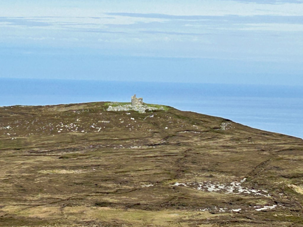
The rain is lashing and all we can do is grin. We have succeeded in getting to the most northerly point of Eire. We recall Old Head of Kinsale at the southern end where the fog shrouded the view. A seat to take a rest looks out over the boiling sea. Beside it is this.

It was raw up there. We got our photos and moved on.

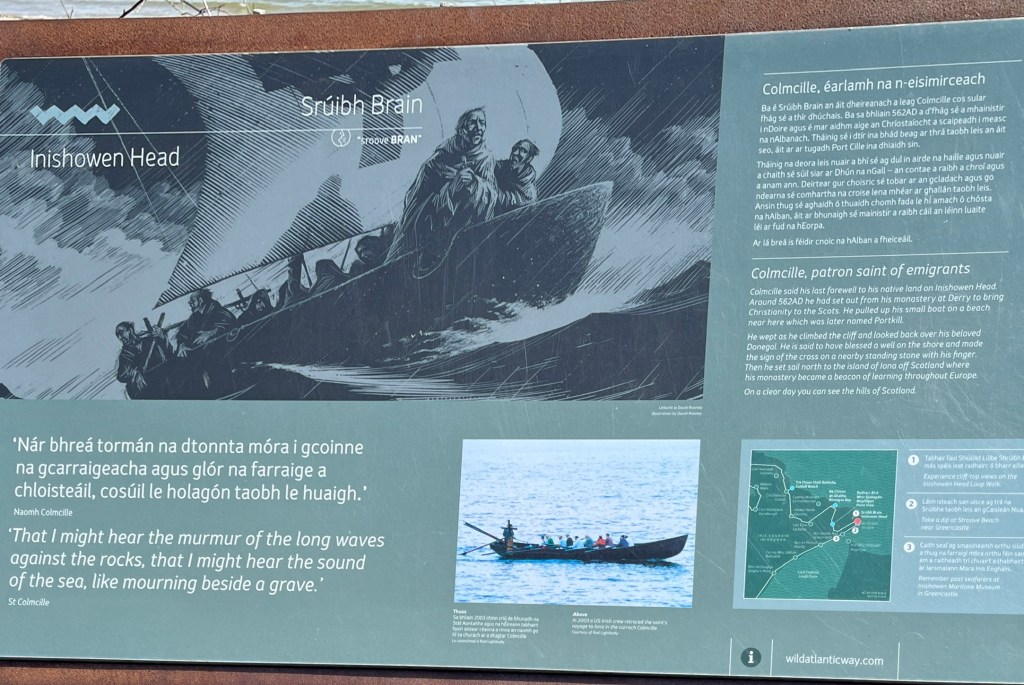
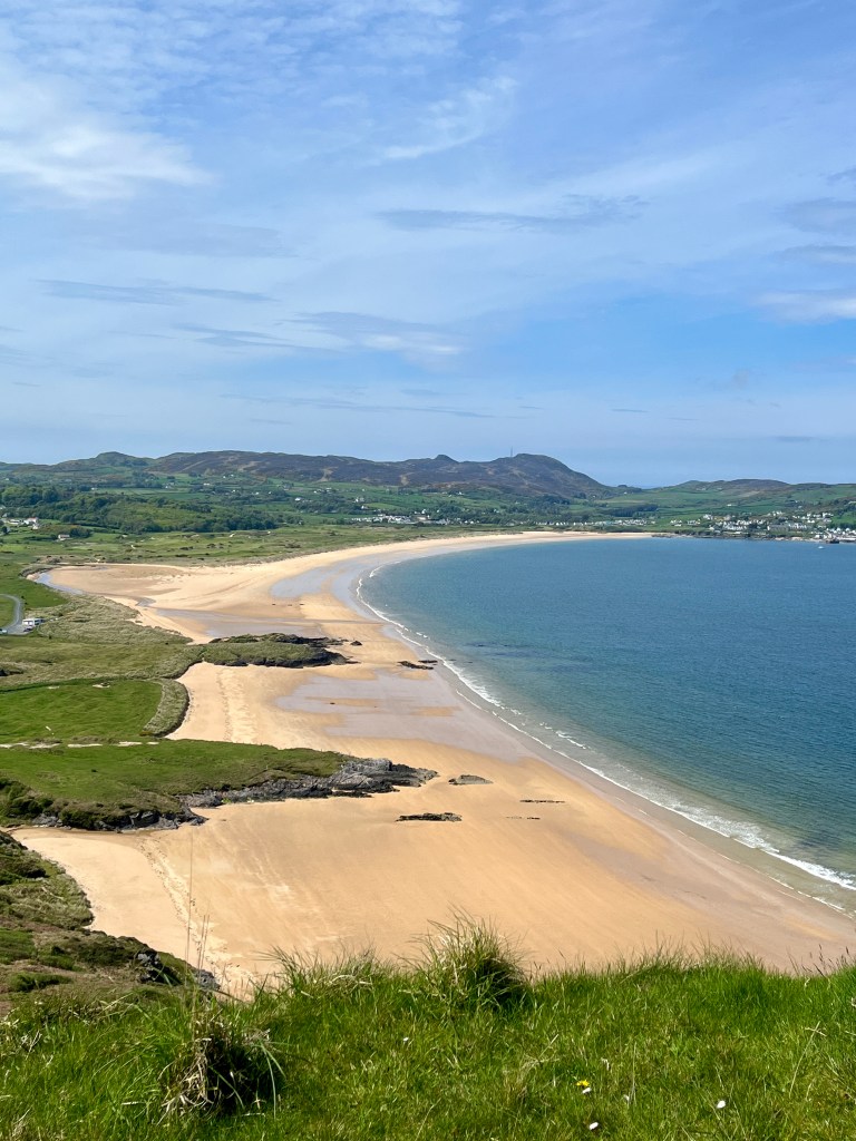
Descending down from the high point at Magilligans lookout, we drop down into Inishowen head.

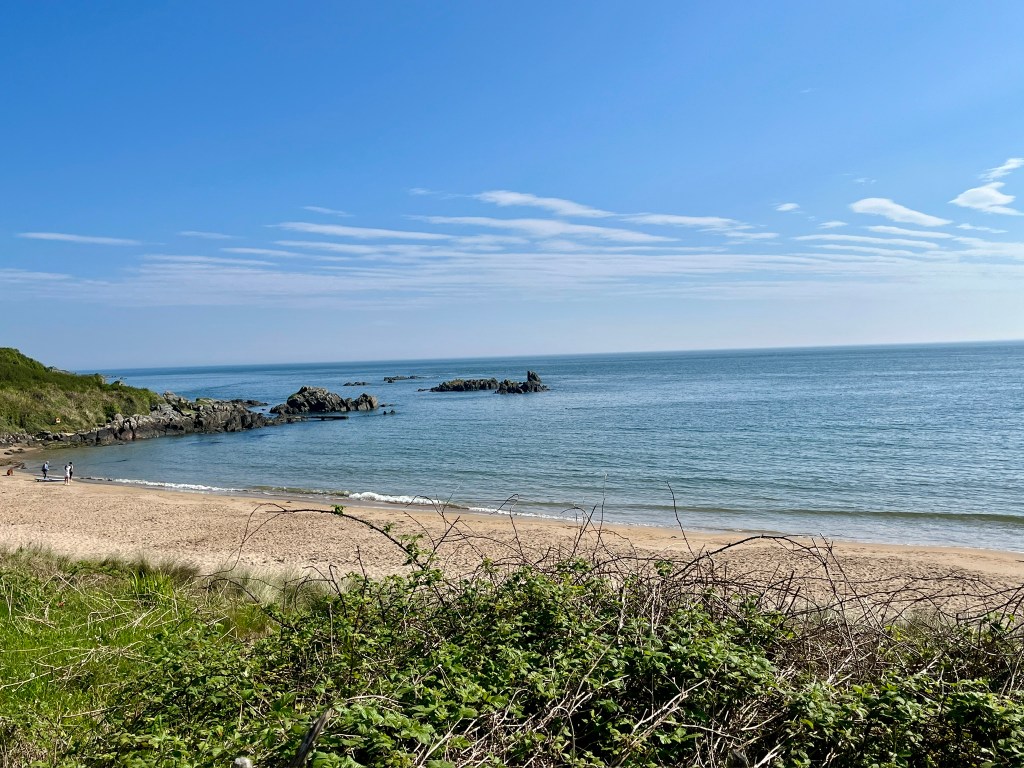
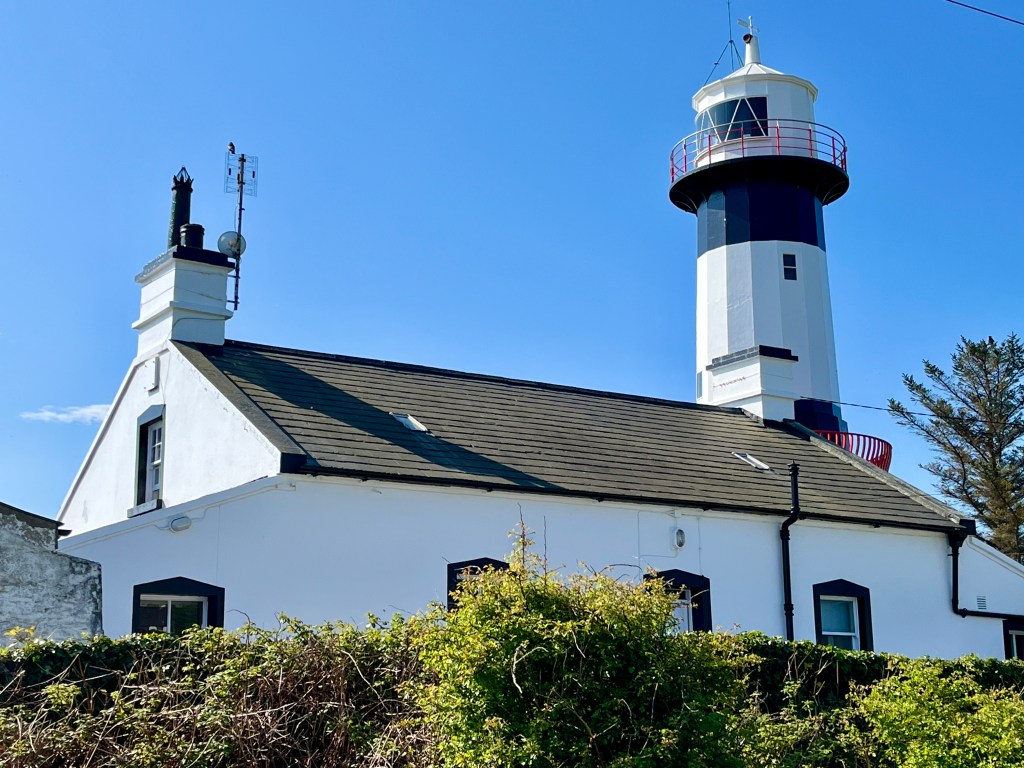
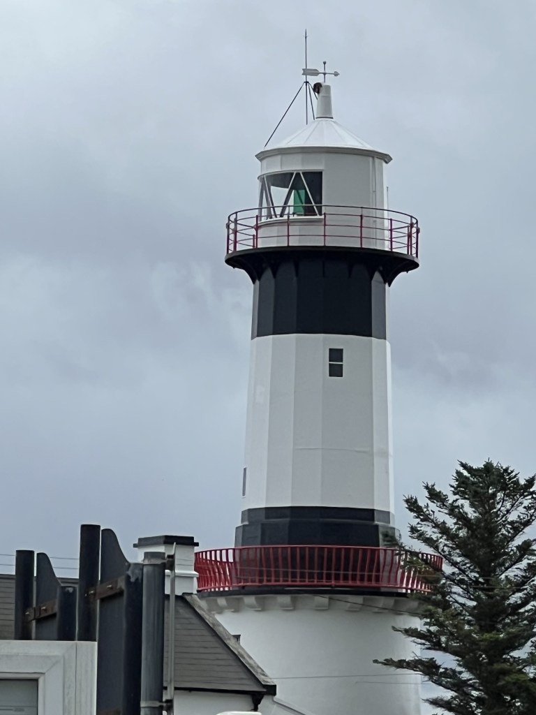
We view the lighthouse and Stroove beach before heading through Greencastle. Our journey ends at the Redcastle Hotel.

As I type, my valet Andy has procured two pints of Guinness. We are celebrating the fact that we have all but completed the Wild Atlantic Way. Tomorrow we cross the border into Northern Ireland.

Day 14, Bunbeg to Rathmullan. Exploring Raw and Windy Landscapes by Motorcycle.

I can’t tell you how much a decent breakfast sets you up for a day on a motorcycle. The weather the past few days has been a concern. Considering we are into August you would be forgiven for thinking we were into Autumn already.

A large area of low pressure is circulating NW of Ireland bringing blustery winds and rain. It is almost stationary.

We set off from Bunbeg and headed north on the R257. 

The road was exposed to the raw wind blowing straight off the sea.

We stopped in a lay-by at Brinlack to take a photo looking back over the bay. White-painted cottages dot a barren landscape. There are no trees anywhere. It’s tough going on the bike. Just before the small town of Gortahork, to add some interest, we take the N56 south. It’s a bit of a dull road, but it takes us to the shores of Lough Nacung. Here, we turn east onto the R251.

Now this road is a beauty. We did nip into a lay-by to get the wet weather gear on. The road was headed to the right of the volcanic peak. It was very gloomy.

Ahead, there were some very ominous-looking clouds over the peaks. The road winds its way up to around 285 meters above sea level before dropping down into the next valley. Here, we turned north onto the R256 on a narrow and twisty road over the moors.

The heavens opened heavily and we had to slow right down. as visibility was limited and the road became a little slippery on the bends. At Falcarragh we stopped under the shelter of a petrol station. We got a coffee and hoped that the rain would pass through. 30 mins later it had abated enough for us to continue without getting too wet.

At Dunfanaghy we turn north and climb up the narrow and winding track to Horn Head. The wind increases dramatically as we climb and pull up in the at the top of the climb.

Breezy on Horn Head.

Horn head is an old look out post dating back to Napoleonic times. Also, a more modern but run down post exists. It got cold very quickly in the biting wind. The roar of the sea rises up from below the cliffs. The wind makes talking hard.

We took our photos and retreated back down the track and set off for Creeslough down the N56. Here we turn onto the R245 and make a stop at Glen Drumlackagh to rest. It gave us a chance to snap a photo of Doe Castle. Once the home of the ruling McSweeney family it is now a national  monument.

The road continues its journey north. It winds its way around Loughs and inlets. Never straight. Always winding to Fanad Head lighthouse. It was rare to get above third gear on these roads.

Whilst having a coffee a family came to admire the bikes and we get talking about where we have been. A general chit chat about our past route. One of them is chewing on some Dillisk. I have no idea what it is. They offer us some to try. It is air dried seaweed. It is delicious. It is supposed to be a delicacy in this region.

I love these interactions we have with people we meet. 

As we ready to leave, the heavens open once again. This time we don’t have the wet weather gear on. The result is inevitable. We get wet. Oh well. Not much to do but carry on. 

The R268 now follows the coast and passes Ballymastocker beach or strand, as they are called here. It’s a stunning strip of sand. The road then climbs through a series of hairpin turns up the hill behind the beach to a viewpoint above. We stop to take some photos.

The road now drops to sea level. It follows the coast all the way to our final stop at the Waters Edge hotel in Rathmullan. As we park the bikes a large rain cloud rolls in. Just to keep us on our toes it rains on us as we make a dash for the hotel door with our bags.

The day has been a fairly technical ride. Coping with buffeting winds and rain again has made us both tired. It is unfortunate that the weather has been so poor for the time of year. But that is Ireland.

Day 13, Donegal to Bunbeg. Exploring the Irish Wild Atlantic Way on Motorcycle: A Journey Through Stunning Landscapes

It was with some trepidation that I peered out of the cottage door. It was still raining. The wind and rain had pummeled the little cottage during the night, and I had hoped it would have passed. The updated forecast suggested another 2 hours until the worst would be over.

Not the best start to the day

We decided to get on the road and donned the wet weather gear. The clear weather would come. Just when was in doubt. After refuelling in Donegal, we set off for Killybegs. Passing through the fishing town, we started to climb into the hills on winding roads. We paused for a coffee.

Then, we continued in sunshine and showers to Slieve League. We paid our €5 entry fee. Finally, we motored up to the top carpark. Oh my!

The view of the cliffs was staggering. The rain had cleared but wispy cloud clung to the sides and tops of the lofty peaks. We took our photos. Standing on the precipice looking at a scene like this laid out before you makes you feel so small. It is time to stand and stare and soak it all in.

Retracing our steps we descended back into Teelin. We took the R 263 road and struck west to Malin More. Then we followed the twisty road along the coast towards Cashel.

Suddenly we came upon a lot of cars parked by the side of the road in the middle of nowhere. Sheepdog trials were playing out in a field beside us. We paused briefly to watch but had to move on as we were blocking the road. It was a brief but wonderful spectacle.

The road climbed again over the moors and hills. It reached an altitude of 230 metres above sea level. Even at these lofty heights, hedges of Fuchsias line the road. The ballerina-like flowers appear to be made of scarlet wax. They grow prolifically up here.

Then our path ahead dropped down on spectacular motorcycle roads into the town of Ardara.

Here we paused for lunch in the sun.

Sat on a bench in the street eating our sandwich a few locals paused to say hello to us. We must have looked rather unusual I suppose.

Leaving on the Portnoo road, the R 261, the road levels out a bit. This makes for easy riding in the sun.

We turn onto the N56. Now this is an altogether different road. Smooth and widish, it gave us a chance to open the throttle and blow the cobwebs away.

Sweeping and winding its way north through Lettermacaward and the wonderfully named Cloghbolie we turn off onto the R259.

This road narrows down and starts to twist and turn its way north through Burtonport and Kincasslagh. Never far from the coast the sea sparkles in the afternoon sun.

The smell of brine fills the air. To our right, hundreds of lakes, both large and small, dot the landscape. They are filled with dark brown tea-coloured water. The lakes are fed by thousands of streams, gurgling in gullies from the high tops recently soaked with rain. They look like mirrors on the heather. We pass Leo’s Tavern, where Enya and Clannad started their musical journey. We pass the distillery at Crolly. We turn off, onto the R257, to journey’s end. The Clady at Bunbeg is an old merchant’s store converted to a home that sits on the harbour’s edge. It is our lodgings for the night.

The sun shines on the fishing boats of all shapes and sizes in the harbour. 

I went for a short walk to view the old harbour. I have a brief conversation with Igor and his 9 year old daughter Tanya. Refugees from Kherson in Ukraine they have lived in Bunbeg for 14 months. Igor comes to admire our bikes. He apologises for his poor English. Tanya speaks excellent English and tells me they had to run away from the war. She tells me the people here are very nice. I am lost for words for once and simply wish them well.

Another day comes to a close. One of outstanding scenery. Superb motorcycling roads. Better weather than I had expected. If you are reading this, you must come and do this for yourself. No, you must.

Day 12, Ballina to Donegal. Exploring Ireland’s Wild Atlantic Way: A Dash to Donegal

And it came to pass. All night long the heavens did their best to turn this area of Ireland into a lake.

A decent breakfast of eggs benedict warmed the cockles of our hearts. We donned the wet weather gear. We had a rain window of around 3 hours. During this time, we needed to reach our next accommodation in Donegal.

I had to cut the itinerary down to a quick dash of 140 Kms. I hoped to arrive before the frontal system.

There was one thing I wanted to show Andy. I know he is a bit of a war historian. I had seen an old concrete hulk anchored in the river here on an earlier visit.

SS Crete Boom

You can read more on this strange craft here.

It was time now for the dash to Donegal. No time to stop for photos. With dark clouds all around us and spots of rain already on our visors it was fingers crossed now. There was a strong and buffeting wind from the south. We had to ease off on the speed for safety. No time to stop at the Yeats grave of take in the mountains to our right.

We arrived at the cottage of Patsy. He is the port of Killybegs pilot. I met him two years ago when I brought my ship into the harbour. He we were back then.

His cottage is charming. I mentioned back then my will to do the Wild Atlantic Way. He offered his place to us and what a boon it is.

Not 30 minutes after we arrived the rain really started to thump down. It has not stopped since. We made it just in time.

We shall have to wait and see what tomorrow brings. Hopefully this system will have moved through and normal service can resume tomorrow.

Day 17, Culdaff Beach to Golden Sands holiday park.

Today dawned bright, calm and warm. It had all the makings of a really lovely day for our last on the Wild Atlantic Way. It would be only 70 miles from start of day to the rest place for the evening. I wanted to be on the County Antrim coast to set us up to visit the Giants Causeway the following day. Under a bright blue sky we set off.

As I was to turn right out of the beach carpark I spied this right opposite and thought it was another gem of a find and simply had to be researched for more information. Alas I could find nothing so if there are any sleuths out there I would be interested to know. Not least why an RAF pilot is flying a Royal Navy aircraft.

On we went following green and pleasant lanes to the west coast of Lough Foyle. I wanted to see the lighthouse at Inishowen head. It flashes Fl(2) WRG 10s. This means that it is a sectored light having a white sector, a green sector and a red sector and flashes twice in 10 seconds. The fact it is sectored means that is covering a danger. To be safe and clear of the danger you must stay in the white sector as you approach the Lough. If you see a green light you are too far to starboard and need to come to port to enter the white sector. If you see red you are too far to port and need to alter your course to starboard to enter the white sector. It is likely guiding ships into Lough Foyle passed some outlying rocks or sandbanks. Here is the mariners chart showing the light house circled and the three coloured sectors. The red is indeed covering outlying sandbanks whilst the green helps clear the headland. By keeping the light dead ahead and white ships can safely enter the Lough.

But as I have mentioned previously it is what you find that you did not know about that brings these places to life.Next to the lighthouse there was this information board.

The board talks of Colmcille. You may know him better as Columba. For it was from here that Columba sailed to Scotland and the Island of Iona to take Christianity to the Picts. I have been to his monastery on Iona but I always thought he left Ireland from closer to Rathlin island further east along the coast. If interested you can read more here.

We then took the road south along the Lough to the delightful little town on the waters edge of Greencastle to take on supplies before continuing south to the larger town of Moville. Still modest in size, Moville is a quintessential seaside town. It was a very pleasant little place. A notice board in the town states “Moville was a point of embarkation for travellers, especially emigrants, to Canada and the United States of America. In the late 19th century, steamships of the Glasgow-based Anchor Line and Allan Line made port at Moville while en route to and from New York, while just after the turn of the 20th century, the Canadian Pacific Line also established a terminal at the port as part of their service connecting Liverpool and Montreal for Canadian-bound Irish immigrants.”

Another feature on interest was an arrow carved in a stone in a layby that we stopped briefly in, in yet another blink and you miss it item of interest. I can imagine that the sealed road was a cart track when the surveyors stone was inlaid into the wall.

We continued on to the border with Northern Ireland and the end of the Wild Atlantic Way. The way ends right on the border in the rather nondescript town of Muff.

In the blink of an eye the road signs are in miles per hour instead of Kilometres and the phone numbers on businesses are now familiar UK format. There is no formal border crossing, no duty free, nothing. The road changes from the R238 on the Irish side to the A2 on the Northern Irish side. It is the same road. All the formalities we went through in Rosslare with the dog and the expense and the visit to Irish customs simply don’t exist here. We could simply have crossed the border and back with zero checks at all. Weird!

We passed through the large town of Derry/Londonderry. The name depends on who you talk to. The first road sign for Londonderry had the London spray painted over.

The adventure is not over yet. We will now pass along the Antrim Coast tourist route to get to our ferry in Belfast. We still have another 11 days with the van so we will cross to Scotland as there is still unfinished business there to attend to.

Our campsite tonight is the Golden Sands campsite in Benone. It is huge and busy and full of families enjoying the weather parked on top of each other. It is not our cup of tea at all but it was all I could find that had space available on a Saturday night. The glorious weather has brought everybody out for the weekend. Give me Sleepy Hollows campsite with its 10 pitches over this any day. There must be close to 300 caravans, motorhomes and large caravan homes here. But it will do for a night.

Todays distance: 70 miles.

Total distance: 1544 miles.

Day 16, Mulroy Drive to Culdaff beach.

What a day! Perfect touring weather. Perfect places to visit and perfect interaction with the locals. Just perfect.

The morning dawned bright and clear with a forecast that looked really good for the day. We set off for Ramelton in Donegal. It is a very pretty town straddling the River Leannan. But it is famous for one of its sons. One David Gallaher. Who he you may ask?

David Gallaher was born in Ramelton in October of 1873. He emigrated with his family when he was only 5 years old to New Zealand. He grew up to Captain the Old Originals, the Original All Blacks Rugby team. There was no way we were not going to pay the place a visit. In a small garden there is a fitting memorial to him. You can read more of his story here.

There were even ferns planted under the sculpture. I had my All Blacks shirt on. One of the locals that I talked to remembers the great Jonah Lomu coming to visit the place. Another said that one day he saw “giants” in the garden when a number of the more recent All Blacks came to visit. They are big men.

We walked up the street from the garden to where the great man was born. Like all these places, it is just a house now. But still worth a look.

We had parked opposite a chemists and as we passed to return to the van, the pharmacist was outside being filmed by one of his staff doing a reminder to use sunscreen. He was making a right mess. I said that in New Zealand we say slip slop slap. Slip on a vest, slop on the sunscreen and slap on a hat. He loved it and asked if I would assist him. I ended up filming the advert with him. He said I was going to be famous in Donegal as the advert was going to be screened in all the pharmacy shops. I am famous again!

How could we beat that for a start to the day.

We headed for Malin Head. The most northern part of Ireland and the most northern part of the Wild Atlantic Way. We had to go as we had visited Kinsale lighthouse at the most southern part. To get there we climbed up and passed through the Gap of Mamore. Single track again and nobody stops to let a camper van pass. I had to pull over every time. But oh the view from the top of the pass was amazing.

So good that even the dog had to take time out to sit and admire the view.

I was intrigued to see a shrine and Holy well at the top.

We continued on to Malin Head. The good weather had brought everybody out including a large entourage of motorcyclists. I had sailed around Malin Head many times. I had heard the words Rockall Hebrides Malin many times on the shipping forecast and even picked up messages from Malin Head Radio as we headed out usually from Liverpool into the North Atlantic bound for the United States on cargo ships. We passed Malin Coastguard radio station with its aerial array and it brought back many great memories. Did you know that the Titanic tested its radio systems with Malin Head radio when it was out on sea trials from Harland and Wolf in Belfast?

There was no way we could do anymore this day without spoiling what we had already done. So we headed for days end at Culdaff Beach carpark where we will spend the night. It is a fantastic spot and I am sure we will be joined by other vans being a Friday night as well. Blue skies, picture perfect beach, rather coolish water temperature and an evening stroll. Perfect!

Todays distance: 99 miles

Total distance: 1474 miles

Day 15, Meenalecky to Mulroy Drive.

After a brief shower of rain yesterday evening we woke to a bright and dare I say it warmish day. 16C when we set off. Today we were just going to follow the Wild Atlantic Way and see what it presented us with. We are crossing the north west and top end of Donegal. It is windswept and spartan. Yet dotted about are collections of houses. Some new and on the large side. Are they holiday homes?

The road snaked its way along the hillsides into the small town of Dunfanaghy before climbing steadily away from the main road on a single track to Horn Head. Another amazing panorama spread out before us. It is all on private land now so access is limited but the view from the top where a WW2 lookout tower remains is staggering. The remains of a Napoleonic era lookout from 1805 still remain. I have sailed along this coast a few times and always viewed it from seaward. It is rather lovely to see it from the other perspective now.

Returning down the track we turn east towards Fanad Head. I had heard of this place. Firstly because a lovely lighthouse beloved of many a mariner adorns the headland but also that a 6000 burial tomb lies close by here. Rather puts things into perspective when you here the age of that don’t you think. This is hard country to farm. Walls of stone delineate fields strewn with boulders. What existence could have been eked from this landscape? We heard that peat cutting and seaweed burning for iodine were main professions.

Looking out over the present vista it is hard to imagine how tough life was.

The road now descended from its lofty perches past the most gorgeous beach at Ballymastocker strand and followed the line of the many sea inlets. Fish farming is big here.

We are now set for the night at the Mulroy drive campsite. This is a new site opened last year by a father and son who have visions to transform it into a must come place. It is a calm evening. Other than 3 motorcyclists we are alone. The midges are out so we are staying in to deprive them of an evening feast.

The son gave me a map listing many activities in the area. Whilst we have only a day this place could well be a hub for a few days at least.

Tomorrow is going to be a big day. Two things we must see. But more on that tomorrow.

Todays distance: 94 miles

Total distance: 1375 miles.