Day 4. Fox Glacier to Wanaka.

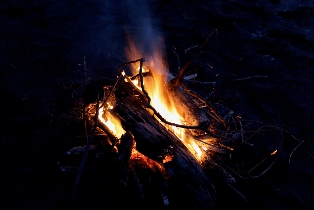
Todays mileage was 266 Kms from Fox Glacier to Wanaka. Overnight the wind howled shaking the van from side to side and the rain fell. And fell. And more fell. The West Coast of the South Island of New Zealand is not Verdant for no good reason. I can now spot a sand fly at 50 paces before it chomps on me. My initial chore of the day was to empty the portable sewage cassette and the waste water tank. Something I had pushed to the back of my mind on day 1. But now I needed to get on with it. The facilities at the camp were very good and I must say that the experience, whilst not rating as one of my most memorable was not one that I would fear when the time came to repeat it. We set off around 10am and struck south on highway 6 for the first town of note called Haast. One must remember that on this coast there is hardly a straight stretch of road at all. That coupled with scenery to take your breath away would mean that slow progress could be expected. However, driving rain reducing visibility to a matter of 50 metres at times slowed my speed. When we climbed up the twisty roads to skirt the peaks that line this route mist and cloud reduced progress to under 40 kms an hour at times. But it was still staggeringly beautiful. A sensory overload. What struck me was how few cars we saw. I know we are coming to the end of the kids school holiday but I was not expecting to see less that 15 cars on the entire journey. If I were to pick one section that epitomises the entire route it would be the section over the Gates of Haast. The road climbs up into the clouds, then dips down into a chasm of a valley where mist and foaming water churn past huge boulders. It then climbs steeply and windingly away up into the mist again before continuing on through native bush untouched for Millenia. The smell of the wet native vegetation was heady, the roar of the numerous waterfalls fuelled by the downpours were deafening and the misty mountains all around were surreal. No wonder this is Lord of the Rings country. Orcs could be hiding anywhere. We needed frequent stops to rest, for this was intense stuff. We are now camped for the night in Wanaka. The daily chores of emptying the rubbish, sweeping the dirt that gathers on the floor of the van out and refilling the water tank are done. I need to rest. I need to remember what I have seen today. I somehow need to store away the images that made me gasp in wonder, shout look at that to Debbie and crane my neck to see just another waterfall whilst trying to keep a 2 tonne van on a slither of wet tarmac. I’m exhausted but exhilarated. Can the rest of the journey ever compare to this? We shall have to see. I will leave you with a few photos that encapsulate todays experience.

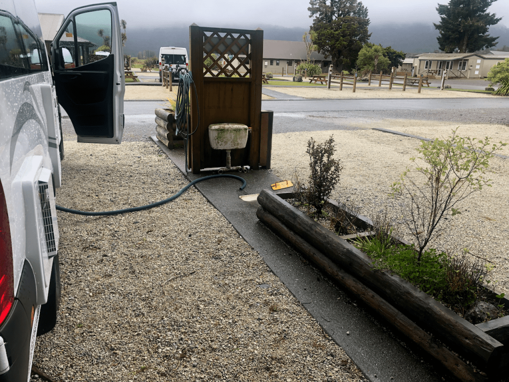
Emptying the grey water tank is a bit of a fiddle but not so onerous. It is a necessity to be done every 3 days or so.

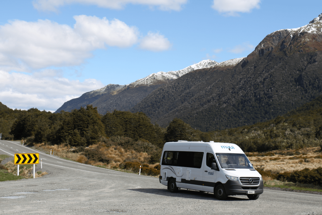
The road lies ahead. Time to go on the next leg of the adventure. Weather looks ominous.

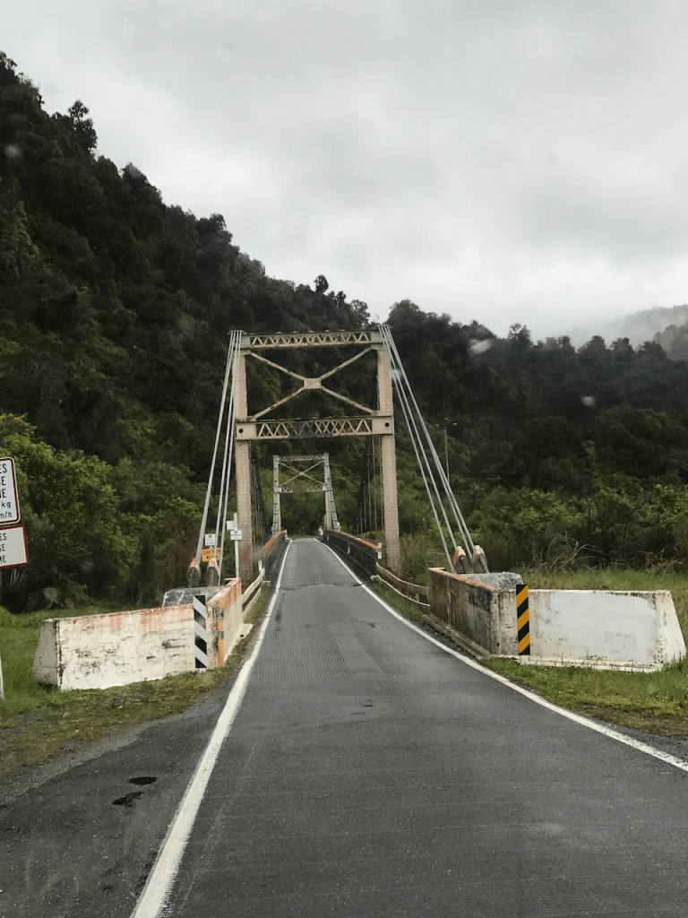
Even though State Highway 6 is the main arterial road on the west coast of the South Island of New Zealand, in common with many strategic roads, bridges tend to be one lane only. Here is one example over a river of cast iron lattice construction. Give way signs indicate who has priority.

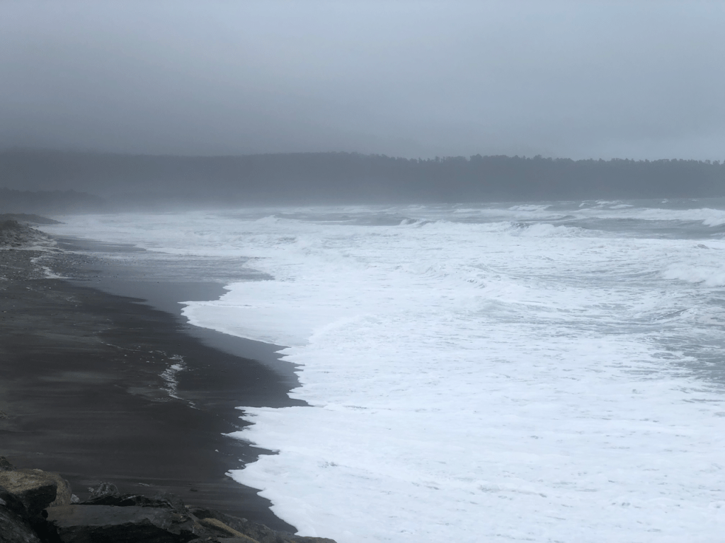
The road often skirts the sea and today the weather had whipped the waves up into a frenzy.

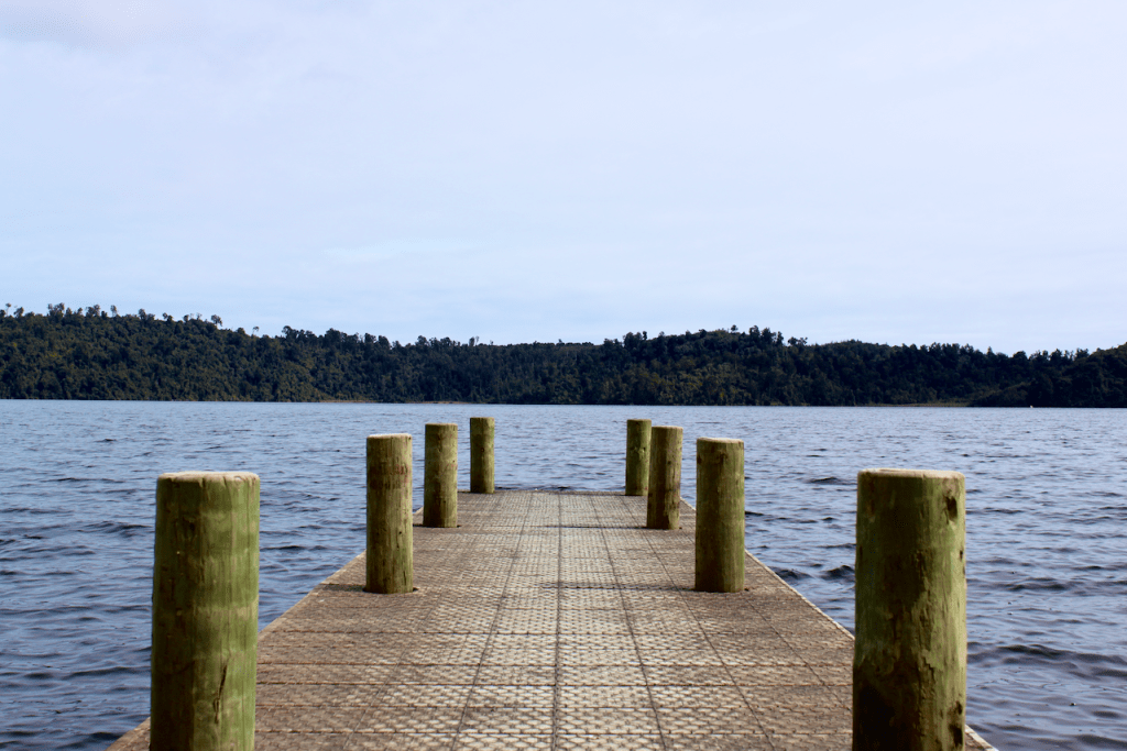
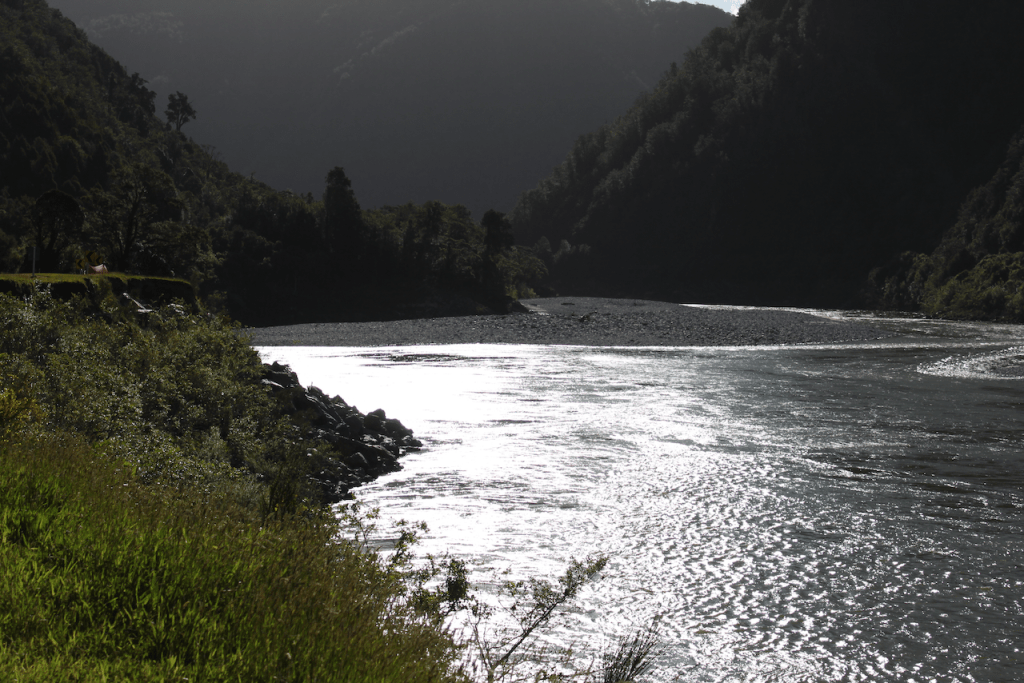
Our first rest break at Lake Paringa. Whilst Debbie brewed up some fresh coffee I took the chance to snap some photos of the creek that ran through the site. The sand flies took the chance to feast on my bare legs as I had forgotten to apply my repellant!

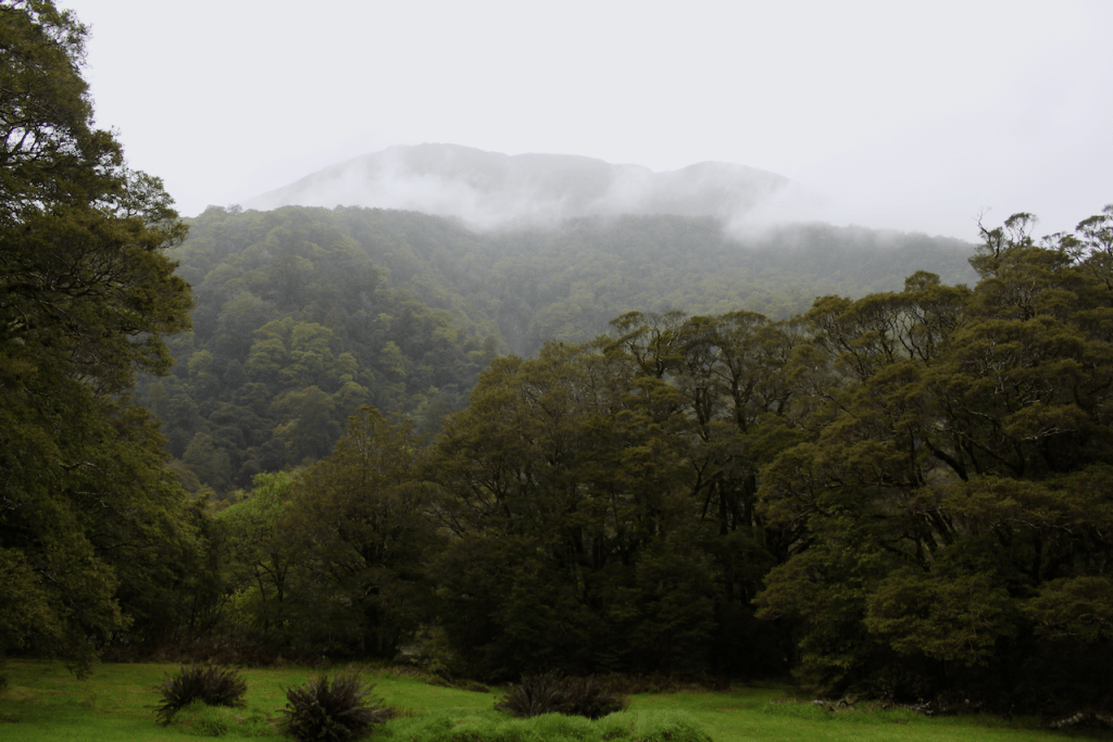
At our second stop at Mount Pleasant it rained so hard that I took a photo out of my window instead.

The girder bridge at the Gates of Haast. One of dozens of similar construction all along this route.

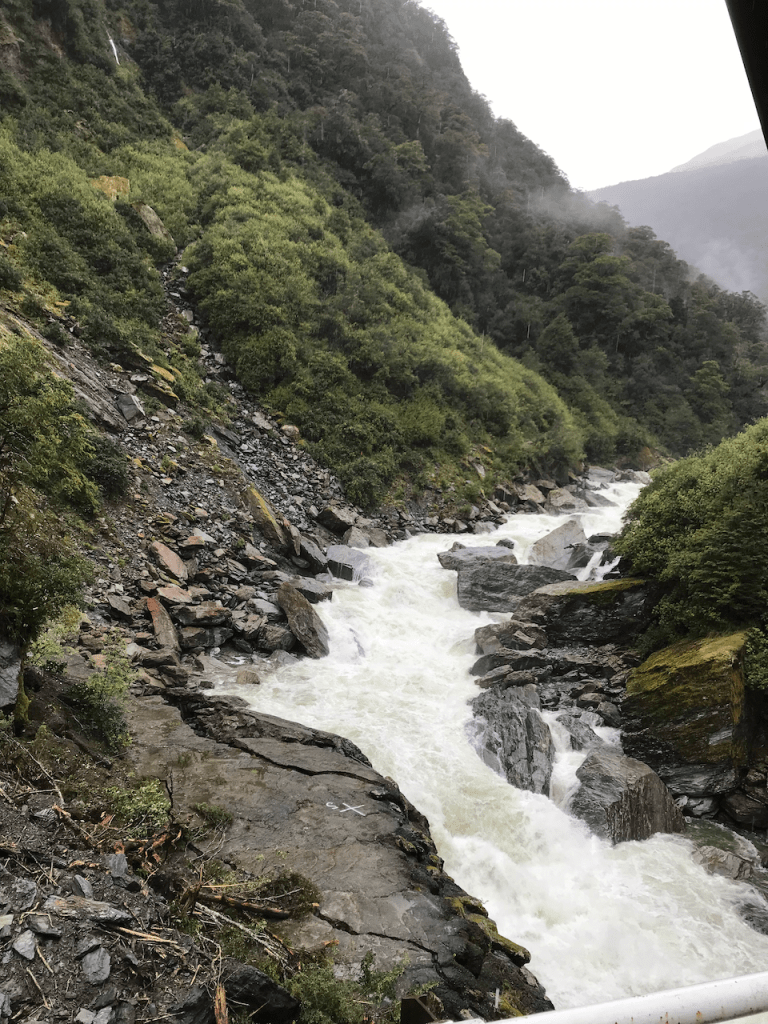
The waterfall cascading under the above bridge at the Gates of Haast.

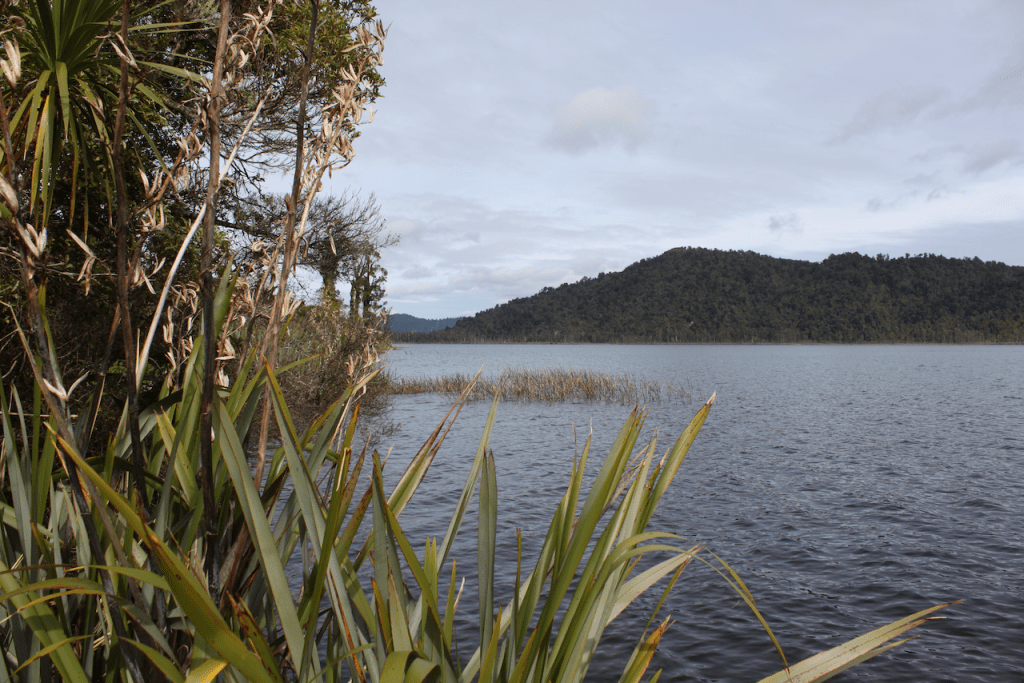
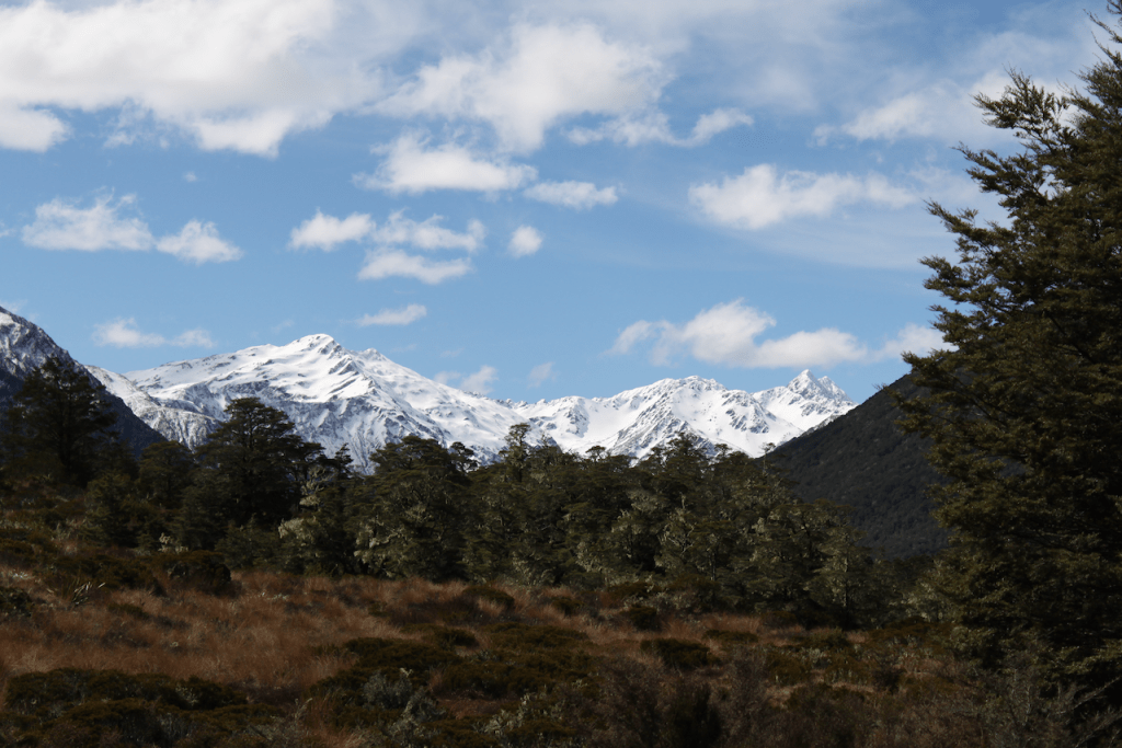
The final leg of the journey took us along the eastern edge of Lake Wanaka as shown here and through The Neck which is a small valley over to the western shore of Lake Hawea and down into Wanaka. It was still raining when I took the photo. The clouds were being shredded by the wind and in the far distance snow was lying on the mountains flanks. The Remarkables.

Day 3. Ross to Fox Glacier.

Today was intentionally a short day behind the wheel. Total kms was 157. It is my birthday today so we wanted to be stopped and set up by 15:00 at the latest. The morning dawned bright and clear and a touch warmer than yesterday. The holiday camp at Ross beach is made up of 20 and 40 feet containers which is a novel idea. They reminded my very much of the pop up shopping mall that appeared in Christchurch after the 2011 earthquake that damaged so many buildings.

Containers made into shower blocks, toilets, kitchens, lounges and accommodation at the Ross beach holiday park.

It was clear that as we headed further south on Highway 6 the weather was on the change as dark clouds gathered over the mountains ahead of us. This section of the West Coast of the South Island is festooned with lakes and clear blue mountain rivers rushing down to the Tasman Sea. Turquoise clear waters pour from the mountains to our left as we head south.

Lake Ianthe sits right on the highway edge and there is a lovely little area to pull over, admire the view and take a break.

Lake Ianthe.

A short journey further south brings us to the town of HariHari. At first glance it appears like many other small townships along the route. However at the southern edge of the town just before the road leaves the town boundary there is a surprise waiting. For there appears to be a replica airplane in a purpose built hanger. You cant get into the hangar but large windows give you a good view inside. On closer inspection the visitor is drawn to the story of Guy Menzies who in January of 1930 completed the first aviation crossing of the Tasman Sea from Australia to New Zealand. He landed in a field, more a swamp to the west of the town of HariHari. The landing sight is marked by a plaques and storyboards and takes around 20 minutes to get to, deviating off the main highway to reach it. Well worth the detour.

A rather unceremonious ending to an astonishing feat of airmanship.

The plaque commemorating the event.

The hangar housing the replica aircraft in the town of HariHari, New Zealand.

The road to Franz Josef town and particularly the stretch between Franz Josef and Fox Glacier town is stunning. Just stunning. They climb through mountain passes requiring speeds of no more that 25 Kms at times to negotiate the numerous hairpins. Steep gulleys on one side of the road, sheer cliffs covered in dense bush on the other. Another motorcyclists must do. However for us, the rain started as we climbed up into the first pass. Not much but enough to keep my speeds down.

We now find ourself in a holiday camp in Fox glacier township. We are one of only 4 bookings tonight. It is rather sad to see this place, normally full of skiers, trampers and hikers so empty. The current covid crisis is hitting these places hard. We are out to dinner tonight away from the van for a hot birthday dinner. Tomorrow we head further south on highway 6 to Haast where the road turns inland towards Lake Hawea and on to Wanaka. Road works are meant to be an issue so we will see how we fare. We have no agenda.

Day 2. Westport to Ross.

Todays run was 182 Kms start to finish. We woke to a heavy dew on the grass, bright blue skies and a warmish gentle breeze. The sound of the surf on the beach was somehow calming. The inside of the van was a little chilly as overnight temperatures had dropped to around 5C. A portable electric heater supplied in the van equipment quickly took the chill off the air and the first order of the day was to get the kettle on for a brew. The only plan we had today was to visit the Punakaiki pancake rocks, a run down the Great Coastal Road to Greymouth and a visit to the glow worm dell just before Hokitika.

First stop of the day was to Cape Foulwind. The present name was bestowed upon this promontory by English explorer James Cook in 1770 after his ship Endeavour was blown quite a distance offshore from this point. It was only 7kms from our camp site so, being a mariner, was a must do and see. The concrete lighthouse replaces a woodend structure that lay just to the right of this photo on a stone plinth. The plinth and the long bolts that held the original wooden structure are still visible to this day.

This is the original lighthouse made of wood. I hope you can read the information boards.

It was a journey of around an hour at the slow pace we were driving down the Great Coast road. This is Highway 6 that runs down the west coast of the upper south island of New Zealand. The section from Westport to Greymouth is a motorcyclists heaven. It is often listed as one of the great motorcycle rides of the world and with good reason. Scenic, twisty and with just enough sections to open the throttle for a blast. In a camper van however it was more of a chance to slow down and suffer from scenic overload. Just when you think you have seen the most stunning vista, you round the next bend and there is another. We stopped at Punakaiki in the Paparoa National park to look at the amazing and unusual rock formations. This is another one to add to your bucket list and one to cross of my wife Debbie’s.

Looking back at a section of the Great Coastal Road, State Highway 6.

A section of the pancake rocks at Punakaiki pronounced Poonakyekee in the Paparoa National park. State highway 6.

The aptly named pancake rocks at Punakaiki.

We stopped in the town of Greymouth for supplies before heading south to the town of Hokitika. The glow worm dell at Hokitika was a bit of a damp squib. I had seen the signs for it on passing on my motorcycle many times. But never stopped. This time in the campervan we did. Ummm? Just kept going. Move along. Nothing to see here. After a refuel stop we motored on down the highway to our campsite at Ross. This is a very small town. The camp lies on Ross beach and here Debbie and I lit a beach camp fire. We partook of a rather nice Shiraz before retiring. I am now used to driving the van and its size no longer makes me nervous. Our what3words location for the night is: evolves.trill.glovebox Download the app at what3words.com and follow us on our journey. Travel tomorrow will be a shorter day in the saddle. It is my birthday and we shall travel a couple of hours south to Fox Glacier township.

Day 1 of the South Island Tour by Campervan.

I have never driven a camper van and so have never toured in one. It was time to remedy that. So, with some trepidation my wife and I booked a Maui camper van for two, complete with toilet and shower so we could go anywhere and stop anywhere. The rules regarding “freedom camping” here in New Zealand have tightened up recently. Vans need to be toilet equipped to go off piste. We picked up our van and at 7.2 metres long and 2.8 metres high it is rather larger than anything I have driven recently. Cruise ships excepted of course.A thorough briefing was given into how the van and the utilities within worked including how to empty the toilet cassette and where. A job for a few days hence I hope.

Initially we drove the van home to load it up. It quickly became apparent that we had more stuff than the van could hold. We have now reduced to the essentials which include plenty of wine, cheese, antipasti, crackers leaving enough space for clothes. That should do.

Day one took us from home just north of Christchurch, passed Hamner Springs, through the Lewis Pass to Springs Junction. After a short break we pushed on to Reefton and onto our stop for the night at a holiday park called Carters Beach near Westport. If you use the what3words app then our position is dweller.foldable.habit If you dont use the app then you should. We decided to stay here to get plugged into mains power and learn how everything operated in the van. A total distance so far of 310 Kms. It took us 6.5 hours including stops. The scenery is breathtaking and we stopped numerous times to take photos. Here are a few to whet your appetite. The final one is of a lady who was warming herself on the beach by a small fire. After chatting to her, turns out she is from Rangiora, not 5 kms from where we live. Small world!

Start of the St. James walkway, Lewis Pass
Photo stop in the Lewis Pass.
River Buller gorge
End of day location. What3words dweller.foldable.habit
Chilling on a black sand carters beach
A perfect end to day one on the beach.