Day 14, Somewhere near Lake Tekapo to home.

Distance travelled 274 Kms. The final leg of the journey, to head home, has come around far too quickly. We had that awful feeling, the one where you dont want the experience to come to an end. But end it must. For if it does not, then the next new adventure cannot begin. The route home was a familiar one to both of us. There was nothing new about it. It was scenic enough. You know the feeling. Knowing we were heading home we just wanted to get home now. Back to a hot bath and our own bed. A decent single malt whiskey, a 14 year old Aberlour was sitting in the cupboard waiting for us. There was one viewpoint I wanted to stop at and show Debbie. It looked back over the Burkes Pass from where we had just come. We got there and saw absolutely nothing. For it was shrouded in mist. Visibility was a few metres. We had to console ourselves with looking at the etched plan view chart that pointed out where had we been able to see anything the stunning vista would be laid out before us. We took a photo of the fog. As you do. We drove home. Final thoughts. Never did we imagine taking a camper van holiday. I have been stuck behind them doing 80Kms/hr, 50 mph and cursed them. I did the same speed in our van although I did pull over frequently to let people get past. Living in a cramped space never became an issue really. By day 3 we had the routines sorted. We left the bed permanently rigged. We never took a shower in the van even though one was fitted. We did not need to. There were plenty of hot showers available wherever we stayed. We did not slum it mind you. We only used the cooker for making tea, to heat the occasional tin of beans (oh come on, it has to be done on holiday) and cook eggs. Other than that we ate cold food or ate in cafes and restaurants. We did not use the toilet for any ahem serious business. We did not need to. New Zealand is blessed with plenty of clean public loos. They are even to be found miles from anywhere out in the boondocks. They even have toilet roll and hand sanitiser. And they have not been stolen. I kid you not. But the main thing that this camper van really achieved was to make us slow down. We took time to stand and stare. My most favourite poem, Leisure, sprang to my mind constantly. We watched the birds, we looked at the mountains, we drew in lung fulls of clean air smelling of damp native forest, of the sea, of seaweed, of wet sand. We really appreciated everything around us. I get the same feelings when riding my motorcycle or travelling by water be it sea or canal. This time I did it with Debbie to share those experiences. With a total mileage of more than 2100 Kms, would we do it again? Nothing will stop us!

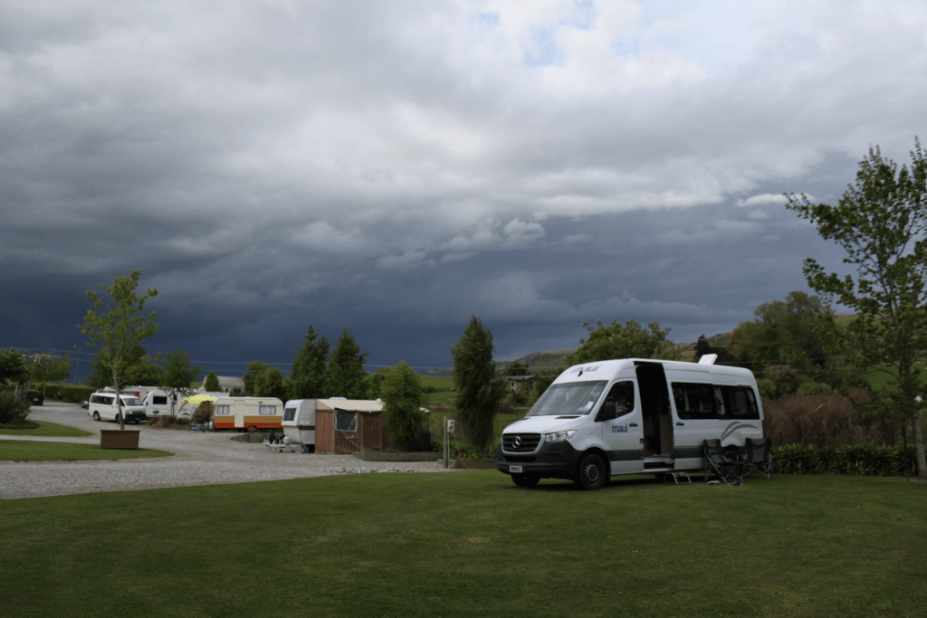
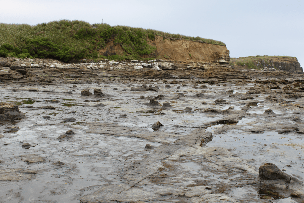
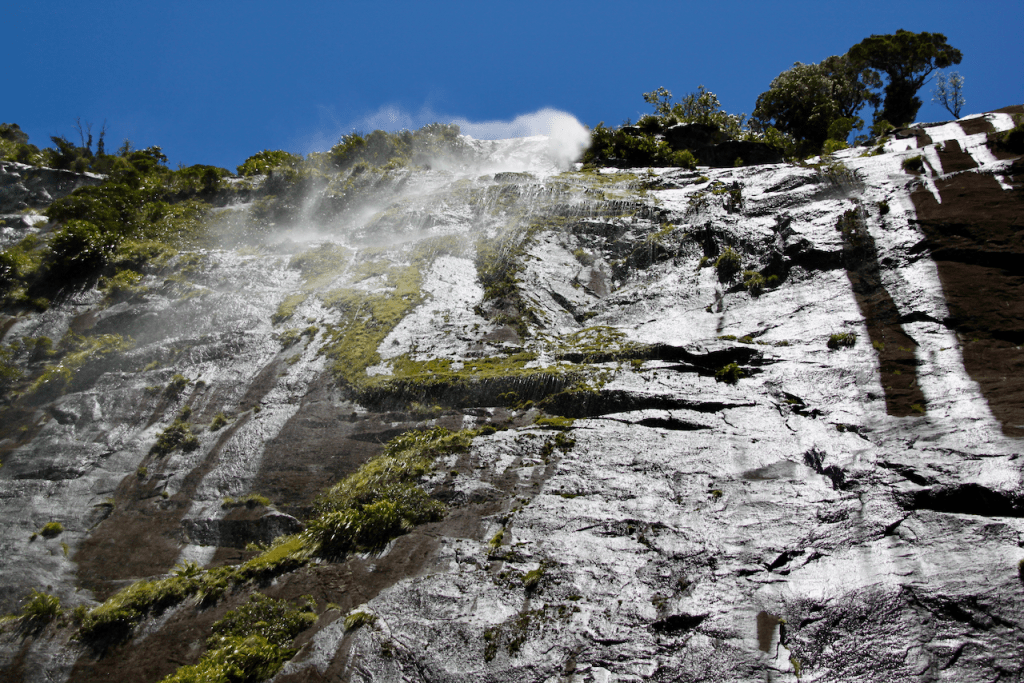
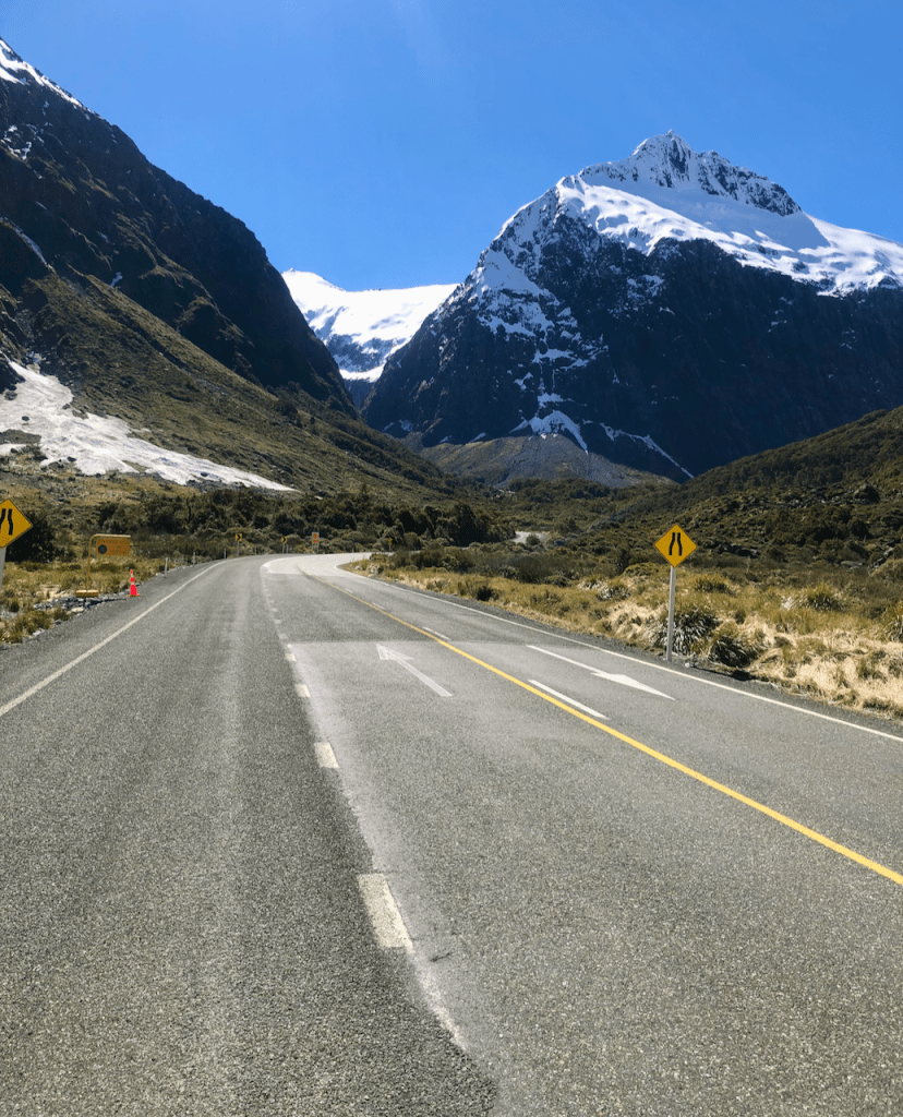
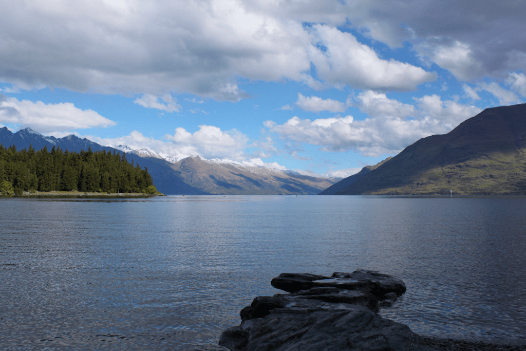
Probably the least inspiring photo of the entire holiday. The view was meant to be spectacular. What3words gridded.clinical.befriend

Lucky for us that this etched plan showed us what we would have seen had the weather been more accommodating.

Day 13, Roxburgh to somewhere near Lake Tekapo.

Distance travelled: 302 Kms. From here to home it was main highway driving. That still means stunning roads through beautiful scenery. But these were all roads we had been on before and we did have a sense that the holiday was drawing to a close. First stop was at Cromwell for a bit of a brunch. We had stayed here before and we knew that in the old preserved part of the town was an Italian restaurant that did excellent food. Known as Armando’s Kitchen, it is another hidden gem of a place. Armando, an expat Italian is a real hoot. Having suffered a nasty fire some 4 years ago he has rebuilt the place as it was and the place is just as welcoming. What3words location for his restaurant is location.muster.lightless From there we motored north for a brief stop at Lake Pukaki to see Aoraki Mount Cook before heading on to Lake Tekapo town. We did consider staying in the motor camp but as this was our last night we thought we would find a place out in the wilds to stop for the night. Just north of the town we came across Edwards Stream overnight camp site. It is basically a clearing where you can pull into and stop for the night. It even had a rudimentary and very clean long drop toilet. We were at the start of the Burkes Pass. This is wide open big sky country surrounded by soaring snow capped peaks. There we stayed and at night there was no light whatsoever. The stars were so bright in the pitch black. It was quiet and around us rabbits nibbled at the grass. This was a fitting place for our last night in the van.

Cromwell Heritage Precinct. What3words location: murmured.interacted.resorting
Inside the blacksmiths stables in Cromwell Heritage Precinct.
Mount Cook in the centre back of the picture looking over the waters of Lake Pukaki.
Home for the night. Just a clearing off the main highway.
Our home for our last night in the van. Nothing for miles and miles. What3words location: mashup.mild.dossier

Day 12. Papatowai to Roxburgh

Distance travelled: 189 kms. We left the Catlins, an area of New Zealand of outstanding natural beauty. Not mountains. Indigenous natural forests, water falls, blue seas and sandy bays. I loved it all. Just a short distance from our overnight stop are the Purakaunui Falls. We had been told about this waterfall by a number of people. You must see them they said. One thing you notice about this country is that where there are tourist must see’s, the Department of Conservation (Known as DOC, dock) do an outstanding job of installing a carpark and toilet (usually a long drop). This place was no exception. To get to the falls we took a walk of around 15 minutes through native bush. There were so many beautiful tree ferns called Pungas that it looked prehistoric. The falls themselves were not spectacular on a World scale such as the Niagara or Victoria Falls. But in the setting where they were they were stunning. A place I wanted to visit was Nugget Point. The only reason was that having sailed ships around this coast, I had navigated using Nugget Point lighthouse on a number of occasions. To see it from the land would be something special. It is a bit of a detour but well worth it. The walk from the car park out to the peninsular upon which the lighthouse stands is precipitous. A sign warns parents to keep your children close by due to the shear drops. Down to the sea. Health and Safety have kept away. I love it! Once at the lighthouse the views take your breath away. Azure blue seas turn white as the swell crashes against the nuggets in foaming waves. King kelp up to 10 metres in length swirls like auburn hair around the rocks. This place is majestic. Put it on your list when you come to this part of the planet. From Nugget Point we retraced our track to the main highway and headed to our next stop for the night at Roxburgh. The plan was to head a little further on but a threatening sky ahead meant we decided to stop a little early and get set up before any bad weather set in.

Purakaunui Falls. What3words location for the carpark is: sender.catacomb.snore
Nugget Point Lighthouse. What3words location is: beverages.ribcage.disturb
The Nuggets looking down from the lighthouse viewing platform. What3words location: pogo.motivations.wags
Camp in Roxburgh just before the heavy rain got to us. What3words location: plugs.gets.skulk

Day 11, Invercargill to Papatowai.

Distance travelled: 137 Kms. Todays plan was simply to visit the Catlins Forest Park. This an area of outstanding beauty on the SE tip of the South Island of New Zealand. We had no particular destination in mind. We could camp off grid if needed. The van was fully recharged after last night in the holiday camp. I had read of a petrified ancient forest and wildlife at a place called Curio Bay so we thought we would take the coastal twisty route to get there. We were so glad we visited Bluff yesterday as today it was chilly and threatened to rain. The road from Invercargill took us initially on a main highway before we turned off at a place called Fortrose. Then suddenly we were in the outback. The place was littered with estuarial rivers all feeding south to the sea. Whitebait nets were strung out everywhere. Whitebait is considered a delicacy here in New Zealand and fetches high prices hence the number of nets set. I can’t say it is my cup of tea tasting rather metallic. But each to their own. The road to Curio Bay again follows the coast undulating as it goes, never far from the sea. On arriving at Curio Bay a plaque tells you what you need to know and it is quite staggering. I have visited petrified forests elsewhere but nothing on this scale or quite so clearly defined. Logs of stone are clearly visible lying where they fell millions of years ago, on the cliff face you can see where tree trunks fell and even count the rings in the trunks. Stumps are clearly visible rising from the volcanic ash bedrock. What is more is that you can walk among them. The whole place is open for you to stroll among so long as you dont damage anything. Elsewhere in the world this would all be fenced off and out of bounds. Not here. From here we decided to motor slowly through the Catlins park and take in the views. The weather started to close in and around 4PM we decided to find a place to camp for the night. We came across a soggy camp ground at a place called Papatowai where there were already a collection of vans and caravans and thought well if it is good enough for them it will do us. Once we set up we noticed there was a food truck which seemed to have attracted a few people. We paid a visit and invested in two servings of fish and chips. A fantastic little find once again. The beach here is another little gem. White sand beaches with trees reminiscent of mangrove swamps line the bay. Shallow water to less than knee height is perfect and safe for kids to play in. If the weather was better. Just as we got back to the van it rained. And rained. And rained all night long. Wise move to stop when we did. Here are todays photos.

The plaque at the carpark tells you all you need to know.
Tree trunks fossilised where they fell still clearly visible.
The stone stumps of an old forest rise from the bedrock
The rings in the trunks of fallen trees can be clearly seen in the cliff face.
The campground at Papatowai. I stopped to go take a look before parking up. The nose of the white food truck peeps out. This was a great little place albeit a bit boggy.
Papatowai lagoon beach. A bit of sun would transform this place into a little paradise.

Day 10, Clifden to Invercargill.

Distance travelled 169 Kms. I don’t think either of us was too sure what today would bring. Information was scarce. The weather was chilly and overcast with a few showers. We were not inspired. Today would be a day of finding roads less travelled and see what came. We knew we wanted to go to Bluff for Debbie has not been. I have been a few times on motorcycle trips and also into the harbour on ships way back in the 80’s to load meat from the freezer works for Black Sea Russia. I wanted to go and see Burt Munros speed record bike. It is on display in a hardware store in Invercargill. Yes, a hardware store. Our route took us through the town of Tuatapere reputed to be the home of the New Zealand Sausage. Sausages were particularly scarce here it would seem. The road picks its way along the coast, undulating through farmlands but rather non descript. Until we came to a brown sign pointing down to Gemstone Beach near a small settlement called Orepuki. Well what a little gem of a find this was. The beach was littered with highly polished stones of all shapes and sizes and colours. Debbie simply had to start combing the beach for little stones, some not so little to take home. The road meanders east through the town of Riverton which seemed deserted as we passed through. This is a place of some repute for its history for the indigenous Maori is one of some importance. The time was passing so we decided to motor to Bluff to view the famous landmark sign, get the obligatory photo and head to Invercargill to find the hardware store of E.Hayes, home of some rare motorcycling history. As last nights camp was out in the boondocks we decided to find a holiday camp for the night to get a shower, empty our rubbish and plug the van in to the power socket to recharge the batteries. Today had some rather good surprises. For me the motorcycling memorabilia in the hardware store was simply magic. For there was not just Bert Munro’s famous land speed motorcycle made famous in the movie with Anthony Hopkins. There are other machines of note. Just sat in a hardware store. You need to visit it. Here are todays photos.

Just one more stone. Just one.
Looking back along gemstone beach from whence we came.
The iconic sign at Bluff.
I saw the road sign to this and just had to stop and pay my respects. The little plaques in memory of lost sailors and fishermen that you can see on the top left makes sobering reading.
Greenpoint Bay is littered with old wrecks.
Burt Munro’s bike of Legend sat in E.Hayes hardware store. A mecca for any two wheeled petrolhead in New Zealand.
The late and great man himself. To the right of the photos is a large glass case full of Burts tools and spare parts.

Day 9. Milford Sound to Clifden.

Distance travelled: 206 Kms. I think we both felt that after Milford Sound was it worth continuing? Was there anything that could compare to the sheer majesty of those mountains, wildlife and scenery. We set off from the lodge with no clear plan as to where the day would end. We would head down the South Scenic route and see what we could find. On the way from Milford Sound to Te Anau we stopped and picked up a hitch hiker whose car had broken down in the middle of nowhere. As soon as we got a phone signal we pulled over and let him phone the AA and dropped him back at his car. Proceeding on we stopped in Te Anau to empty the vans waste tanks, top up with potable water and refuel. That was so that wherever we did end up we were prepared. The road from Te Anau to Manapouri and south following the Waiau river is pretty. The landscape undulates through sheep and dairy farms and through a number of escarpments. Small villages that all look the same go by. We stopped at various sign posted view points and by around 4pm we decided that we would find somewhere to stop. We came across a signpost for the Clifden suspension bridge campsite. Clifden, not to be confused with Clifton in the UK. That sounded like a viewing was required. It was a gravel lay by in the middle of nowhere but oh my! The bridge was a real find. Beside the river was a grassy campsite for a few tents. The river gurgled just about 40 feet away from us. The lay by had clean and new toilets too. There were already two other camper vans there. This was our spot for the night. It was a quiet little gem of a place. The bridge was a historic masterpiece of engineering. This place was a real find indeed. The what3words location was drilling.stately.deputies Here are todays photos.

Part of the Lake Manapouri hydro power system
Clifden suspension bridge dating from 1898. Old in New Zealand terms.
One of the four supporting towers and information boards.
A view along the bridge.
Drone view. The old and the new bridges.

Day 8, Milford Sound.

Distance travelled today was none by road. Around 35 Kms by boat. The day dawned bright and still. We had a lazy start wondering whether to book a boat trip or not. Our Weka paid us a visit over breakfast again hoping for some food no doubt. We dont feed the birds. Especially the Keas. They can become beggars once you start doing that. Having had breakfast we decided to book a boat trip. The lodge provided a shuttle bus down to the departure lounge for the boat. It was a quiet day. I reckon there was about 35 people on our boat. Some had flown in from Queenstown and Te Anau for the trip. After a short safety briefing we were off and what a day. The commentary from the boat Captain Dan was informative, not intrusive and set a good tone. Recent rain had energised the waterfalls. The water was almost an emerald green colour in the fjord. It is difficult to pick a few photos from the many that we took to give you a flavour of the day. Once the trip was over we decided to walk the few kilometres back to the lodge and our van. I’m glad we did as we chanced upon quite a tame Kea sat on the fence and watched us go by. The day was rounded off very nicely with dinner in the lodge restaurant and a cheeky New Zealand red to accompany it. Tomorrow we will head further south. Not sure to where. No plan yet. Here is a selection of todays photos.

You don’t get too many days this good in Milford Sound.
The view from the bridge of the Southern Discovery.
Look at the colour of the water.
We went so close so we could look up into a waterfall being blown to mist by the winds aloft.
Looking back towards the little dock.
Debbie braving the sun. At the entrance to the fjord the wind dropped away entirely. It was around 20 knots inside.
The captain put the bow of the ship under this waterfall for the brave and foolhardy to get soaked. Not me!
Look at me!. A posing Kea waits for a photo.

Day 7. Queenstown to Milford Sound.

Distance travelled today: 292Kms. A crisp, blue sky day dawned. It was chilly overnight and the van was a little on the cool side when we woke. So, instead of getting up, I put the webasto heating on, put the kettle on and retreated back under the duvet. The resident ducks were already awake, having been so since around 6am quacking noisily to each other. Our plan today was simply to get to Milford Sound.

 We set off at 10am and as is the norm, every hour and a half we stop for a rest, a cup of tea and a stretch. I had no idea quite how big Lake Wakatipu is. I was quite wrong thinking that Queenstown was at its southern end. We started off on the road to Mossburn and quickly realised the lake extended farther south than I had imagined. The small township of Kingston actually lies on the southern shores of the lake. This is a glacier specialists paradise. Hanging valleys are scattered everywhere. Evidence of old moraines are everywhere. The scenery flattens out as we head south into pasture lands. We then strike west towards the town of Te Anau and on the horizon lofty peaks rise with snow on their summits. The last time I was in that town was in 1980 but I have no memory of the place. Clearly it has grown significantly since then. It is only once you head north away from the town that the snow capped peaks ahead give you some clue as to what is coming. We stopped a few times to admire the view. The trouble is that around the next bend the view gets better and better. There are signs saying “Avalanche risk-no stopping” dotted along the road . A glance to each side shows evidence of past slips and avalanches which add to the wow factor of this road. Eventually you come to the Homer Tunnel which is enshrined in New Zealand lore. We are camped at the Milford Sound Lodge on the shores of the Sound. We are set among the native trees in a well set out space for camper vans. Native birds called Keas and Wekas so tame they approach within a few feet of us come to check us out. This is a magical place. The peaks tower all around us. It is a humbling landscape. It makes you feel rather insignificant in its magnificence. This was on my bucket list having heard so much about it. All the stories and tales have not done this place any justice at all. It simply leaves you speechless and my photos can only give you a flavour of the sheer majesty of the Sound. You simply need to come see for yourself. I have been into Milford Sound about a dozen times on cruise ships. The journey to the Sound by road beats it hands down ten fold. I will leave you with some images of the day but they don’t do the place any justice really. Tomorrow we will spend the day in Milford Sound and if the weather continues to be so good, we will take a boat trip and get a different perspective to the one I usually get.

We start to climb into the Southern Alps.
Tea break in an alpine meadow
Still higher. The air temperature had dropped from 16C at Queenstown to 5C here.
The Homer Tunnel. Waiting for our turn to enter as the tunnel is one way traffic.
Parked up at the Milford Sound lodge.
A Weka, an indigenous bird, comes to say hello.
And invites itself in to investigate.

Day 6. Queenstown and Glenorchy.

Todays distance travelled was 95 Kms. Plans changed today. The intended gondola ride up the mountain never happened for it was shut today and tomorrow. I should have checked but never mind. I did not want to plan this to death rather just go when we were ready. So we decided to take a run up the eastern shore of Lake Wakatipu to the small settlement of Glenorchy. It rained overnight and through the morning so we started the day rather lazily. We had a leisurely breakfast and set off around 11:30 for Glenorchy. The road up the eastern lake shore meanders its way around rocky outcrops and through native bush that stretches from the lofty heights down to the waters edge. The speed limit on the round is meant to be 100Kms/hr. I never got above 80 and was down to around 15 on the narrow and steep sided sections. The rain showers and gusty conditions kept me cautious and I pulled over many times to let faster traffic past me as there are very few good overtaking spots. I did not want anybody taking risks on my account trying to get past me on unsuitable stretches of the road due to impatience. Besides, we were taking it easy to enjoy the outstanding views. The views across the lake to the soaring snow capped peaks opposite reminded me of Loch Ness in the Scottish Highlands. We stopped at Bennetts Bluff to take some photos. It was a brief stop for the biting wind blowing down the lake and smatterings of rain drove us back to the car rather sharpish.

Looking south from Bennetts Bluff down Lake Wakatipu. Running out and dodging the showers and biting wind to get some photos.

Glenorchy is a small town at the top of the Lake and to here in years gone by the TSS Earnslaw would bring supplies and livestock for the farms and hill stations in the area. Now it is a quiet place. I guess in the height of summer and in covid free times it will get busier.

The pier at Glenorchy where the TSS Earnslaw would tie up to load and unload supplies from Queenstown. Now she comes with tourists.

The shed at the head of the pier. Now houses tourist information.There must have been trains around here in days gone by or at least rails down the pier to the ship side.

Having returned to Queenstown we had to make a visit to another icon of the area. Fergburgers. Quite a famous place it would seem as even Ed Sheeran left a poster on the wall claiming the burgers are the best in NZ. They are good. Though they are huge. We wont need to eat for days now.

Musician Ed Sheeran’s signed paper bag as a memento of his visit and impressions of the fare.

So that was our day in Queenstown and Glenorchy. Tomorrow we hope to get to Milford Sound. There is still a warning about possible avalanches on the road from Te Anau to Milford Sound so we will check the latest advice tomorrow.

Day 5. Wanaka to Queenstown via Cardrona.

Distance travelled to day was 172 kms. Cardrona is a must see on any Kiwi roadtrip. The collection of old buildings lie in a valley on the back route from Wanaka to Queenstown on the Crown Range Road. The road beyond the hotel is twisty and scenic and has a number of tight hairpin bends to negotiate. For that reason I suspect, our campervan company specifically bans us going beyond the Cardrona hotel and a warning comes up on the satnav not to proceed further. Thats a shame as the summit offers an amazing view. I have ridden the road on a motorcycle. Not to be able to show it to Debbie is a shame.

Breakfast at the Cardrona hotel in front of a warming log fire is not to be missed. This iconic collection of old buildings must be on any bucket list visit to New Zealand. What3words location unspent.regatta.dirtier

It is only 20 kms from Wanaka to Cardrona. At around 2 kms from Cardrona is what is known as Bradrona. In days past bras were hung on a fence along the main road to raise awareness of breast cancer. It caused traffic issues with cars slowing down to look at the collection. So the entire collection was moved onto a fence in a purpose built carpark where it lies today. Members of my own family have suffered from the disease so it was only fitting that Debbie left one of her bras as a lasting memory of our visit.

The bra fence near Cardrona known as Bradrona. A fitting reminder of breast cancer and its effect on families. They will need a stronger fence soon. What3words location: bedbug.instantly.transfers

Having backtracked the 20 kms to Wanaka we then headed to Queenstown via Lake Dunstan and Cromwell. The route took us past the Central Otago Pinot Noir vineyards near Bannockburn, past Roaring Meg hydro power station and eventually, after a small detour, to Arrowtown. Another of Debbie’s must see places. It is a small old gold rush town. If there was one thing they could do to enhance it, it would be to ban traffic from the road. It rather spoils the image. There is an amazing sweet (candy) shop reminiscent of days gone by. We simply had to go for a visit inside and get some mint humbugs.

The interior of the “Remarkable Sweet Shop” Another one of those must sees. It really is a delightful little store.

Our final stop for the day was in Queenstown where we are staying at the Queenstown Holiday park and motels at Creeksyde. It is a very clean, centrally located and rather quirky place and we love it. The town is a very easy walk away and we spent the evening wandering into town and walking along the beachfront. I wanted to see the old steam boat the TSS Earnslaw which was docked. Our what3words location is : torrid.exhibiting.essay We are here for two nights so tomorrow we will see whether we can go up the mountain on the gondola weather permitting and a visit to Fergburger. More on that tomorrow.

TSS Earnslaw moored in Queenstown.
Looking north up Lake Wakatipu
Looking West across Lake Wakatipu